Weather
Hi, It's Me, Snow. I May Not Be Done With You Yet, Hudson Valley
No, it's not an early April Fools' Day joke.

For those in the Hudson Valley who are actually still hoping for another blast of wintry weather, well, we have some good news for you. We may see an inch or so of wet snow late Sunday night into Monday morning, the National Weather Service says.
It will likely remain dry through Easter, when temperatures will reach the mid-50s, with the odds of snow rising after midnight.
Our friends at Hudson Valley Weather have been keeping an eye on the storm system. Again, it's one of those "time will tell" scenarios.
Find out what's happening in Yorktown-Somersfor free with the latest updates from Patch.
"The current projection would generate a slushy coating to an inch or two across the region from I-84 on south," Hudson Valley Weather said. "But if the storm tracks another 25 to 50 miles north… it would pull a swath of 2 to 4 inches of wet snow into the Hudson Valley, just in time for the Monday morning commute. So we need to keep focused on this event."
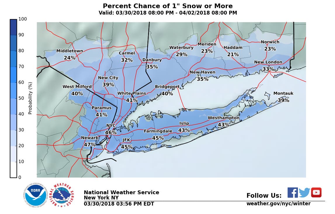
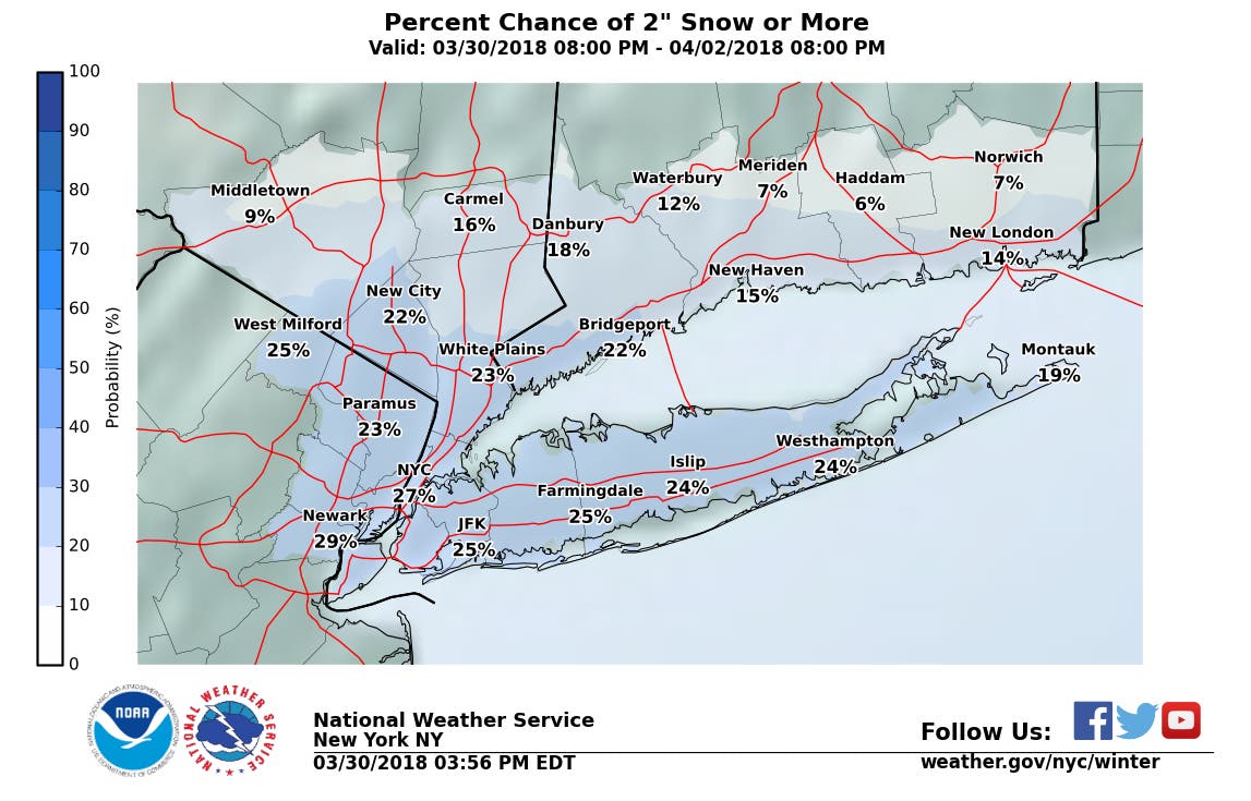
There's about a 30-40 percent chance of more than an inch of snow accumulation the lower Hudson Valley, according to NWS snow total estimate maps.
Find out what's happening in Yorktown-Somersfor free with the latest updates from Patch.

Saturday Discussion : Watching Sunday Night Snow Threat A rather decent weekend of weather ahead for the Hudson Valley. Saturday looks to see a good deal of sunshine, and temps right... https://t.co/eY3FR62WhU
— Hudson Valley Wx (@HudsonValleyWx) March 31, 2018
Here's the complete forecast for northern Westchester from the National Weather Service:
- Saturday: Sunny, with a high near 58. Northwest wind 5 to 9 mph becoming south in the afternoon.
- Saturday Night: A 30 percent chance of showers after 3am. Increasing clouds, with a low around 39. South wind around 9 mph.
- Sunday: Cloudy, then gradually becoming mostly sunny, with a high near 56. West wind 9 to 13 mph, with gusts as high as 24 mph.
- Sunday Night: A 50 percent chance of snow after midnight. Increasing clouds, with a low around 31. North wind 5 to 8 mph.
- Monday: Snow likely, mainly before noon. Cloudy through mid morning, then gradual clearing, with a high near 47. Light and variable wind becoming west around 5 mph in the afternoon. Chance of precipitation is 60%. New snow accumulation of around an inch possible.
- Monday Night: Increasing clouds, with a low around 35.
- Tuesday: Rain likely, mainly after 9am. Cloudy, with a high near 51. Chance of precipitation is 60%.
- Tuesday Night: A 50 percent chance of showers. Cloudy, with a low around 46.
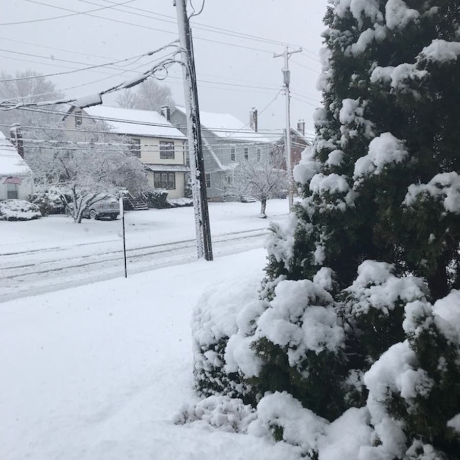
Photo credit: Michael Woyton/Patch Staff.
Get more local news delivered straight to your inbox. Sign up for free Patch newsletters and alerts.


