Weather
Wet, Warm To Possible Wintry Mix: Yorktown's Weekend Weather
It's a mixed bag for the weekend in Somers. We tell you what to expect.

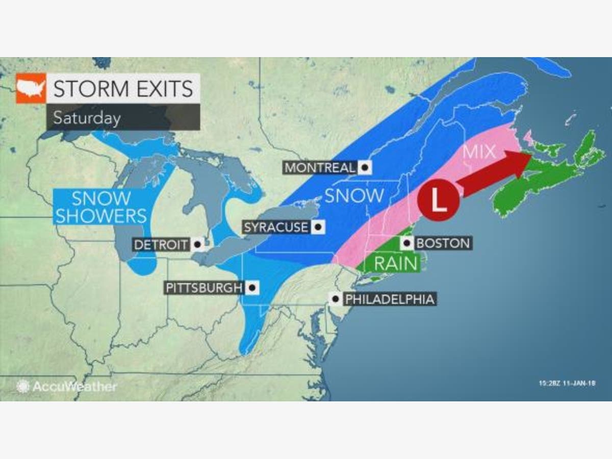
YORKTOWN, NY — Fog, heavy rain, rapid thaw, flood watches — and that’s just Friday for the Hudson Valley. The March-like temperatures with highs close to 60 in parts of the region will be short lived. Saturday’s high will likely end up in the mid-30s, and that means the continued precipitation could be a wintry mix in the more northern parts of the lower- and mid-Hudson Valley.
“Following a surge of warmth with rain, colder air will rapidly invade the region, while the storm is still in progress,” said AccuWeather Senior Meteorologist Alex Sosnowski.
“In a matter of a few hours, temperatures will plunge from balmly levels in the 60s and 50s F to the 30s and 20s,” he said.
Find out what's happening in Yorktown-Somersfor free with the latest updates from Patch.
SEE ALSO: Foggy Start To Flood Watch In Hudson alley
The precipitation moves out during the day Saturday, leaving Sunday as a sunny day.
Find out what's happening in Yorktown-Somersfor free with the latest updates from Patch.
However, you will need that winter coat again because temps will not get much above 20 degrees during the day.
Here is the weekend forecast for northern Westchester County from the National Weather Service:
- Friday Night: Periods of rain. The rain could be heavy at times. Areas of fog. Low around 32. South wind around 9 mph becoming north after midnight. Chance of precipitation is 100%. New precipitation amounts between a half and three quarters of an inch possible.
- Saturday: Rain or freezing rain likely before 11am, then a slight chance of freezing rain and sleet between 11am and noon. Mostly cloudy, with a temperature falling to around 25 by 5pm. Wind chill values between 15 and 25. North wind 14 to 17 mph. Chance of precipitation is 60%. Little or no ice accumulation expected. Little or no sleet accumulation expected.
- Saturday Night: Partly cloudy, with a low around 7. Wind chill values between -5 and zero. North wind 10 to 14 mph.
- Sunday: Sunny, with a high near 23. Wind chill values between -5 and 5. North wind around 8 mph.
- Sunday Night: Mostly clear, with a low around 6. North wind 5 to 7 mph.
- M.L.King Day: Partly sunny, with a high near 26.
- Monday Night: A 30 percent chance of snow after 3am. Mostly cloudy, with a low around 20.
Map: AccuWeather.com.
Get more local news delivered straight to your inbox. Sign up for free Patch newsletters and alerts.


