Weather
Flooding Possible In Southeast PA Tuesday Night; Franklin Affecting Beaches
A risk for dangerous rip currents at New Jersey and Delaware beaches also continues into Wednesday.

PENNSYLVANIA — A band of storms with heavy rain, coupled with a hurricane churning offshore, could cause flooding in the Philadelphia region this week, forecasters said.
And vacationers and residents along the East Coast should prepare for the possibility of dangerous swimming conditions and beach closures as the storm's impacts may last several days, forecasters said. At least one Jersey Shore beach is closed.
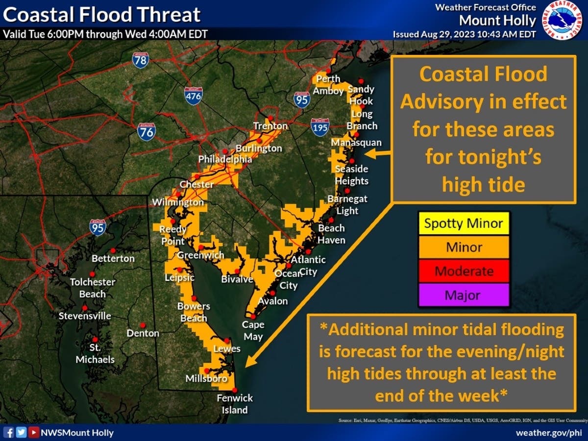
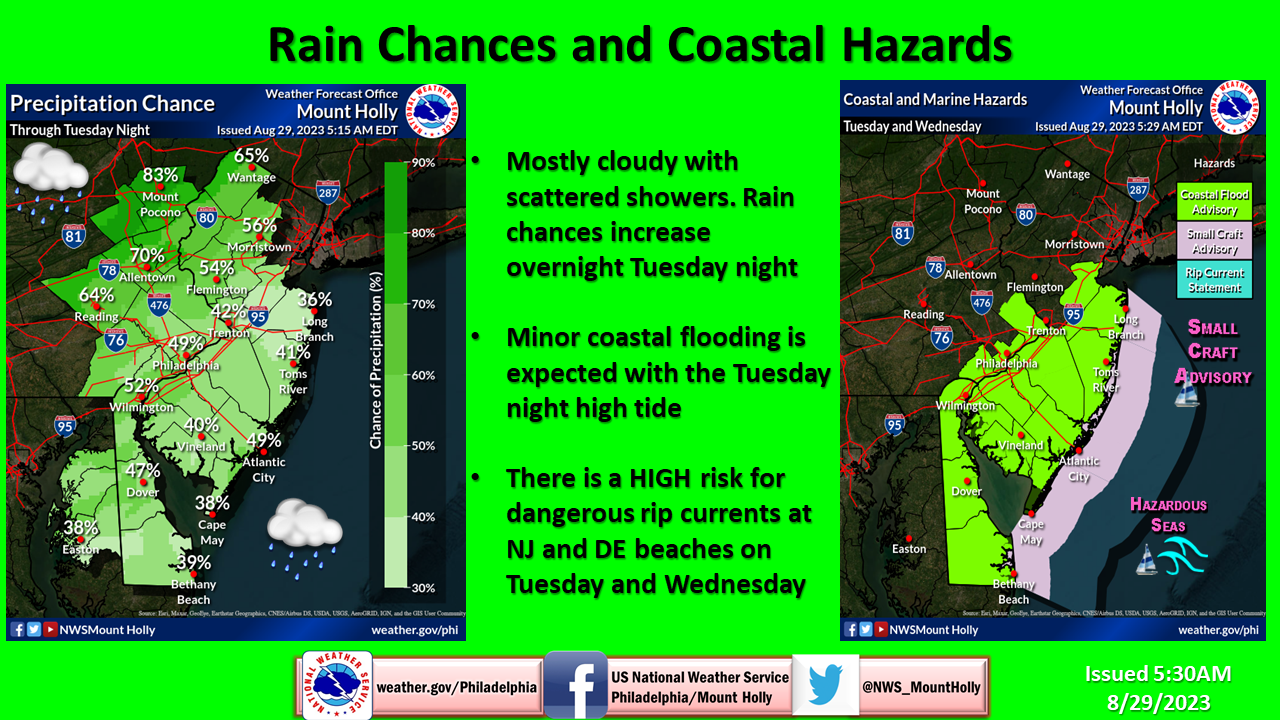
The chance of rain and scattered showers will increase in the region overnight Tuesday into Wednesday, said the National Weather Service. And given the extra moisture and wind from Franklin, plus the approaching full moon, minor coastal flooding is a risk for areas with the high tide.
Find out what's happening in Across Pennsylvaniafor free with the latest updates from Patch.
“Do not park your vehicle in areas prone to flooding and do not drive through flood waters,” advised NWS forecasters.
Delaware, Philadelphia and Lower Bucks counties are under a coastal flood advisory from 11 p.m. Tuesday night until 4 a.m. Wednesday. Forecasters added that flooding is possible on roads along tidal waterways, and “some partial or full road closures are possible.”
Find out what's happening in Across Pennsylvaniafor free with the latest updates from Patch.
"Rain chances will also be on the rise again Tuesday night with some embedded heavy rain possible," NWS forecasters added.
"Expect the bulk of the rainfall and most thunderstorm activity to hold off until near or after midnight."
Forecasters warned those looking to take a dip in the water at beaches in both New Jersey and Delaware about dangerous rip currents and rough surf, which continues into Wednesday. The wind-whipped seas will be hazardous, and there is a small craft advisory through Wednesday for seas over 5 feet.
Current tracking models show that Hurricane Franklin "will pass far enough northwest of Bermuda to limit significant impacts," but it will still bring gusty winds and rough surf to portions of the archipelago, said AccuWeather.
And, residents of Florida and Georgia are bracing for Hurricane Idalia, which should strengthen to an "extremely dangerous major hurricane" by landfall in the Sunshine State on Wednesday. The remnants of this storm should stay south of the mid-Atlantic, forecasters said.
“Four to 8 inches of rain is expected to span across a large portion of the Southeast coastline with 2-4 inches expected to dampen regions as far inland as central Georgia, western South Carolina and central North Carolina,” AccuWeather said.
Here is a look at the forecast in southeast Pennsylvania through Wednesday, from the National Weather Service:
Tuesday afternoon: Mostly cloudy, with a high near 80. East wind around 5 mph.
Tuesday night: A chance of showers and thunderstorms, then showers likely and possibly a thunderstorm after 3am. Patchy fog after 8pm. Otherwise, cloudy, with a low around 70. East wind around 5 mph becoming calm in the evening. Chance of precipitation is 60 percent. New rainfall amounts of less than a tenth of an inch, except higher amounts possible in thunderstorms.
Wednesday: Showers and thunderstorms likely before 11am, then a slight chance of showers between 11am and noon. Cloudy through mid morning, then gradual clearing, with a high near 84. Southwest wind 5 to 10 mph becoming northwest in the morning. Chance of precipitation is 60 percent. New precipitation amounts of less than a tenth of an inch, except higher amounts possible in thunderstorms.
Wednesday night: Mostly cloudy, with a low around 59. North wind around 10 mph.
Get more local news delivered straight to your inbox. Sign up for free Patch newsletters and alerts.