Weather
PA Snow Totals Up In Latest Weekend Storm Forecast
One of the most significant snow events in recent history will come with dangerously cold temperatures, potential ice, and more.

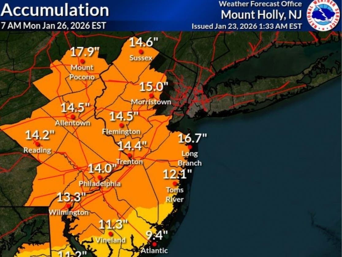
Up to 18 inches of snow is now predicted in the greater Philadelphia area this weekend as one of the most powerful storms in recent history approaches the region.
The new estimate range 12 to 18 inches, with an expected average of 14, is an increase over Thursday's forecast, which called for the area to get 13 inches, the National Weather Service said. The city and the more immediate suburbs could be closer to 12, while outlying, northern and western parts of Montgomery and Bucks counties could be closer to 18.
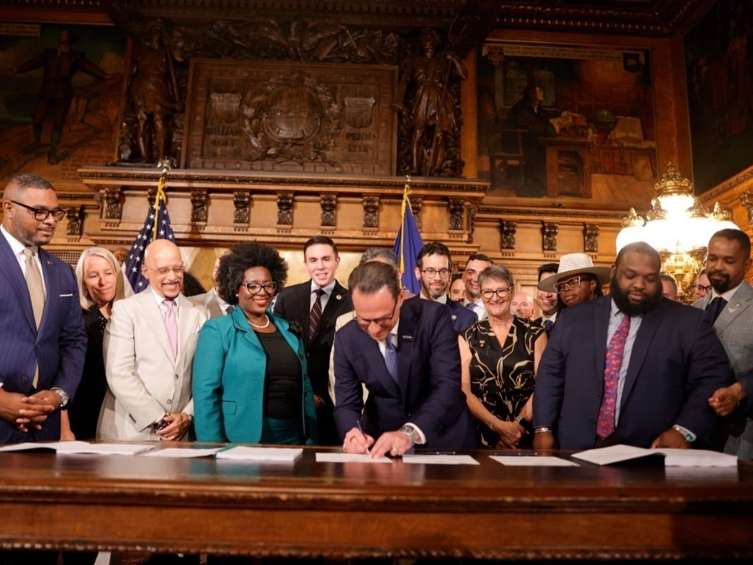
Gov. Josh Shapiro on Friday signed a disaster declaration that will make it easier for Pennsylvania to respond and recover from the weather event.
Find out what's happening in Across Pennsylvaniafor free with the latest updates from Patch.
The storm is part of a front that is impacting a massive swath of the nation.
"It is rare that storms combine this much snow, ice and bitter cold over such a large area," Accuweather Senior Vice President Evan Myers said in a statement. "A widespread travel-halting winter storm will stall daily life for days in large portions of the central and eastern U.S."
Find out what's happening in Across Pennsylvaniafor free with the latest updates from Patch.
The storm is slated to arrive late Saturday night into Sunday morning, and then continue all day Sunday. It could continue into early Monday morning.
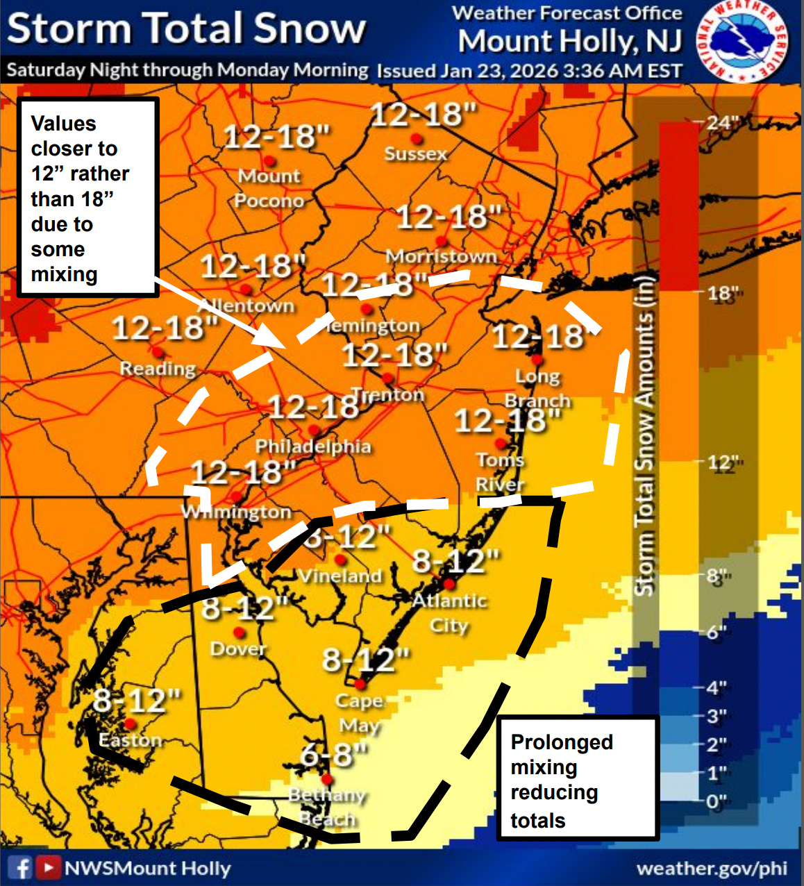
"There is increasing confidence in major snowfall accumulations across much of the area, making travel very difficult, and potentially resulting in widespread closures and infrastructure impacts," the National Weather Service's Mt. Holly, New Jersey branch said in a briefing Friday morning.
A Winter Storm Watch has been declared for the region beginning at 7 p.m. Saturday and continuing until 1 p.m. Monday.
It's possible than some of the snow may mix with freezing rain or sleet for brief periods Sunday, which would also swing that pendulum of accumulation closer to 12 inches than 18.
"If ice does not mix in over areas such as Washington, D.C., Philadelphia and New York City, snowfall may exceed the higher end of the average," Accuweather adds.
While a few inches may fall Saturday night, the bulk of the storm is expected to come Sunday, with a foot or more falling throughout the day. Travel is not advised, particularly before snow plows have the chance to treat and clear roads, officials said.
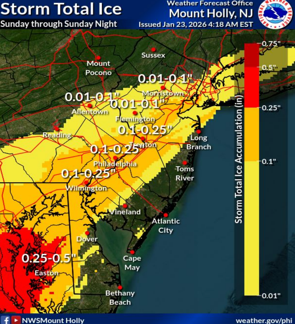
Forecasters warn that freezing rain, in particular, could lead to ice accumulations, which is more likely to damage trees and powerlines. That could in turn lead to widespread power outages.
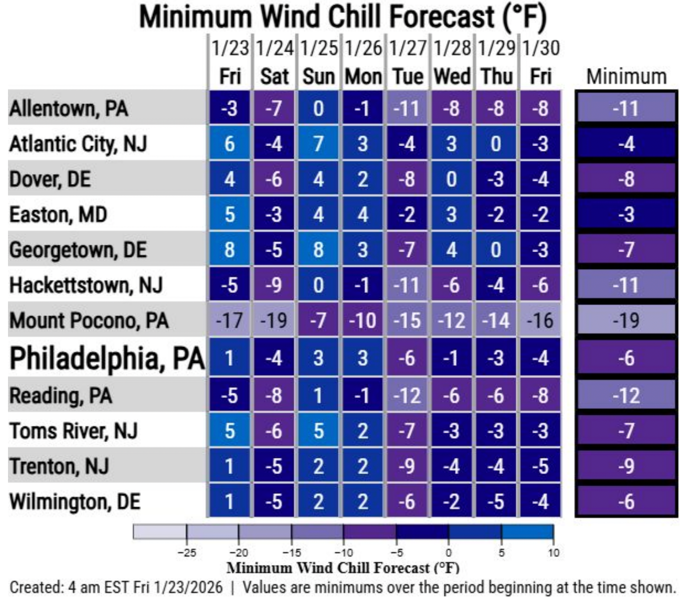
Another danger and prominent aspect of this storm will be the wind and the sheer cold. Temperatures are expected to plummet to 9 degrees on Friday night 15 degrees on Saturday night, with the high temperatures not escaping the mid-20s through next week. Wind gusts Friday and Saturday nights could cause subzero wind chills before the storm even arrives, and gusts up to 25 miles an hour on Sunday and Monday could keep the wind chill hovering around zero, forecasters said.
A Cold Weather Advisory has been issued for the region through Monday.
"Prolonged exposure to dangerous wind chills could result in hypothermia or frostbite if precautions are not taken," the National Weather Service warns.
Here's the full forecast, according to the National Weather Service:
Friday
Partly sunny, with a high near 36. West wind 5 to 15 mph, with gusts as high as 25 mph.
Friday Night
Partly cloudy, with a low around 9. Wind chill values as low as -3. Northwest wind 10 to 15 mph, with gusts as high as 30 mph.
Saturday
Partly sunny, with a high near 20. Wind chill values as low as -4. North wind 5 to 10 mph.
Saturday Night
Snow, mainly after 1 a.m. Low around 15. Northeast wind 5 to 10 mph. Chance of precipitation is 90 percent. New snow accumulation of 1 to 3 inches possible.
Sunday
Snow before 1 p.m., then snow and freezing rain. The snow could be heavy at times. High near 26. Northeast wind 10 to 15 mph, with gusts as high as 25 mph. Chance of precipitation is 100 percent. New ice accumulation of less than a 0.1 of an inch possible. New snow accumulation of 7 to 11 inches possible.
Sunday Night
Snow and freezing rain, becoming all snow after 4 a.m. Low around 25. Chance of precipitation is 100 percent. New precipitation amounts between a half and three quarters of an inch possible.
Monday
A chance of snow. Mostly cloudy, with a high near 27. Chance of precipitation is 50 percent.
Monday Night
Partly cloudy, with a low around 7.
Tuesday
Sunny, with a high near 20.
Tuesday Night
Partly cloudy, with a low around 9.
Wednesday
Mostly sunny, with a high near 23.
Wednesday Night
Mostly cloudy, with a low around 7.
Thursday
Partly sunny, with a high near 20.
Get more local news delivered straight to your inbox. Sign up for free Patch newsletters and alerts.