Weather
Another Nor'easter Sets Its Sights On Pennsylvania
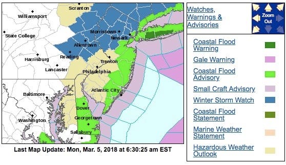
The National Weather Service has issued a winter storm watch in portions of Bucks and Montgomery counties.

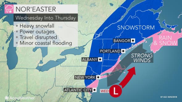
Another potentially destructive nor'easter is expected to hit Eastern Pennsylvania mid-week, just as the area recovers from Friday's vicious storm. The National Weather Service has issued a winter storm watch in portions of Bucks and Montgomery counties, as well as in the Lehigh Valley and Pocono regions.
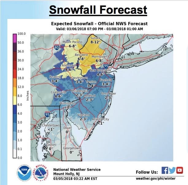
Current accumulation estimates say the storm could dump as much as four inches around Philadelphia and as much as eight inches in some parts of Eastern Pennsylvania.
Find out what's happening in Doylestownfor free with the latest updates from Patch.
Precipitation will likely begin Tuesday night and last through late Wednesday. The snow could mix with rain. Strong winds are also expected.
Here is a map indicating where winter storm watches have already been announced:
Find out what's happening in Doylestownfor free with the latest updates from Patch.
Meanwhile, residents are still recovering from Friday's storm, which left a half a million people in Eastern Pennsylvania without power. More than 53,000 PECO customers are still without electricity as of Monday morning, and several area roads remain closed due to downed trees and power lines.
Friday's storm dumped as much as two feet of snow in parts of the Poconos. Some parts of suburban Philadelphia got significant accumulation despite the original forecasts indicating it was a rain event. See the town-by-town snowfall totals for Eastern Pennsylvania.
RELATED: Man Killed By Falling Tree During PA Nor'easter
Forecasters do not believe Wednesday's storm will quite as strong in terms of wind gusts. Wind gusts in excess of 30 mph are possible; Friday's storm saw gusts of up to 60mph. Even still, the wind along with accumulating wet snow could again bring down tree limbs and utility wires, resulting in more power outages, according to the NWS.
The National Weather Service has issued some preliminary estimates for the snow:
Here is the forecast:
Today: Mostly sunny, with a high near 45. North wind 11 to 14 mph, with gusts as high as 25 mph.
Tonight: Mostly clear, with a low around 26. North wind 3 to 7 mph.
Tuesday: Increasing clouds, with a high near 45. Light and variable wind.
Tuesday Night: Rain likely before 10pm, then rain and snow likely between 10pm and midnight, then snow likely after midnight. Cloudy, with a low around 32. East wind 5 to 8 mph. Chance of precipitation is 70%. New snow accumulation of around an inch possible.
Wednesday: Snow before 2pm, then rain and snow between 2pm and 4pm, then snow after 4pm. High near 37. East wind 11 to 15 mph becoming north in the afternoon. Chance of precipitation is 90%. New snow accumulation of 1 to 3 inches possible.
Wednesday Night: A chance of snow. Mostly cloudy, with a low around 30. Chance of precipitation is 50%.
Thursday: A chance of snow showers before 7am. Partly sunny, with a high near 41. Chance of precipitation is 30%.
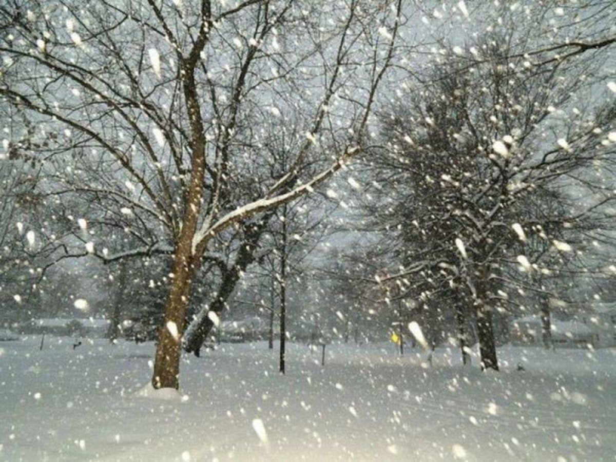
Photo via Shutterstock
Get more local news delivered straight to your inbox. Sign up for free Patch newsletters and alerts.