Crime & Safety
Rain This Week In Pennsylvania As Irma Remnants Pass Through
Remnants of Hurricane Irma are expected to impact Pennsylvania over the next few days.

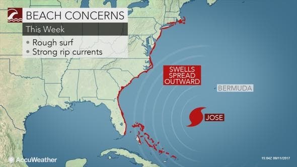
Remnants of Hurricane Irma are expected to impact Pennsylvania over the next few days while Jose, a Category 1 hurricane packing 105-mph winds, will cause rip tides along the New Jersey coast.
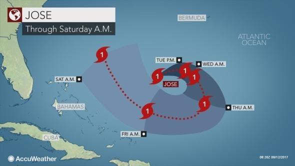
Hurricane Jose could pose a bigger threat to the East Coast by next week, forecasters say. But before that happens, Irma clouds will stretch from Canada all the way down to Tennessee.
“The main circulation of Irma will move into the mid-Atlantic and Northeastern states later this week, and may even linger for part of the upcoming weekend,” AccuWeather Meteorologist Brett Rathbun said in a news release. “The sunny start to the week will end generally cloudy.”
Find out what's happening in Phoenixvillefor free with the latest updates from Patch.
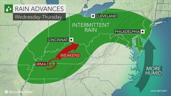
“There will still be enough moisture for scattered showers, but it will in no way be a washout or bring a flash flood threat to the area,” according to Rathbun. “However, those attending any outdoor events will want to grab a jacket or umbrella.”
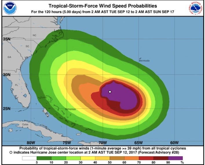
All interests across the East Coast of the United States should keep a close eye on Hurricane Jose, meanwhile, as it meanders across the central Atlantic Ocean this week, according to AccuWeather.
Find out what's happening in Phoenixvillefor free with the latest updates from Patch.
There are several paths Jose can take this weekend and during the third week of September. Possibilities include direct impacts to the mid-Atlantic (including New Jersey and Pennsylvania), New England or Atlantic Canada. Jose could also be swept completely out to sea next week, posing no direct threat to land, according to AccuWeather.
Regardless of Jose’s exact track, there will be beach concerns up and down the East Coast as the storm churns offshore. Surf and rip currents will be enhanced along the coasts of Florida, Georgia, South Carolina and the Outer Banks of North Carolina, especially later this week and this weekend, the release says.
Rough surf could then follow along the New Jersey and New England coasts.
Beach erosion that was inflicted by Irma along the southern Atlantic Seaboard could be exacerbated, according to AccuWeather.
Here is the forecast for the next week:
- Tuesday: Mostly sunny, with a high near 82. Light and variable wind.
- Tuesday night: Mostly cloudy, with a low around 58. South wind 3 to 6 mph.
- Wednesday: A chance of showers, mainly after noon. Mostly cloudy, with a high near 79. Calm wind becoming south 5 to 8 mph in the afternoon. Chance of precipitation is 30%. New precipitation amounts of less than a tenth of an inch possible.
- Wednesday night: Mostly cloudy, with a low around 65. Southwest wind 5 to 7 mph.
- Thursday: A chance of showers, with thunderstorms also possible after noon. Mostly cloudy, with a high near 82. Southwest wind 5 to 8 mph. Chance of precipitation is 50%. New rainfall amounts of less than a tenth of an inch, except higher amounts possible in thunderstorms.
- Thursday night: A chance of showers and thunderstorms. Mostly cloudy, with a low around 64. Chance of precipitation is 40%. New precipitation amounts of less than a tenth of an inch, except higher amounts possible in thunderstorms.
- Friday: A chance of showers. Mostly cloudy, with a high near 79. Chance of precipitation is 30%.
- Friday night: Mostly cloudy, with a low around 63.
- Saturday: Partly sunny, with a high near 79.
- Saturday night: Mostly cloudy, with a low around 62.
- Sunday: Mostly sunny, with a high near 78.
- Sunday night: Partly cloudy, with a low around 60.
- Monday: Mostly sunny, with a high near 77.
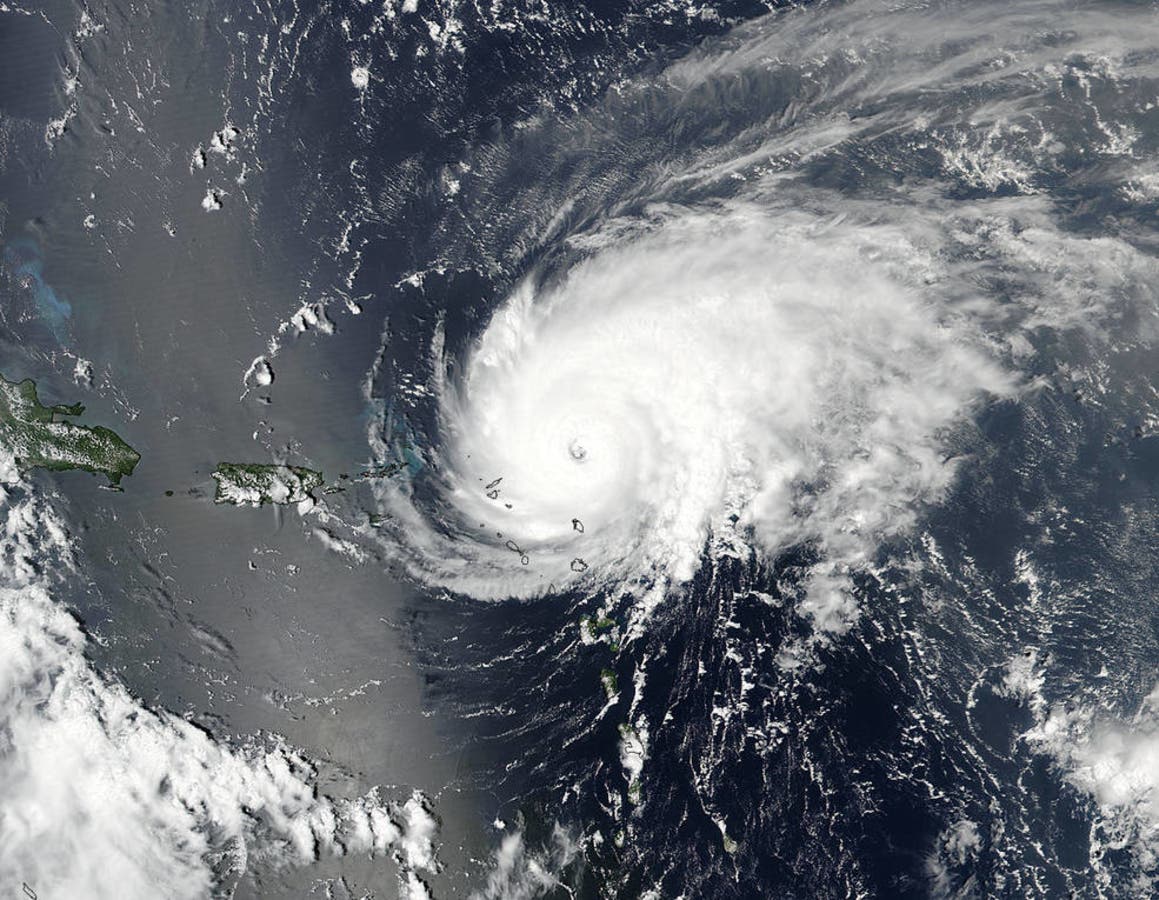
Photo: NASA (Hurricane Jose)
Get more local news delivered straight to your inbox. Sign up for free Patch newsletters and alerts.