Community Corner
Narragansett/South Kingstown to Get 4-8 Inches of Snow: Hour-by-Hour Forecast
The storm could bring enough snowfall to break the record for the snowiest winter on record in Boston.

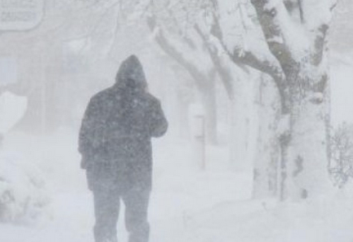
The latest snowstorm in a string of storms that have hit Rhode Island over the past five weeks is expected to make travel treacherous on Sunday night.
Here’s the latest National Weather Service forecast:
Find out what's happening in Narragansett-South Kingstownfor free with the latest updates from Patch.
- A WINTER STORM WARNING REMAINS IN EFFECT FROM 3 PM THIS AFTERNOON TO 7 AM EST MONDAY...
- LOCATIONS...CENTRAL AND SOUTHERN RHODE ISLAND AS WELL AS MOST OF SOUTHEAST MASSACHUSETTS RIGHT TO THE SOUTH COAST AND AS FAR EAST AS THE CAPE COD CANAL.
- ACCUMULATIONS...4 TO 8 INCHES OF SNOW.
- TIMING...AREAS OF LIGHT SNOW WILL DEVELOP THIS AFTERNOON. THE SNOW WILL INCREASE IN INTENSITY THIS EVENING FALLING MODERATE TO HEAVY AT TIMES. THE BULK OF THE ACCUMULATING SNOW WILL OCCUR BETWEEN 4 PM AND 1 AM...WHEN SNOWFALL RATES MAY BE ON THE ORDER OF 1 INCH PER HOUR. THE SNOW WILL TAPER OFF TO FLURRIES TOWARD DAYBREAK MONDAY.
- IMPACTS...UNTREATED ROADS WILL BECOME SNOW COVERED AND SLIPPERY BY THIS EVENING ALONG WITH POOR VISIBILITY AT TIMES. GIVEN TEMPERATURES WILL BE NEAR FREEZING...THE SNOW WILL BE OF THE WET VARIETY ESPECIALLY NEAR THE SOUTH COAST. THIS MAY EXACERBATE ANY ON GOING ROOF PROBLEMS.
- UNCERTAINTY...THE HEAVIEST SNOW LOOKS TO OCCUR CLOSE TO THE SOUTH COAST. HOWEVER...THERE IS A LOW RISK THE SNOW COULD MIX WITH OR CHANGE TO A PERIOD OF RAIN NEAR THE SOUTH COAST. IF THIS OCCURS...SNOW ACCUMULATIONS WILL BE LESS THAN FORECAST.
- WINDS...SOUTHWEST 5 TO 10 MPH.
- TEMPERATURES...IN THE UPPER 20S AND LOWER 30S.
Snow will begin as snow showers on mid-Sunday afternoon before intensifying late Sunday afternoon and Sunday evening. The snow will continue to fall into early Monday morning.
Here is the hour-by-hour forecast from The Weather Channel:
Find out what's happening in Narragansett-South Kingstownfor free with the latest updates from Patch.
Sunday
- 4 p.m.: Snow showers, 30
- 5 p.m. Sunday: Snow showers, 30
- 6 p.m. Sunday: Snow showers, 30
- 7 p.m. Sunday: Snow showers, 30
- 8 p.m. Sunday: Snow, 30
- 9 p.m. Sunday: Snow, 31
- 10 p.m. Sunday: Snow, 32
- 11 p.m. Sunday: Snow, 32
- Midnight: Snow, 32
Monday
- 1 a.m.: Snow, 32
- 2 a.m.: Light snow, 32
- 3 a.m.: Light snow, 32
- 4 a.m.: Snow showers, 31
- 5 a.m.: Cloudy, 30
- 6 a.m.: Cloudy, 30
- 7 a.m.: Cloudy, 30
- 8 a.m.: Mostly cloudy, 31
- 9 a.m.: Mostly cloudy, 33
Once we get past this latest snowstorm, we should see plenty of sunshine -- and seasonal temperatures -- for the upcoming week.
The Weather Channel is predicting that it will be partly cloudy with highs in the 30s on Monday and Tuesday. Wednesday is expected to be partly cloudy with highs in the 40s. Yes, the 40s!
Three more things to remember:
- We turn the clocks ahead next weekend.
- Spring training games start this week.
- Spring is three weeks away.
Get more local news delivered straight to your inbox. Sign up for free Patch newsletters and alerts.