Weather
RI Weather: When The Rain Will Be Heaviest Today
A whole lot of rain is expected Thursday, and there are times it could get really heavy.

Nearly all of Southern New England is under a flash flood watch Thursday as the region prepares for heavy rainfall and warming temperatures. The National Weather Service is calling for between 1-2 inches of rain through the the early afternoon.
The rain will pick up around 11 a.m. and be at its heaviest during the first part of the evening commute. Between 2-5 p.m. will likely will be the worst of it. The skies should start clearing up around 7-8 p.m.
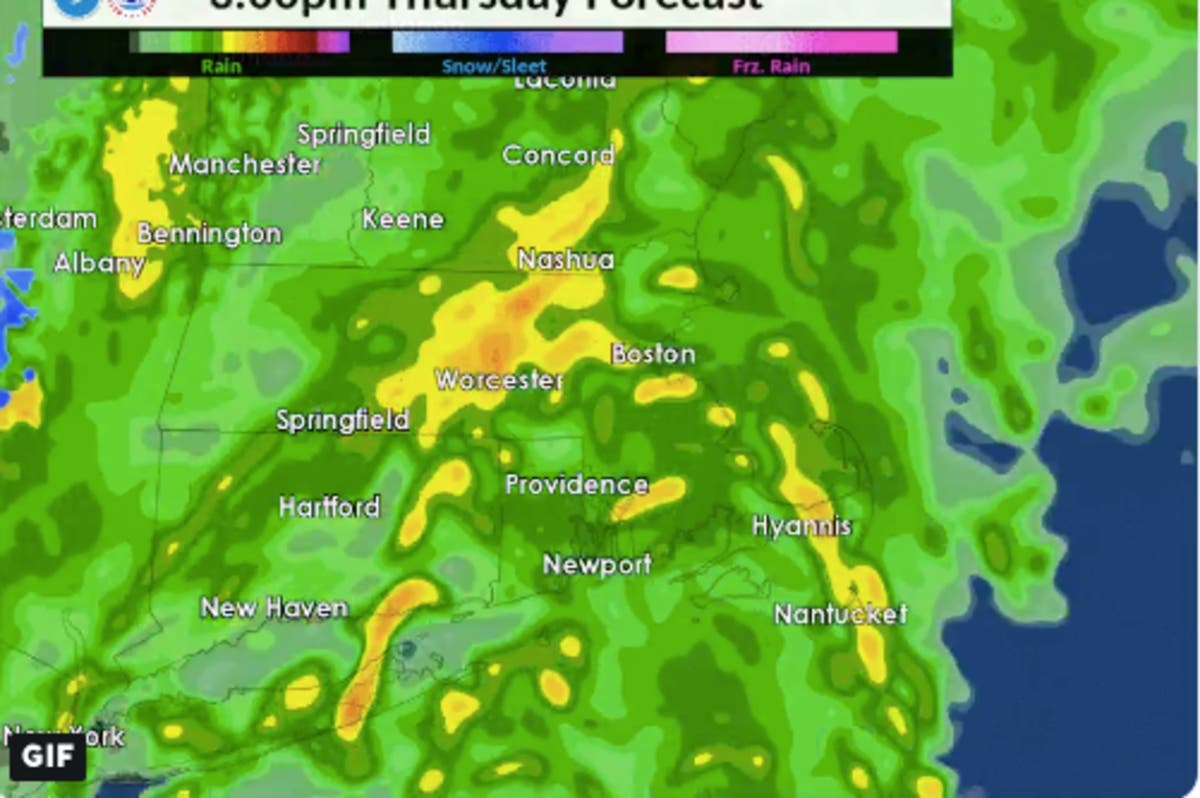
[Heavy Rain/Urban Street Flooding Threat] Approximate radar simulation indicates the heaviest rain/greatest threat for urban street flooding from 11 am to 6 pm. Heaviest rain on the Boston to Providence corridor between 3-5 pm with an impact on the first part of the eve rush hr. pic.twitter.com/eIiCZCpTCm
— NWS Boston (@NWSBoston) January 24, 2019
Meanwhile, a drastic increase in temperatures into the 50s will aid in the melting of much of the snow and ice we've accumulated the last few days. It's good news on the surface, but combined with the heavy rains it could present a flooding threat.
Find out what's happening in Newportfor free with the latest updates from Patch.
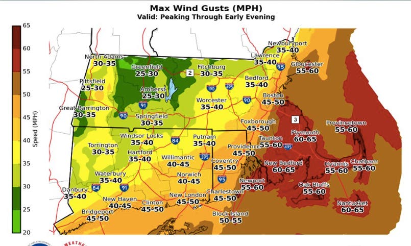
Forecasters are also expecting wind gusts in excess of 45-55 miles per hour in some areas. The southern half of the state is under a high wind watch.
There could see some tree damage and scattered power outages throughout the day, the NWS said. The worst of the winds will be between noon - 6 p.m.
Find out what's happening in Newportfor free with the latest updates from Patch.
NWS images
Get more local news delivered straight to your inbox. Sign up for free Patch newsletters and alerts.