Politics & Government
UPDATE: Is Your Street Being Plowed? Check This List
As Falls Church digs out, City releases list of secondary streets crews plan to tackle. Be sure you live in City limits.

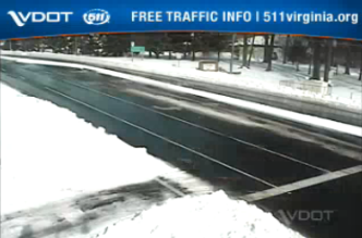
PHOTO: A screen grab Monday morning, from a live shot traffic camera on Route 7, at Haycock and Shreve roads; most primary roads in Northern Virginia are clear but crews are now tackling secondary roadways.
FALLS CHURCH, VA -- Public Works crews have been working around the clock since Friday to clear snow emergency routes and make residential streets passable, the City of Falls Church reports Monday morning.
Sign up here for the Falls Church Patch daily newsletter, news alerts
Find out what's happening in Falls Churchfor free with the latest updates from Patch.
The teams are still working to clear one lane on each street, which they plan to do Monday, the City said. Crews also plan to concentrate on intersections and hauling the mass amounts of snow.
Before contacting the City, check this list to be sure your street is within City boundaries, by checking the City Address Finder to make sure you are within the 2.2 square miles of the City of Falls Church. A number of addresses (including all in Pimmit Hills) are in Fairfax County.
Find out what's happening in Falls Churchfor free with the latest updates from Patch.
Crews will clear one lane on the following streets Monday
If your street is not listed, email pio@fallschurchva.gov or find the City on Facebook and Twitter.
North Side Streets (in alphabetical order)
- Greenwich Street
- Pennsylvania Avenue
- Riley Street
- Shadow Walk
South Side Streets (in alphabetical order)
- Gundry Drive
- Kent Street
- Rollins Street
- South Virginia Avenue
- Tinner Hill Road
- West Westmoreland Road
Get more local news delivered straight to your inbox. Sign up for free Patch newsletters and alerts.