Neighbor News
Hot weekend- Thunderstorms possible!
It will be really hot and HUMID! Thunderstorms seem possible this evening!
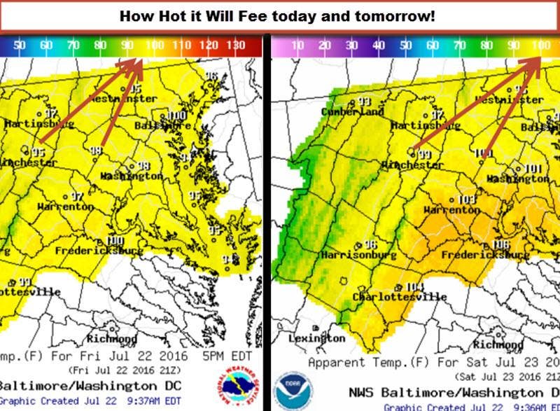
No need to make the obvious any more obvious! The dreaded three H's (Hazy, Hot, and Humid) weather has returned and the heat is not going anywhere fast!
Today we soar to the mid 90s but have a chance later in the day for some storms coming in from the north. The front bringing the storms could knock the humidity back a notch tomorrow, but will not stop the heat!
Temps in the 90s will persist through Tuesday of next week! There is a chance of some slightly colder temperatures about mid week! We will see!
Find out what's happening in Leesburgfor free with the latest updates from Patch.
There is a slight chance of a shower or storm tomorrow and a better chance Monday. Then a chance of daily showers and storms through most of next week.
Very Long range outlooks show a chance at a break for a little bit with a little cooler air, but honestly the rest of the summer could be above normal temperatures! We also have to watch that we do not get into a drier pattern. We are very fortunate to have had so much rain. Areas north and south of the Central Mid Atlantic are experiencing really dry conditions! You can see a map of the drought conditions here! Here is a map of Rain Departure From Normals for the last 180 days.
Find out what's happening in Leesburgfor free with the latest updates from Patch.

Here is a link to 7 Heat Safety Tips
Patch Weather Forecast for Leesburg, VA
Please Note:
These outlooks are not official forecasts and you should always refer to the National Weather Service for official forecasts, especially when it comes to protection of life and property. Data may not be current, therefore the reader should always rely upon official forecast products for their area provided by the National Weather Service.
All for now!