Health & Fitness
Lorton Rainfall Aug. 6-12: El Niño Watch, Hurricane Season Update, Winter???
Daily rainfall totals for previous 24 hours measured at 6am from my rain gauge in Lorton.


This past week, the National Weather Service’s Climate Prediction Center issued an El Niño watch, saying that weak-to-moderate El Niño conditions are likely to develop during August or September 2012. An earlier alert in May indicated there was a 50% chance for El Niño conditions to develop during the second half of 2012. This forecast is more specific in timing and characterizes the probability as “likely”.
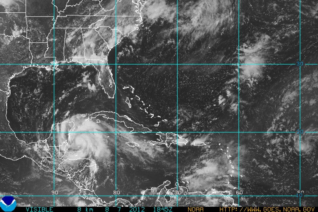
Also updated this past week was the 2012 Atlantic Hurricane Season Outlook. Hurricane season runs from June through November each year. The chance for an above normal hurricane season was raised from 25% (in the outlook issued in May) to 35%. The number of named storms is predicted to be 12-17 (rather than 9-15), with 5-8 of those strong enough to be classified hurricanes (rather than 4-8) and 2-3 major hurricanes (1-3 before). Why the change? When the update was issued, we’d already had 6 named storms, of which two became hurricanes, so the season has already been quite active. Also, the potential El Niño would tend to inhibit hurricane growth in the Atlantic by increasing the wind shear above the Atlantic tropics, effectively ripping the top off of forming hurricanes and preventing their growth. However, the El Niño forecast is now more specific in the timing - it will develop at the tail end of hurricane season and so won’t suppress as many storms as first expect. “We are increasing the likelihood of an above-normal season because storm-conducive wind patterns and warmer-than-normal sea surface temperatures are now in place in the Atlantic,” said Gerry Bell, Ph.D., lead seasonal hurricane forecaster at the Climate Prediction Center. “These conditions are linked to the ongoing high activity era for Atlantic hurricanes that began in 1995. Also, strong early-season activity is generally indicative of a more active season.”
Perhaps the hurricanes will miss Virginia this year. It’s still a good idea to be prepared. Visit http://www.ready.gov/hurricanes to learn more.
Find out what's happening in Lortonfor free with the latest updates from Patch.
So what does El Niño mean for Lorton? Weak and moderate El Niño events during winter tend to result in temperatures colder than normal with above normal snowfall. A study done by the National Weather Service’s Wakefield Virginia Forecast Office found that the local area had average temperature values from 1.5 to 2 F below the 1950-2005 average and received above normal snowfall.. They also found that strong El Niño events tend to be warmer than normal with less snow than average.
Last week - we got some rain! Some. During a typical week this time of year we see ¾” of rain. My rain gauge in Lorton recorded the following precipitation at 6am on the day indicated for the previous 24 hours:
Find out what's happening in Lortonfor free with the latest updates from Patch.