Community Corner
Mount Vernon Creates Interactive Alexandria Map Showing 'Washington's World'
Mount Vernon is looking for input on map that shows how George Washington would have seen Alexandria in his day.


Mount Vernon has created several historic interactive maps to show “Washington’s World” — including one of Alexandria — that will show visitors interesting landmarks important to George Washington during his time.
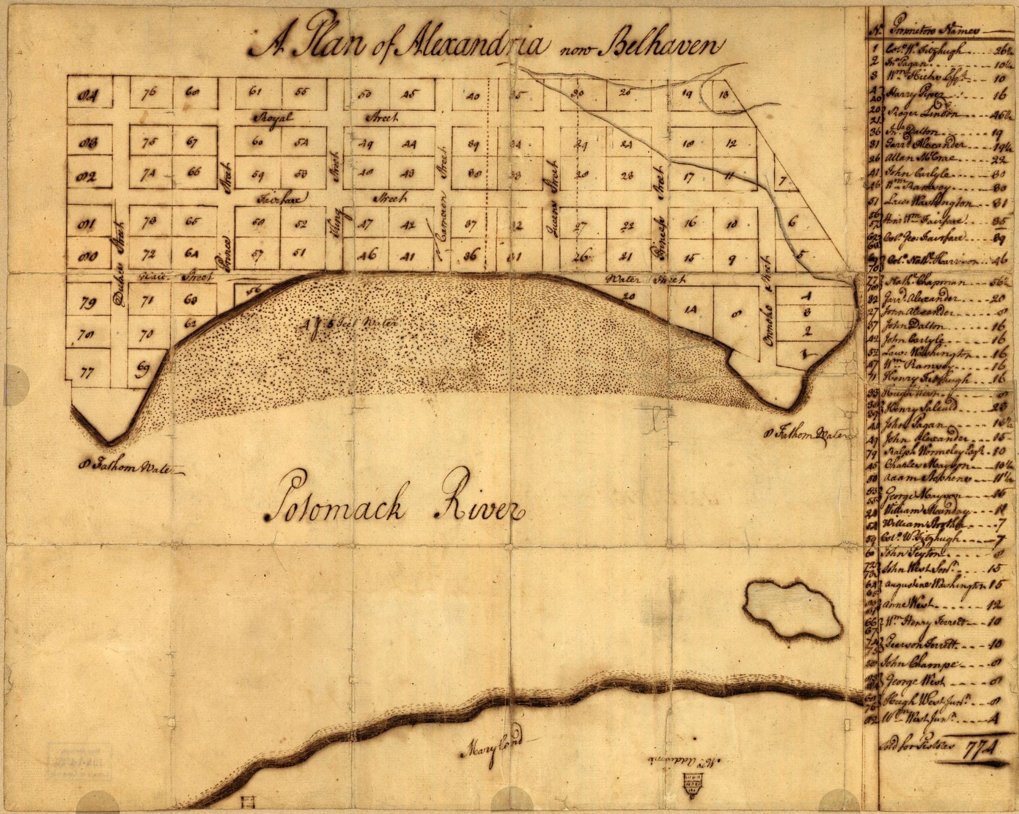
A map of Alexandria, produced by George Washington, is labeled: “A Plan of Alexandria, now Belhaven.” Mount Vernon says that Washington created the map in 1749. The map is from the Library of Congress, Maps Division
“George Washington played an integral part in the town’s early history and development throughout his lifetime,” Mount Vernon says about Alexandria. “In 1748, he assisted the county surveyor in laying out the town into 84 lots along 10 streets around a central market square.”
Find out what's happening in Old Town Alexandriafor free with the latest updates from Patch.
Mount Vernon is looking for history buffs to add their knowledge to the interactive map, which is marked with various locations important to Washington, such as the homes of William Ramsey, Dr. James Craik, Presbyterian Church and Christ Church and much more.
You can see the interactive map here and the historic map here. When you get to the interactive map, you must zoom in to Alexandria to see the locations that are mapped out. You can zoom in using the bar on the upper left side of the site.
Find out what's happening in Old Town Alexandriafor free with the latest updates from Patch.
If you receive email alerts from Mount Vernon, you’ll see the historic map embedded into the interactive map.
Get more local news delivered straight to your inbox. Sign up for free Patch newsletters and alerts.