Weather
Tornado Watch For Tuscaloosa County Until 6 p.m.
The National Weather Service has issued a Tornado Watch until 6 p.m. Thursday evening for Tuscaloosa County.

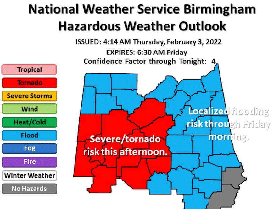
TUSCALOOSA, AL — The National Weather Service Forecast Office in Birmingham has placed Tuscaloosa County under a Tornado Watch until 6 p.m. Thursday evening.
Click here to subscribe to our free daily newsletter and breaking news alerts.
The Tornado Watch includes the cities of Aliceville, Brent, Carrollton, Eutaw, Greensboro, Livingston, Moundville, Northport, Tuscaloosa and York.
Find out what's happening in Tuscaloosafor free with the latest updates from Patch.
The NWS says periods of heavy rainfall are possible through Thursday night along and north of Interstate 85. What's more, additional rainfall totals of 1 to 3 inches are forecast, with locally higher amounts.
The NWS then said this may result in localized flooding of low lying or poor drainage areas. What's more, strong to severe thunderstorm are possible this afternoon across portions of west Alabama.
Find out what's happening in Tuscaloosafor free with the latest updates from Patch.
Tuscaloosa County EMA offers a free emergency notifications service - TuscALERT — that sends updates on severe weather directly to your phone, email or mobile device. Click here to sign up for TuscALERT.
Click here for a map of storm shelters across the Tuscaloosa metro. The Tuscaloosa County EMA website also provides regular updates on when shelters open during severe weather events.
This is a developing story. Be sure to follow us here for live updates as severe weather moves over West Alabama
Get more local news delivered straight to your inbox. Sign up for free Patch newsletters and alerts.