Community Corner
East Bay Fires Complex Grows To 230,000 Acres
20,000 structures are threatened in the SCU Lightning Complex fire zone, made up of 20 fires in 5 counties. Two first responders injured.


Read Friday's article on the fires here.
EAST BAY AREA, CA — The lightning-sparked East Bay fires are part of the giant the SCU Lightning Complex incident, and includes all fires burning in Alameda, Contra Costa, Santa Clara, San Joaquin, and Stanislaus counties.
While no new evacuation orders or warnings were issued in Alameda or Contra Costa counties on Thursday, the other three counties had rapid spread of flames and fresh evacuations. See the list below.
Find out what's happening in Fremontfor free with the latest updates from Patch.
Stephen Volmer, a fire behavior analyst for Cal Fire, looks at fuels, weather and topography to predict how a fire will spread. He said these fires are throwing embers up to three-quarters of a mile, rapidly increasing how fast the fires advance. And once those embers land, "just in the grass, the fire will move at up to 120 feet a minute," said Volmer, "it's putting the fire at moving faster than we can engage it safely."
The status report at 7:00 a.m. Friday: 229,968 acres burned, 10-percent containment, no deaths, and four injuries. Further information about the injuries is not available.
Find out what's happening in Fremontfor free with the latest updates from Patch.
There have been 5 structures reported damaged or lost, and another 20,000 structures are threatened.
More than 1,100 firefighters are on the fire lines or in the air battling the blazes, including Cal Fire and local departments. In addition to fire trucks, there are 33 water tenders, 4 helicopters, and 29 dozers assigned to the fires. Both equipment and personnel were increased on Thursday.
Evacuation Orders are issued when there is an immediate threat to life. This is a lawful order to leave now. The area is lawfully closed to public access. Evacuation Warnings are issued when there is a potential threat to life and property. Those who require additional time to evacuate, and those with pets and livestock should leave immediately, while everyone else should prepare.
Evacuation Orders:
Alameda County / Stanislaus County:
Evacuation Warnings:
Alameda County:
In the South Bay, all eyes turn to Mt. Hamilton when the temperature drops during a winter storm to see if there's snow on the peak. The wildfire reached Lick Observatory property, atop Mt. Hamilton, on Wednesday. The observatory was set up as a command post, and fire crews were stationed at the observatory to protect the structures. When the sun rose on Thursday, the observatory still stood.
Lastest official News https://t.co/lVHHtakVvx
— UC Observatories (@UCObservatories) August 20, 2020
Back in the East Bay, the Alameda County Fairgrounds in Pleasanton is the staging ground for fire crews, the place where "CAL FIRE Team 6 is working tirelessly with all of our troops and cooperators to organize, staff and mitigate the #SCULightningComplex."
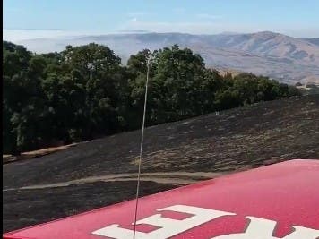
Especially hard hit: the East Bay's treasured regional parks. The Fremont Fire Department shared video Wednesday evening from Mission Peak.
Evening view from the backside of Mission Peak, courtesy of @FremontFire Battalion 5. @EBRPD #SCULightningComplex #Fremont pic.twitter.com/6Fdrpyj8E3
— Fremont Fire Department (@FremontFire) August 20, 2020
In a statement, Dave Mason of the East Bay Regional Park District reports "an unprecedented number of wildfires in parks, including Round Valley Regional Preserve, Morgan Territory Regional Preserve, Del Valle Regional Park, Sunol Wilderness Regional Preserve, Ohlone Wilderness Regional Preserve, Mission Peak Regional Preserve, and Pleasanton Ridge Regional Park."
All East Bay Regional Parks are also closed until further notice with the exception of some shoreline parks.
Although hiking, biking and other strenuous exercise may not be advised because of poor air quality, these are the parks that remain open:
- Crown Beach State Park
- Hayward Regional Shoreline
- MLK Jr. Regional Shoreline
- McLaughlin East Shore State Park
- Oyster Bay Regional Shoreline
- Point Isabel Regional Shoreline
- Quarry Lakes Regional Recreation Area
Three evacuation centers have been set up in Santa Clara County — in Milpitas, Morgan Hill, and Patterson.
Also See:
- PG&E Employee Dies Assigned To LNU Lightning Complex Fire
- The Salvation Army Feeds Deer Zone Fire Crews, Evacuees In Contra Costa County
- San Mateo/Santa Cruz County Fires
- Marin County Fires
- Napa County Fires
- 2,500 Lightning Strikes In Bay Area: SEE
- Hopscotch Drawn On San Francisco Sidewalk Sparks Joy: Watch
Get more local news delivered straight to your inbox. Sign up for free Patch newsletters and alerts.