Crime & Safety
2 Wildfires Burn In Sonoma County; Mandatory Evacuations Ordered
Evacuation warnings were upgraded to mandatory evacuations Tuesday for the two blazes that are part of the LNU Lightning Complex fires.

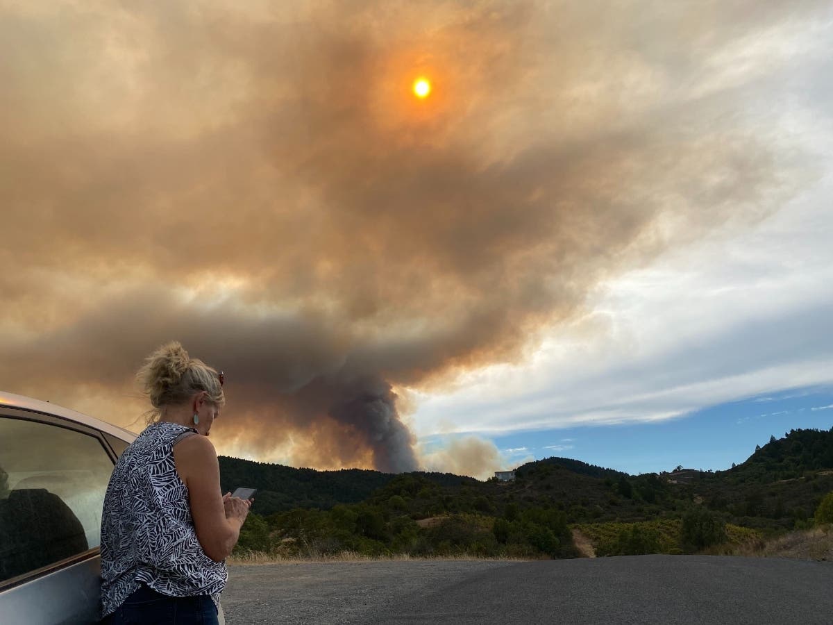


SONOMA COUNTY, CA — An evacuation warning was upgraded to a mandatory evacuation order Tuesday for residents in the Venado area of northwestern Sonoma County because of a wildfire that was estimated to be more than 500 acres and growing.
"THIS IS NOW A WILDFIRE EVACUATION ORDER," the officials with the county of Sonoma said about the wildland blaze that has been dubbed the 13-4 Fire.
The Sonoma County Sheriff's Office reiterated the evacuation order.
Find out what's happening in Healdsburgfor free with the latest updates from Patch.
"WildFire 13-4 is growing and has now been upgraded to a Mandatory Evacuation," the sheriff's office said just after 3 p.m. Tuesday. "The area that needs to evacuate immediately is South of Stewarts Point-Skaggs Springs Road, North of Austin Creek, West of the intersection of Mill Creek Road at Puccioni Road and East of the Cedars. If you're in the area, you must leave now."
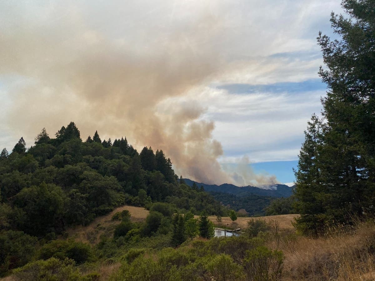
Evacuation orders were also in effect Tuesday for a second Sonoma County wildfire, the 11-16 Fire, which was 25 acres in size and burning north of Jenner
Find out what's happening in Healdsburgfor free with the latest updates from Patch.
The two Sonoma County fires are now part of the 32,025-acre LNU Lightning Complex fires that include five fires in Napa County.
More than 500 firefighters and other fire personnel are battling the North Bay blazes that threaten 1,900 homes and other structures. At least one home and two outbuildings have been destroyed in the Napa County Hennessey Fire.
In Sonoma County, mandatory evacuation orders as of 8:05 p.m. Tuesday for the 13-4 Fire included:
- South of Stewarts Point Skaggs Springs Road
- West of West Dry Creek Road and Westside Road
- North of Sweetwater Springs Road and McCray Ridge Road
- East of the East Austin Creek (the actual creek)
- East of Sewell Road and King Ridge Road
- North of Old Cazadero Road and Austin Creek (the actual creek) and East Austin Creek through the recreation area
- West of East Austin Creek and Wal Bridge Ridge.
- South of Stewarts Point Skaggs Springs Road.
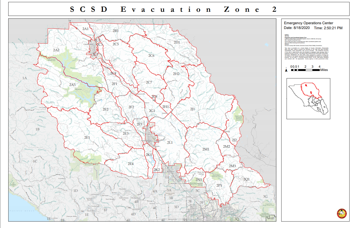
- These areas are referenced in grids 2E1, 2E2, 2E3, 2E4 and 1B3 of the map below. Future orders will reference this map as well.
Mandatory evacuations Tuesday night for the 11-16 Fire include:
- Meyers Grade Road to the Sonoma Coast
- South of Fort Ross Road
- North of the Intersection of Meyers Grade Road at Highway 1.
And an evacuation warning for the 13-4 Fire was issued Tuesday night for Map Grid 1C2:
- West of South Fork Gualala River
- North of Fort Ross Road.South
- East of King Ridge Road
RELATED COVERAGE: Napa County Lightning Complex Fires Latest: More Evacuations
LNU Lightning Complex - Evening Update 08-18-2020#CALFIRE#CALFIRELNU pic.twitter.com/cGEN8rPxi8
— CAL FIRE LNU (@CALFIRELNU) August 19, 2020
.jpg)
The #ThirteenFourFire is starting to grow in Northwest Sonoma County. While it’s burning in a relatively isolated area, there are homes and ranches near the fire zone. Please follow mandatory evacuation orders. See the latest: https://t.co/flQFmp8buE
— Mike McGuire (@ilike_mike) August" class="redactor-linkify-object">https://twitter.com/ilike_mike... 18, 2020
This developing story will be updated; please refresh your screen for the latest.
Get more local news delivered straight to your inbox. Sign up for free Patch newsletters and alerts.