Politics & Government
County Debuts Gorgeous Aerial Video of Mill Valley's Watershed
The six-minute video was shot mostly from drones that allow the viewer to see what the watershed looks like from above.
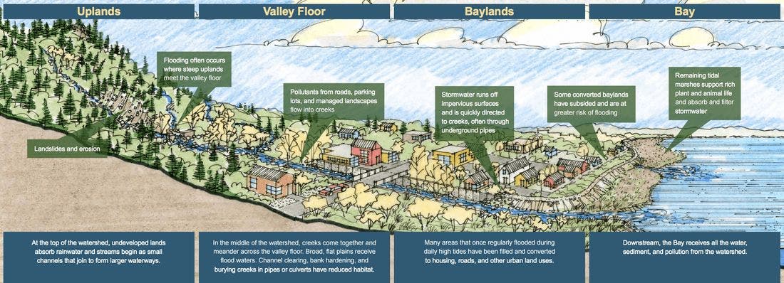
Mill Valley last week got a stark reminder of the watershed that surrounds us – and the flooding that comes when heavy rains mix with king high tides.
The County of Marin and the City of Mill Valley are well aware of the consequences of our proximity to Richardson Bay and the creeks that lead into it, and the agencies helped create the Southern Marin Flood Protection and Watershed Program in the aftermath of massive flooding caused nearly $100 million in damage throughout Marin in 2005.