Crime & Safety
See Smoke In Southwest Riverside County? Likely A Controlled Burn, Feds Say
A controlled burn helps forest officials manage wildlands, making future wildfires easier to fight, a U.S. Forest Service spokesperson said.

LAKE ELSINORE, CA —Did you see smoke rising from Riverside County mountain areas? Don't be alarmed, officials said.
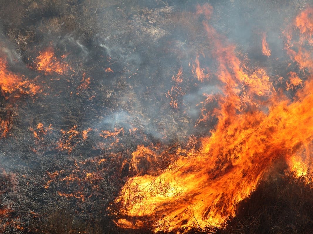
The U.S. Forest Service this week is conducting prescribed burns in the Cleveland and San Bernardino national forests to clear excess vegetation and give fire officials a better chance of halting wildland fires before they begin, the agency said.
Firefighters on Thursday morning began the controlled burns within the Trabuco Ranger District, near the El Cariso Fire Station off Ortega Highway (state Route 74). The burn was likely to continue as long as winds did not strengthen in that area, Cleveland National Forest spokesman Nathan Judy said.
Find out what's happening in Murrietafor free with the latest updates from Patch.
Controlled burns were also reported in the San Bernardino National Forest. Another burn was in progress near forest service Ranger Station 57 near Idyllwild.
Smoke may be visible from state Route 74 and Interstate 15, according to a forest service statement posted to social media. There was no need to report smoke plumes in that area.
Find out what's happening in Murrietafor free with the latest updates from Patch.
Even so, residents got nervous at the sign of smoke.
California Highway Patrol officers reported at least one 911 call around 11 a.m. in which a resident reported smoke over Mount San Jacinto.
Why Do Firefighters Conduct Controlled Or Prescribed Burns?
Crews conduct controlled burns to clear excess foliage in forests, though the acreage varies depending on the area and current conditions. The events are well coordinated, according to a report from U.S. Forest Service San Bernardino spokeswoman Lisa Cox. Each prescribed burn is managed by a specific team, led by a firefighter known as the "burn boss."
The burn boss evaluates conditions and manages the "burn window," or how long the weather conditions are favorable. Fire crews then conduct the burning and the mopping up necessary at the end of the day, Cox said.
If anything changes, the burn boss calls off the event, as happened Monday in the area south of Big Bear Lake in the San Bernardino National Forest.
That controlled burn was curtailed after firefighters burned only 2 acres, Cox said. Firefighters attempted to create a "broadcast burn" — or a low-intensity fire, such as one ignited by a lightning strike. Their planned outcome was to "make the area safer for firefighters to work behind nearby homes in case of wildfire," Cox said.
But gusting winds and dry air conditions on that day caused the managed fire to burn hotter and faster than firefighters predicted, closing the burn window. Video released on Twitter showed the wind fanning flames and the area filling with smoke.
"The weather changed slightly with a lowering humidity, making the fire burn with increased intensity than desired, so the burn boss halted ignitions," according to the San Bernardino National Forest Twitter feed.
Replies to that message ranged from congratulations to the forest service for good judgment to questioning if prescribed burns were a "dangerous practice."
"Burns are closely monitored and immediately suspended when there are signs of changing weather," the San Bernardino National Forest Twitter feed said.
Officials planned to restart the broadcast burn in the Big Bear Lake area when the weather permits.
Get more local news delivered straight to your inbox. Sign up for free Patch newsletters and alerts.