Weather
Second Of Back-To-Back Storms To Bring Rain, Flooding Risk And Heavy Snow To Bay Area
Heavy rain, lightning, and even some snow are expected across NorCal over the next few days. When and where?

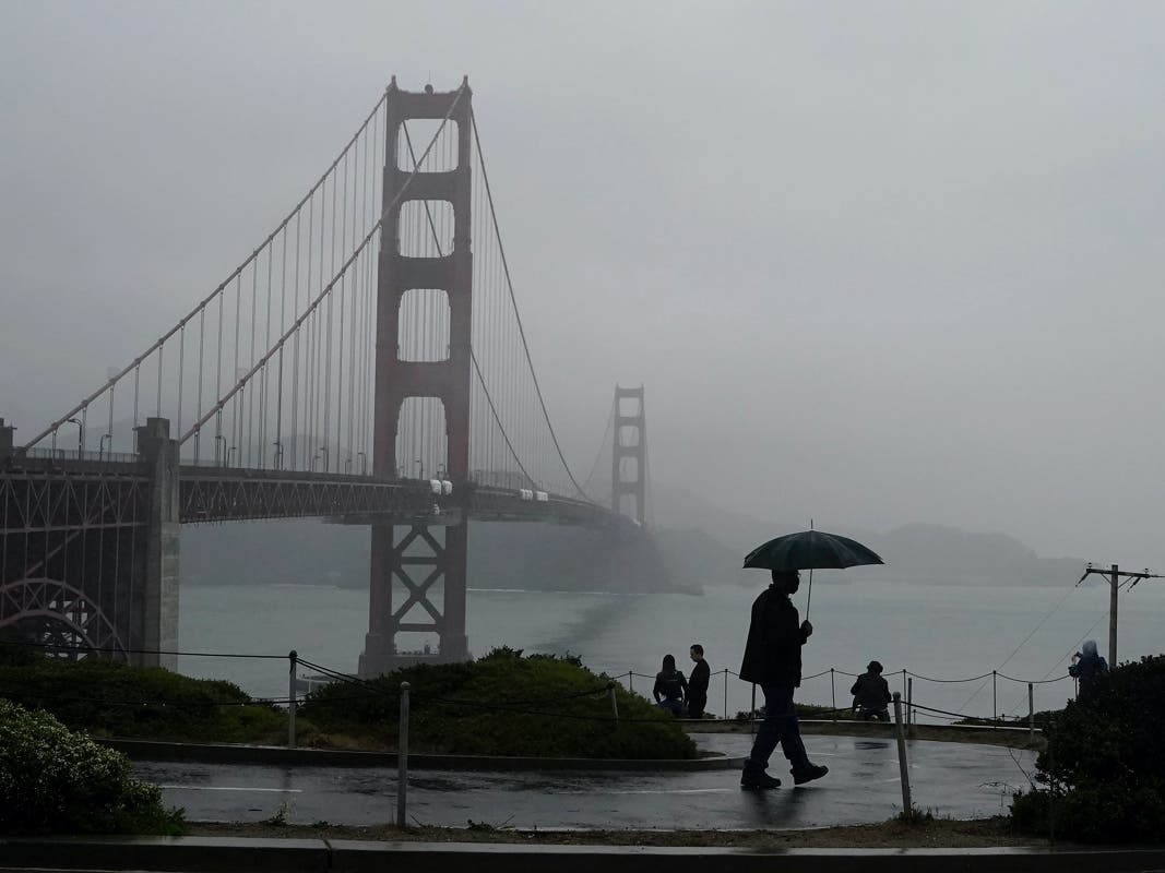
BAY AREA — After a prolonged, scorching heatwave that reduced the Sierra Nevada snowpack by roughly 25%, some much needed rain is hitting the Bay Area.
Rain began Thursday night and continued into Friday morning. The rain paused for a while in the morning, then heavy showers started up again after noon.
Heavier rain is expected Saturday, which could create localized flooding throughout the region. Santa Cruz and Big Sur could see totals of 1.5 to 2 inches, while San Francisco, the North Bay, and Contra Costa County could see up to 1.5 inches, according to the National Weather Service.
Find out what's happening in San Franciscofor free with the latest updates from Patch.
Isolated to scattered thunderstorms are possible late Friday and Saturday all across the region, forecasters said. Storms could produce lightning, heavier rainfall, small hail, and winds that could reach up to 30 mph in higher locations. NWS meteorologist Dylan Flynn told The Mercury News that lightning is likeliest Friday afternoon across the Bay Area, when there will be a 25-30% chance.
Find out what's happening in San Franciscofor free with the latest updates from Patch.
The storm is likely to bring up to 3 feet of snow to higher elevations in the Sierra Nevadas, including Tahoe, Donner, and Lassen, according to the National Weather Service. The service issued a winter storm watch for the southern Cascades and Northern Sierra about 4,500 feet from 5 p.m. Friday through 11 p.m. Sunday, and said travel could be “very difficult to impossible” in higher mountain elevations.
Modest rain is also expected in SoCal, particularly Sunday morning, according to AccuWeather.
Get more local news delivered straight to your inbox. Sign up for free Patch newsletters and alerts.