Community Corner
'Near Blizzard' Conditions Now Forecast for Bethany/Woodbridge
The National Weather Service has issued a Winter Storm Watch for the storm headed for the area.


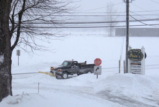
After a week of writing about this possible developing major snowstorm, we’re almost here and it looks to be a significant winter storm, according to the latest information from the National Weather Service.
The National Weather Service says the conditions for Fairfield, New Haven, Middlesex and New London counties could be “near blizzard” like as strong gusty winds will make visibilities very low. Traveling Saturday afternoon and evening may be very difficult, the weather service says.
The snowfall projections are all over the place with a minimum of two inches, and a maximum of eight inches possible. But this appears to be a storm where the closer you live to the Shoreline, the more snow you’ll receive, likely in the six-inch range.
Find out what's happening in Bethwoodfor free with the latest updates from Patch.
A Winter Storm Watch is now in effect from Saturday morning through Sunday afternoon.
According to the bulletin:
*HAZARD TYPES...HEAVY SNOW.
* ACCUMULATIONS...SNOW ACCUMULATION OF 2 TO 8 INCHES.
* WINDS...NORTH 15 TO 20 MPH WITH GUSTS UP TO 30 MPH.
* TEMPERATURES...IN THE MID 20S.
* VISIBILITIES...ONE HALF MILE OR LESS AT TIMES.
* TIMING...SATURDAY MORNING THROUGH SUNDAY AFTERNOON.
* IMPACTS...HAZARDOUS TRAVEL DUE TO REDUCED VISIBILITIES AND SIGNIFICANT SNOW ACCUMULATIONS. BLOWING AND DRIFTING OF SNOW WITH NEAR BLIZZARD CONDITIONS ARE EXPECTED DUE TO STRONG WINDS.
PRECAUTIONARY/PREPAREDNESS ACTIONS...
A WINTER STORM WATCH MEANS THERE IS A POTENTIAL FOR SIGNIFICANT SNOW...SLEET...OR ICE ACCUMULATIONS THAT MAY IMPACT TRAVEL. CONTINUE TO MONITOR THE LATEST FORECASTS.
Find out what's happening in Bethwoodfor free with the latest updates from Patch.
Coastal Flood Watch for southern Fairfield and southern New Haven
A Coastal Flood Watch is also in effect for southern Fairfield and southern New Haven counties from Saturday evening through late Saturday night. Minor coastal flooding is possible and a warning may need to be issued for late Saturday evening.
Hyperlocal National Weather Service Forecast:
Tonight A chance of snow, mainly after 4am. Increasing clouds, with a low around 19. Wind chill values between 10 and 15. Northeast wind 5 to 14 mph, with gusts as high as 28 mph. Chance of precipitation is 30%.
Saturday Snow, mainly after 10am. The snow could be heavy at times. High near 28. Wind chill values between 5 and 15. Blustery, with a northeast wind 17 to 21 mph, with gusts as high as 34 mph. Chance of precipitation is 80%. New snow accumulation of 1 to 3 inches possible.
Saturday Night Snow, mainly before 4am. The snow could be heavy at times. Low around 21. Wind chill values between 10 and 15. Blustery, with a north wind 14 to 22 mph, with gusts as high as 36 mph. Chance of precipitation is 80%. New snow accumulation of 1 to 3 inches possible.
Sunday A chance of snow, mainly before 7am. Mostly sunny, with a high near 34. Northwest wind 8 to 13 mph. Chance of precipitation is 30%.
Image via Tim Jensen/Patch
Get more local news delivered straight to your inbox. Sign up for free Patch newsletters and alerts.