Community Corner
Walking On Water
The map of an older, and very different, New London lies buried beneath our streets.
I cannot claim to have an excellent sense of direction. I’ve never yet been so lost that I haven’t managed to extricate myself, but I’m not one of those people who seem to have a compass implanted in their head. There were a few hours once when I thought I would have to live out my entire life driving in circles through a certain part of Baltimore, but I managed to escape.
I mostly rely on foolproof tricks, one of them being that in coastal Connecticut, if you’re heading towards the shore, you are going south. Except - alas - in New London, because of course New London’s waterfront is not Long Island Sound, but the Thames. And therefore the city faces wast.
Find out what's happening in New Londonfor free with the latest updates from Patch.
I say “of course” because I know this on a logical, map-reading level. Yet I can’t seem to remember it when I’m actually going anywhere. I know that when I’m in New London, looking out at the water, I’m facing east, not south. Yet when I’m walking or driving in any given direction I become incapable of naming which direction that is.
I thought that was why New London’s streets, and their relation to the water, seemed slightly “off” to me. But there’s another reason too. It’s because some of those streets used to be water, and others were built around a shoreline that’s now lost.
Find out what's happening in New Londonfor free with the latest updates from Patch.
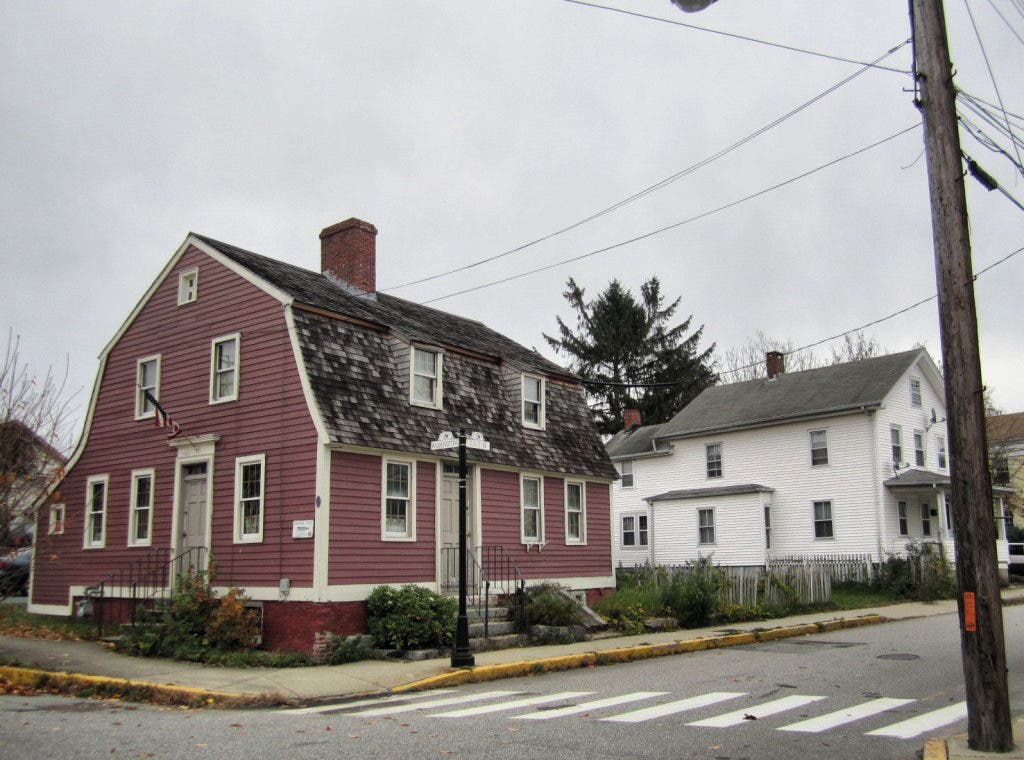
Think of Coit Street, the way it strangely curves. I never knew, until a few months ago, that it was once called Cove Street, for it was built around the erstwhile Bream Cove. At first this body of water, center of New London’s early ship-building, was crossed by “a foot-bridge, with a draw.” Later, this route became Blinman Street, referred to as “the highway to the water.” Frances Manwaring Caulkins writes that in the early days of settlement: “Bank St. was laid out on the very brink of the upland, above the sandy shore, and a spur (now Coit St.) was carried around the head of Bream Cove to Truman St...No names were given to any of the streets for at least a century after the settlement; save that Main St. was uniformly called the Town St. and Bank St. the Bank.”
It seems easier to orient oneself in that version of New London, where “the cove at the north was Mill Cove; the two coves at the south, Bream and Close. Water St. was the Beach, and the head of it at the entrance of Mill Cove, was Sandy Point.” Though it’s disconcerting to imagine water reaching almost to the , and those hundred years of nameless roads.
The rectangle made by Coit, Washington, Blinman, and Brewer Streets is designated as the Coit Street Historic District. Preserved there are examples of 18th and 19th century architecture as well as the memory of those who bought lots there beginning in 1647. The eponymous John Coit was a shipwright, as were other original settlers in the neighborhood; the coves were deep enough for the pinnaces, shallops, and barques they built. Later, as the water was filled in to make more land for development, the inhabitants of the neighborhood practiced trades related to the water – rigger, captain, ship’s carpenter – but not immediately dependent on it. The eventual lack of waterfront did not diminish property values; in the 1800s, nearness to downtown became the selling point.
And so here we are, traveling our roads that insist on their now unnecessary paths, still driving around Bream Cove and Close Cove, even if we don’t know it. I prefer to think that this, and not my own lack of navigational ability, is why New London often seems to twist and turn in confusion. We walk on solid ground in the footsteps of those who took bridges. Our map is predicated on realities that no longer exist, and places we can no longer go.