Weather
Hurricane Isaias: Storm Still Category 3 Ahead Of Landfall, Thousands Without Power In FL
Florida's Panhandle is facing the threat of catastrophic coastal flooding, destructive winds and widespread power outages.


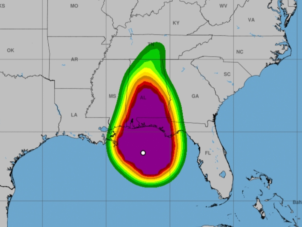
PENSACOLA, FL — Florida's Panhandle is facing the threat of catastrophic coastal flooding, destructive winds and widespread power outages as Hurricane Isaias barrels toward the northern Gulf Coast Friday evening.
According to the 4 p.m. update from the National Hurricane Center, Isaias remains a Category 3 hurricane with maximum sustained winds of 120 mph as it moves north at approximately 17 mph.
Forecasters said the storm's center was located approximately 90 miles south of Pensacola in Friday afternoon's advisory, with landfall expected Friday evening along the Alabama or Florida Panhandle coastline.
Find out what's happening in Across Floridafor free with the latest updates from Patch.
As of the latest totals, roughly 16,000 customers were without power in Florida, with the largest outages in Escambia County (3,404) as of 4:30 p.m.
Forecasters warned that portions of the western Florida Panhandle are likely to experience hurricane-force winds, life-threatening storm surge and torrential rainfall as conditions deteriorate throughout the afternoon and evening.
Find out what's happening in Across Floridafor free with the latest updates from Patch.
A hurricane warning remains in effect from Ocean Springs, Mississippi, to the Bay-Gulf county line in Florida, while a storm surge warning extends eastward to the Suwannee River.
The greatest coastal flooding threat is concentrated along the western Florida Panhandle, where storm surge could reach 6 to 9 feet above normally dry ground from the Alabama-Florida border to Grayton Beach.
Farther east, storm surge of 4 to 7 feet is possible from Grayton Beach to Indian Pass, while the coastline from Indian Pass to the Steinhatchee River could experience 4 to 6 feet.
Forecasters warned that dangerous waves accompanying the surge could worsen flooding and make conditions especially hazardous in coastal communities.
Heavy rainfall is also expected across the Florida Panhandle and Big Bend region, with widespread totals of 4 to 8 inches and localized amounts potentially reaching 15 inches.
The National Hurricane Center said in its latest update that the rainfall could produce considerable flash flooding and urban flooding, along with rising rivers and streams.
In addition to the flooding threat, tropical storm-force winds extend outward as far as 205 miles from the hurricane's center, meaning communities well outside the immediate landfall area could experience dangerous conditions.
A wind gust of 47 mph was reported at Navarre Beach, Florida, as the storm approached Friday afternoon.
Tornadoes are also possible across the Florida Panhandle Friday afternoon and overnight, adding another hazard for residents already facing the threat of damaging winds and flooding.
Although Isaias is expected to weaken after moving inland Saturday, forecasters warned that dangerous conditions could persist well beyond landfall.
The National Hurricane Center continues to monitor Isaias as the storm approaches the northern Gulf Coast and encourage those in the potentially impacted areas to stay weather aware.
Get more local news delivered straight to your inbox. Sign up for free Patch newsletters and alerts.