Weather
Near Record-Warmth Possible Friday, But Chance Of Severe Storms For Chicago Area
The NOAA's storm prediction center shows a risk for storms on Friday.

Slightly cooler temperatures with highs near 50 are expected Wednesday and Thursday, before "near-record warmth" is possible on Friday, according to the National Weather Service.
Periods of rain and fog are expected the next few days, although the weather service notes that there will be "plenty of dry hours." The high for Wednesday is 49 degrees, and 51 degrees on Thursday. It will be coolest near the lake, the weather service said.
Warmer temperatures will move in Friday, with a high of 75 degrees possible. According to NWS data, the record high for March 6 (Friday) is 70 degrees, which was set in 2000.
Find out what's happening in Across Illinoisfor free with the latest updates from Patch.
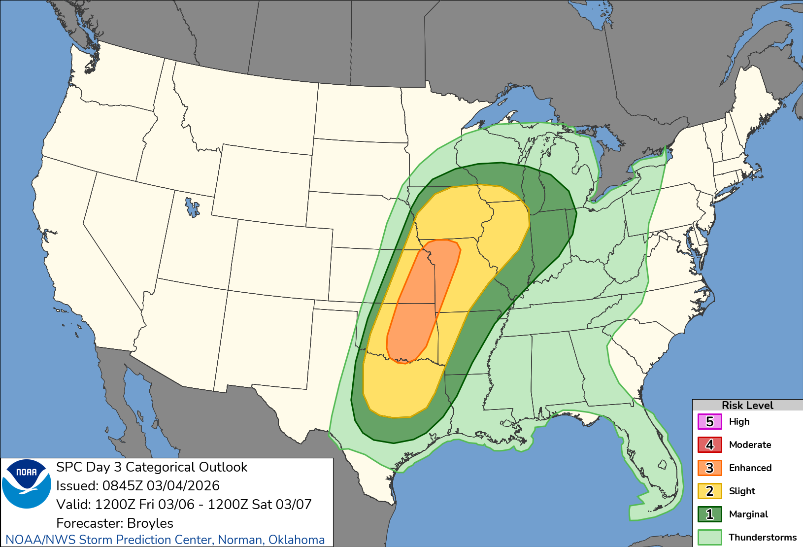
NOAA
With the warmth, there also is a chance of showers and storms, some of which could be severe, the weather service. The NOAA's storm prediction center gives a "slight" risk for storms on Friday.
Find out what's happening in Across Illinoisfor free with the latest updates from Patch.
Strong to severe storms are possible, especially for late Friday night, according to the current forecast.
After Friday, warm temperatures stick around for at least a few days. The high for Saturday is 64, 51 on Sunday, and 70 on Monday, according to the weather service.
Get more local news delivered straight to your inbox. Sign up for free Patch newsletters and alerts.