Weather
Baltimore County Weather: March 2017 Snowstorm Live Feed
Get the latest updates on the winter storm and how it will impact Baltimore County.

TOWSON, MD — The Nor'easter is fast approaching the Baltimore-Washington area, and she's bringing lots of snow with her.
We'll be keeping a live stream of updates on the weather — and any changes to the forecast — in this post throughout the day, so stay tuned.
How much are we going to get? Snow and sleet will measure anywhere from 4 to 12 inches, with the greatest accumulation anticipated northwest of Interstate 95, the National Weather Service says.
Find out what's happening in Owings Mills-Reisterstownfor free with the latest updates from Patch.
Areas in the north and western part of the county may see 8 to 12 inches of snow, according to weather officials. Southern Baltimore County could see 4 to 8 inches.
Here is the latest forecast of snow amounts across the region from 3pm Monday through 8pm Wednesday. pic.twitter.com/JCS0UNmzc9
— NWS DC/Baltimore (@NWS_BaltWash) March 13, 2017
When is it going to hit? A winter storm warning is in effect from 7 p.m. on Monday, March 13, to 2 p.m. on Tuesday, March 14. The heaviest snow is expected late Monday night.
Find out what's happening in Owings Mills-Reisterstownfor free with the latest updates from Patch.
Will schools be closed? Check on school closings here.
What is the county doing to prepare? See the Baltimore County Stormfighter.
How can I prepare? Charge electronic devices and make sure you have batteries, a snow shovel and salt as well as food and water. Fill up the gas tank in your car. Check on neighbors and older adults. In the event of a power outage, call BGE at 1-877-778-2222 or report the outage online.
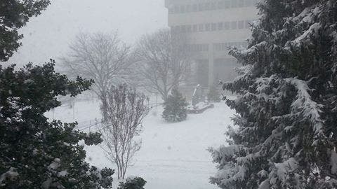
File photo courtesy of Baltimore County government.
Get more local news delivered straight to your inbox. Sign up for free Patch newsletters and alerts.