Home & Garden
Massachusetts Weather Forecast: Hazardous Weather Outlook For 'Uncertainty'
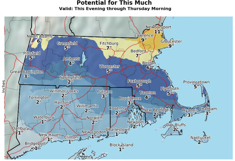
Wide spread: The NWS says to expect as much as 9-11 inches in Northern Mass. and 3-6 elsewhere or as little as nothing at all.

A hazardous weather outlook is in effect for all but a few Massachusetts counties as the Bay State braces for "uncertainty" on the outskirts of a Northern New England storm. There could be as much as nearly a foot in Northern Massachusetts, and several inches elsewhere, to as little as just a few flakes, the National Weather Service said Wednesday morning.
There is "lots of uncertainty this evening into [Thursday morning,]" the NWS said. A potentially heavy storm is expected for Maine and into New Hampshire; it should be stalling out in Northern Massachusetts but could dump 3-9 inches in the area — potentially 11. See three snow total maps below
Essex County, which is expected to get 3-4 inches of snow but could see as much as 9, is under a winter storm watch as a result. Parts of Merrimack Valley could also see 3-7 inches. Much of the state could see an inch or 2 of snow, but rain and a wintry mix is more likely. The NWS released preliminary snow estimates below. Subscribe to your local Patch to keep up on weather and other local updates.
Find out what's happening in Bostonfor free with the latest updates from Patch.

The potential for significant snow around the region still exists. Here is a look at the NWS snow "potential" map through tomorrow evening.
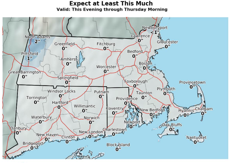
But the NWS also says to "expect at least this much" through Thursday evening — essentially nothing save for a few flakes close to New Hampshire.
Find out what's happening in Bostonfor free with the latest updates from Patch.
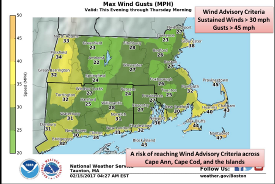
Barnstable, Dukes and Nantucket are not under the hazardous weather outlook, but there are expected to be the strongest winds in those areas. Wind gusts in the 40 mph range will blow along the Cape and coast, while inland will see gusts in the mid-20s.
This would be the third storm in a week's time, but this time Southern New England could dodge snow almost altogether in favor a wintry mix. That may come as a relief to towns that have seen more than 2 feet of snow since Thursday.
"Parts of southern New England, including Boston, are expected to see mixed precipitation or rain, at this time," said Weather.com. "Areas west and north of Boston have the greatest likelihood of seeing snow or a wintry mix."
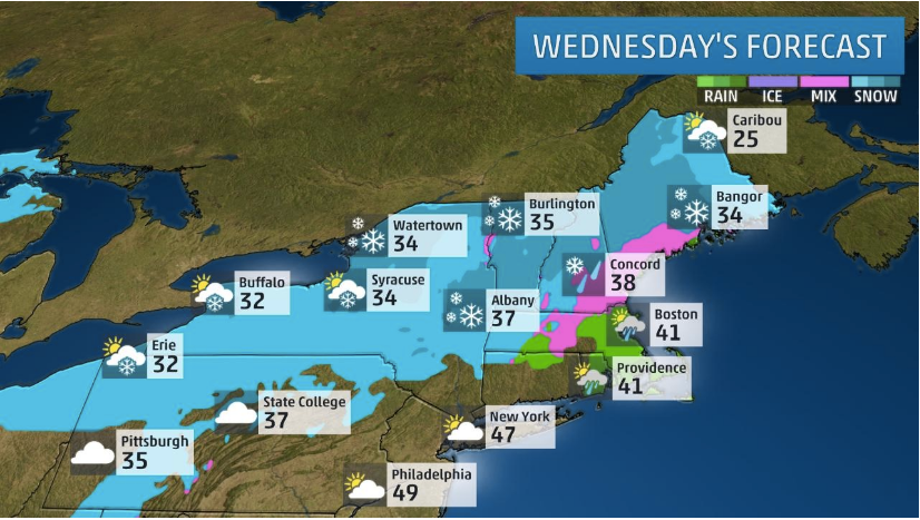
Thursday's forecast looks to be much more harmless: cloudy in the mid 30s but mostly dry.
Some sunshine and less wind will make it feel a bit warmer. A light snowfall possible late tonight into early Thu. https://t.co/iTrYwzX09F pic.twitter.com/1kVtqJIX64
— NWS Boston (@NWSBoston) February 14, 2017
Get more local news delivered straight to your inbox. Sign up for free Patch newsletters and alerts.