Weather
Memorial Day Weather Goes Out with a Bang
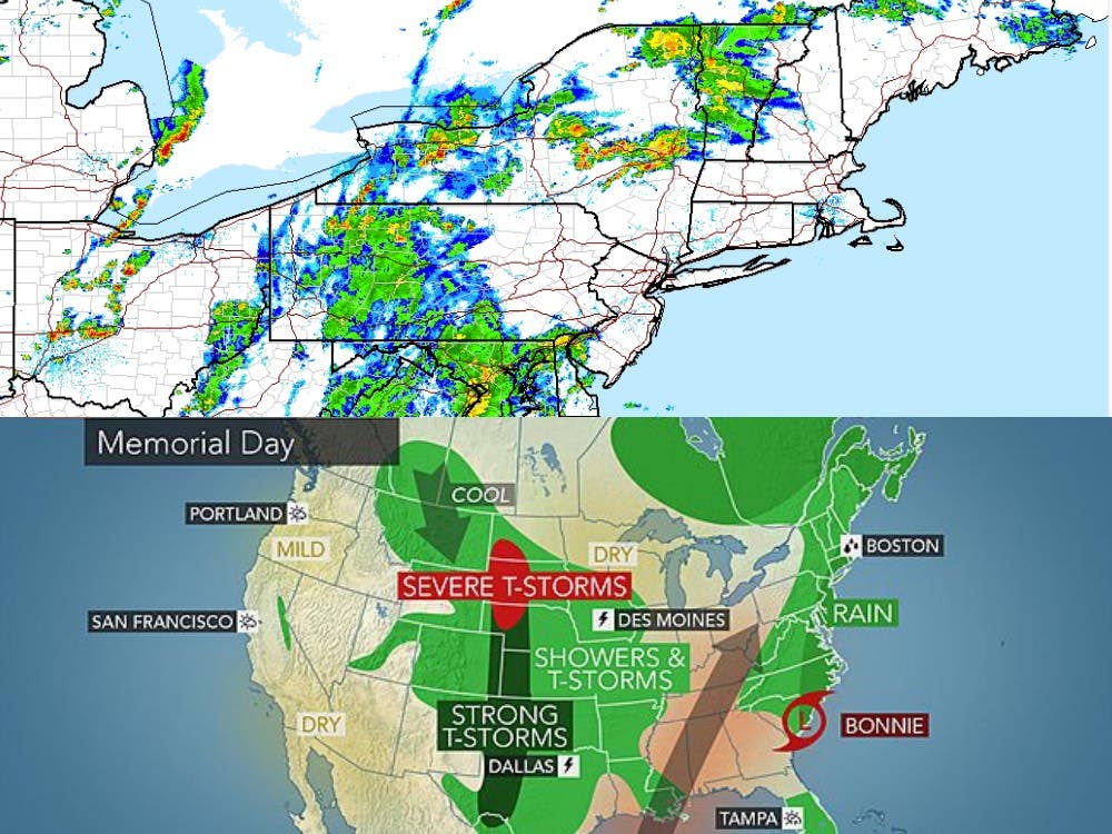
A hazardous weather alert has been issued for tonight, tomorrow. The remnants of Tropical Storm Bonnie could be heavy, cause some flooding.

The National Weather Service issued a hazardous weather outlook this afternoon warning of heavy showers, thunderstorms, strong winds – especially in the mountains, and maybe even some localized flooding.
The alert is active through Monday afternoon.
AccuWeather.com put it more bluntly: Bonnie's rainfall may ruin outdoor plans along Northeast coast.
Find out what's happening in Concordfor free with the latest updates from Patch.
As Bonnie moves into tropical rainstorm mode on Monday, frequent showers are expected.
“Those with outdoor plans are reminded to seek shelter as soon as thunder is heard,” noted Senior Meteorologist Kristina Pydynowski. The danger of being struck by lightning is then present.
Find out what's happening in Concordfor free with the latest updates from Patch.
The last thing anyone wants is to get hit by something like this – caught on a police dashcam.
The forecast
Here’s the latest forecast from the National Weather Service:
Memorial Day: Scattered showers and thunderstorms possible during the early morning hours and then continuing throughout the day. The rain is expected to be heavy at times with temperatures in the mid-70s. Temps drop down into the lower 60s during the evening.
Tuesday: A slight chance of showers in the early morning hours and then sunny skies, highs in the mid-80s, with a light breeze. Temps drop down into the upper 50s during the evening.
Wednesday: Sunny with temps in the upper 70s and dropping down into the 50s at night.
Thursday: Mostly sunny skies with highs in the lower 70s and temps in the 50s during the evening.
The latest local weather forecast is available on the front page of every Patch.com news and community website.
Graphic courtesy of AccuWeather.com.
Get more local news delivered straight to your inbox. Sign up for free Patch newsletters and alerts.