Community Corner
Rain, Thunderstorms and then, Another Warm Spell
This week's Granite State weather forecaster – t-storms, fog, sunny days, and chilly nights.

The National Weather Service has issued a “hazardous weather outlook” warning for much of the day today for central, southern, and southeastern New Hampshire, including Hillsborough, Merrimack, and Rockingham counties.
An area of low pressure is lingering over the region through Monday and could possibly bring thunderstorms as well as local, heavy rainfall. Showers are expected to start between 3 and 4 p.m. today and continue into the evening.
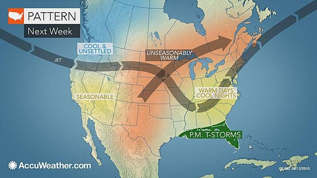
After Monday though, it’s going to be very nice.
Find out what's happening in Concordfor free with the latest updates from Patch.
AccuWeather.com forecasters suggest that it will be unseasonably warm during the days with very cool evenings, according to a report this morning. Expect a lot of sunshine and the opportunity to enjoy at least one more week and possibly the weekend with summer weather.
The forecast
Find out what's happening in Concordfor free with the latest updates from Patch.
Showers today and tonight with highs in the mid-60s and a light breeze but no more than a quarter of an inch of rain is expected. Lows drop down into the mid-50s tonight.
On Monday, partly sunny skies with highs in the low 70s with wind as much at 15 mph at times from the west. Temps will drop down into the 50s overnight.
More sun can be expected on Tuesday with temps rising into the low 80s in some parts of the state with a light breeze. Temperatures will be in the lower to middle 50s during the evening.
Expect similar weather on Wednesday and Thursday.
By Friday though, it will be even warmer, with highs in the mid-80s.
The sun is expected to continue into the weekend.
Don’t forget to visit the front page of your local NH Patch news and community website for the latest weather updates.
Get more local news delivered straight to your inbox. Sign up for free Patch newsletters and alerts.