Weather
Hurricane Lee Turns North: Latest NJ Impacts
Life-threatening rip currents could develop at Jersey Shore beaches. Lee is also expected to bring gusty winds later this week.

NEW JERSEY — Dangerous rip currents at beaches and high surf at sea are again possible along the Jersey Shore, as the powerful Hurricane Lee prepares to turn northward on its path through the Atlantic.
Though Lee is still to our south and is expected to past well east of New Jersey later this week, this very large hurricane has already created hazardous swimming conditions, even for experienced swimmers. The risk of life-threatening rip currents and dangerous surf will develop develop Wednesday and Thursday at local beaches, National Weather Service forecasters said.
Officials have confirmed four drownings this year along the Jersey Shore, during similar dangerous swimming conditions caused by Hurricane Franklin over Labor Day.
Find out what's happening in Across New Jerseyfor free with the latest updates from Patch.
The U.S. Coast Guard is urging beachgoers along the Mid-Atlantic coast to exercise "extreme caution" when swimming, as someone caught in a rip current can be swept away from shore quickly.
"The best way to escape a rip current is by swimming parallel to the shore instead of towards it, since most rip currents are less than 80 feet wide," the Coast Guard said in an advisory Wednesday.
Find out what's happening in Across New Jerseyfor free with the latest updates from Patch.
"The most important thing to remember if you are ever caught in a rip current is not to panic. Continue to breathe, try to keep your head above water, and don’t exhaust yourself fighting against the force of the current."
A Small Craft Advisory is in effect through Thursday night for the ocean waters, as seas will be around 4-7 feet.
Lee will also bring gusty winds on Thursday and Friday as it passes the region, said forecasters.
"North to northwest winds will generally average around 10 mph with 15 to 20 mph gusts, highest along the coasts," the National Weather Service added.
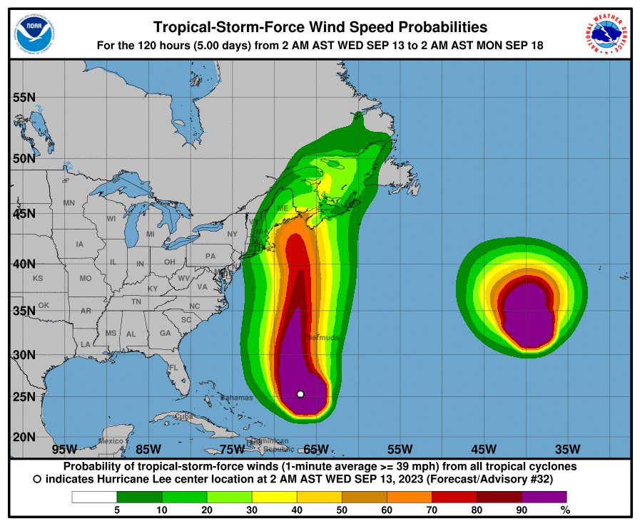
The storm's hurricane-force winds extend outward up to 115 miles from the center, and the tropical-storm-force winds extend outward up to 240 miles, per the National Hurricane Center.
Along with the rip current risk in coastal Monmouth, Cape May, Ocean, and Atlantic counties, Wednesday's forecast also calls for the possibility of scattered thunderstorms with potentially heavy rain in the afternoon.
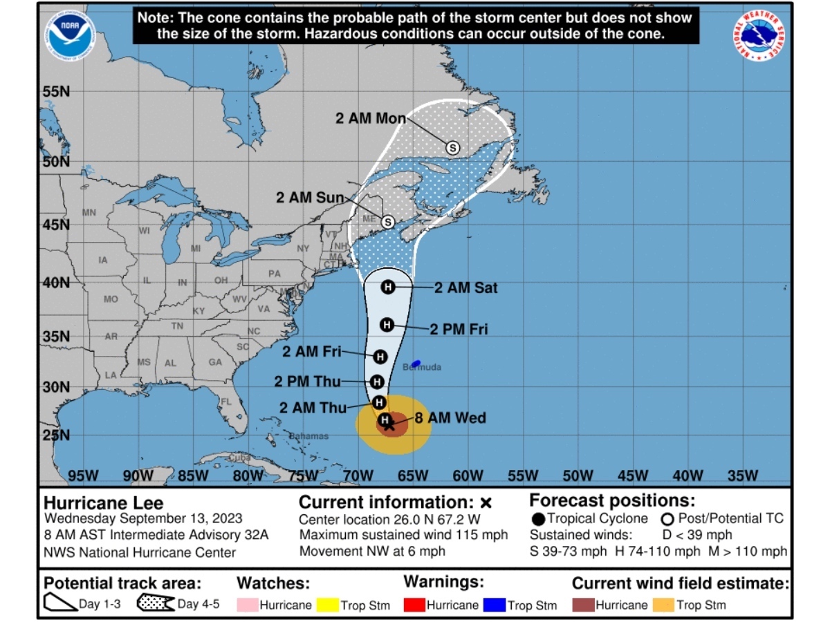
Lee's predicted path
As of 8 a.m. Wednesday, Hurricane Lee is about 460 miles southwest of Bermuda, with maximum sustained winds of 115 miles per hour (making it a major Category 3 hurricane on the Saffir-Simpson Hurricane Wind Scale).
Bermuda is now under a tropical storm warning.
"A turn toward the north-northwest is expected later today, followed by a northward turn and an increase in speed on Thursday and Friday," the National Hurricane Center said. "On the forecast track, the center of Lee will pass west of Bermuda Thursday and Thursday night and then approach the coast of New England or Atlantic Canada late this week."
Lee has reduced in strength from the time it was a Category 5 over the open Atlantic. However, forecasters with AccuWeather said it could unleash "significant impacts" in eastern New England and Atlantic Canada by this weekend, including high storm surge and heavy rain.
By the time it rolls inland to our northeast, Lee will have traveled close to 3,000 miles since its birth last week, AccuWeather added.
Related articles:
Get more local news delivered straight to your inbox. Sign up for free Patch newsletters and alerts.