Weather
More Downpours Expected Sunday After Heavy Flooding Hits Parts Of N.J.
Soaking rains Saturday caused extensive flooding issues in some parts of New Jersey, and the forecast shows there is further risk Sunday.

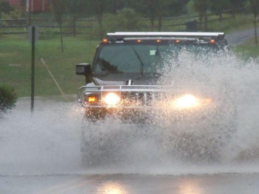
Soaking rains throughout the day Saturday caused extensive flooding issues in some parts of New Jersey, and the forecast shows there is further risk of more heavy downpours Sunday and Monday.
In the Princeton area, flooding caused water rescues, road closures, stranded cars, and flooded buildings, parking lots and train stations. West Windsor Township declared a State of Emergency due to the flooding. The State of Emergency has since been lifted, but police on Saturday night were asking residents refrain from any non-emergency travel.
Conditions are not likely to dry out Sunday. There is a Flood Advisory in place through 2:15 p.m. Sunday in Somerset County, parts of Morris County and parts of Middlesex County.
Find out what's happening in Hillsboroughfor free with the latest updates from Patch.
The National Weather Service continues its Hazardous Weather Outlook for all of New Jersey, saying there is the potential for localized flooding both Sunday and Monday due to heavy rains projected to move across the area
"Another round of drenching showers and heavy thunderstorms will keep the risk of flash flooding elevated across the northeastern United States for the final day of July," AccuWeather reports. "In addition to being drenching, a few storms in the mid-Atlantic could be locally strong and gusty. The storms could cause sporadic tree damage and power outages."
Find out what's happening in Hillsboroughfor free with the latest updates from Patch.
About six inches of rain fell on Central New Jersey during the late afternoon and nighttime hours on Saturday, according to the National Weather Service.
Here is the forecast:
Today: Showers and thunderstorms likely, mainly after 2pm. Some of the storms could produce heavy rain. Partly sunny, with a high near 84. Southeast wind around 7 mph. Chance of precipitation is 70%. New rainfall amounts between a quarter and half of an inch possible.
Tonight: Showers and thunderstorms likely before 10pm, then showers likely and possibly a thunderstorm between 10pm and 1am, then scattered showers and thunderstorms after 1am. Some of the storms could produce heavy rain. Mostly cloudy, with a low around 71. Northeast wind 3 to 5 mph. Chance of precipitation is 70%. New rainfall amounts between a tenth and quarter of an inch, except higher amounts possible in thunderstorms.
Monday: Scattered showers, with thunderstorms also possible after noon. Some of the storms could produce heavy rain. Mostly cloudy, with a high near 83. Light and variable wind. Chance of precipitation is 30%. New rainfall amounts between a tenth and quarter of an inch, except higher amounts possible in thunderstorms.
Monday Night: Scattered showers and thunderstorms before 11pm, then isolated showers. Mostly cloudy, with a low around 69. Light north wind. Chance of precipitation is 50%. New precipitation amounts between a tenth and quarter of an inch, except higher amounts possible in thunderstorms.
Tuesday: A slight chance of showers and thunderstorms. Partly sunny, with a high near 84. North wind 6 to 8 mph. Chance of precipitation is 20%.
Here are some photos shared on social media of the flooding:
At 11: Flooding created dangerous conditions in the Princeton area. pic.twitter.com/OtHQ8sT8HR
— Aundrea Cline-Thomas (@AClineThomas) July 31, 2016
Princeton Junction train station. Heavy flooding in New Jersey. Credit Matthew Gagnon. Story at 11pm. pic.twitter.com/sTI6pF0ZNh
— CeFaan Kim (@CeFaanKim) July 31, 2016
I love Princeton but I do not enjoy how I was trapped there due to crazy flooding pic.twitter.com/ocx5HnulB8
— Tara (@OhmygodTARA) July 31, 2016
Get more local news delivered straight to your inbox. Sign up for free Patch newsletters and alerts.