Weather
24 Inches Of Snow, Blizzard Alerts In 17 Counties As Massive Winter Storm Moves Into NJ
"If you can, stay home on Monday," said Gov. Mikie Sherrill, declaring a state of emergency with more NJ counties under a blizzard warning.

Gov. Mikie Sherrill has declared a State of Emergency as a massive winter storm barrels into the Garden State. 21 counties are now under a blizzard warning.
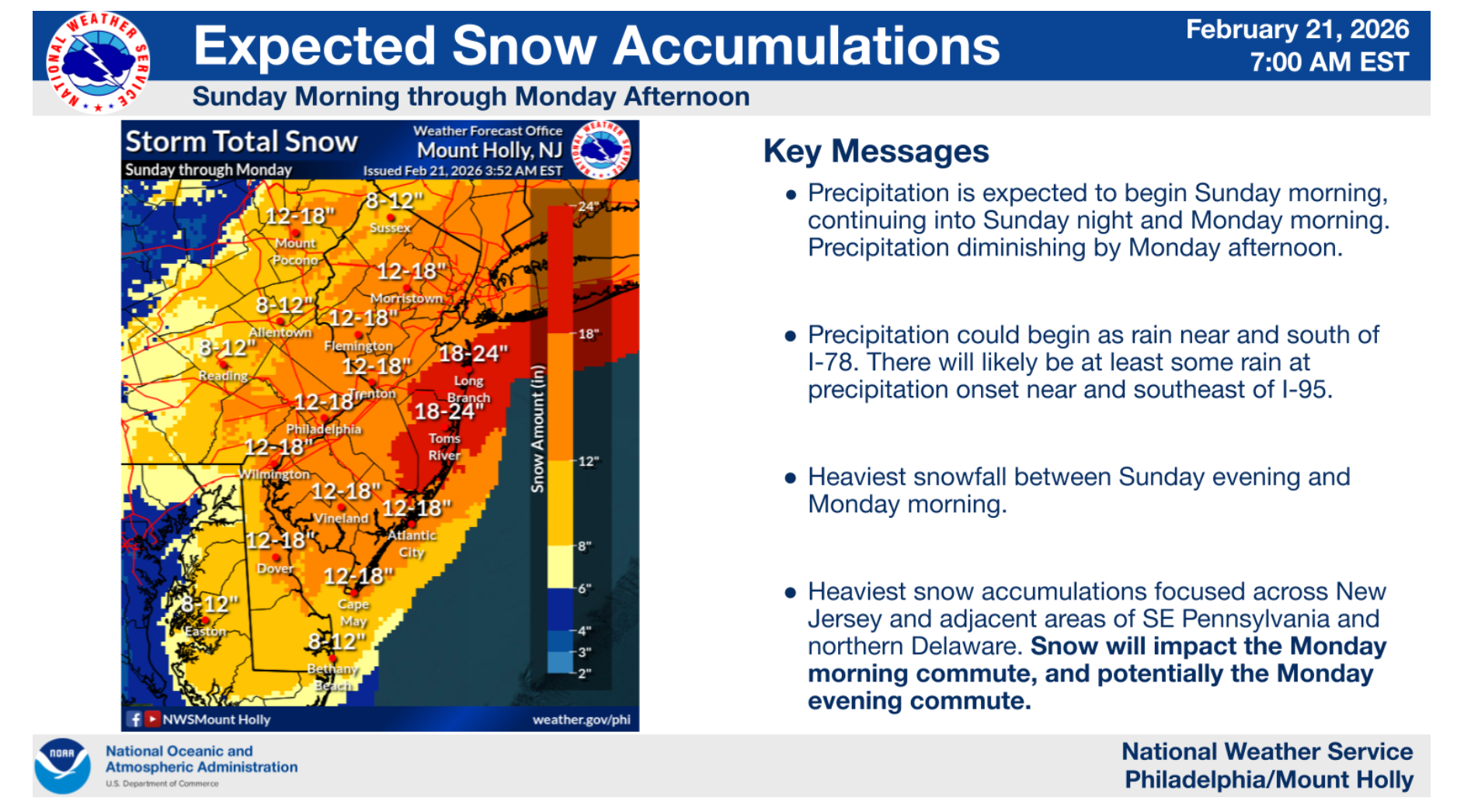
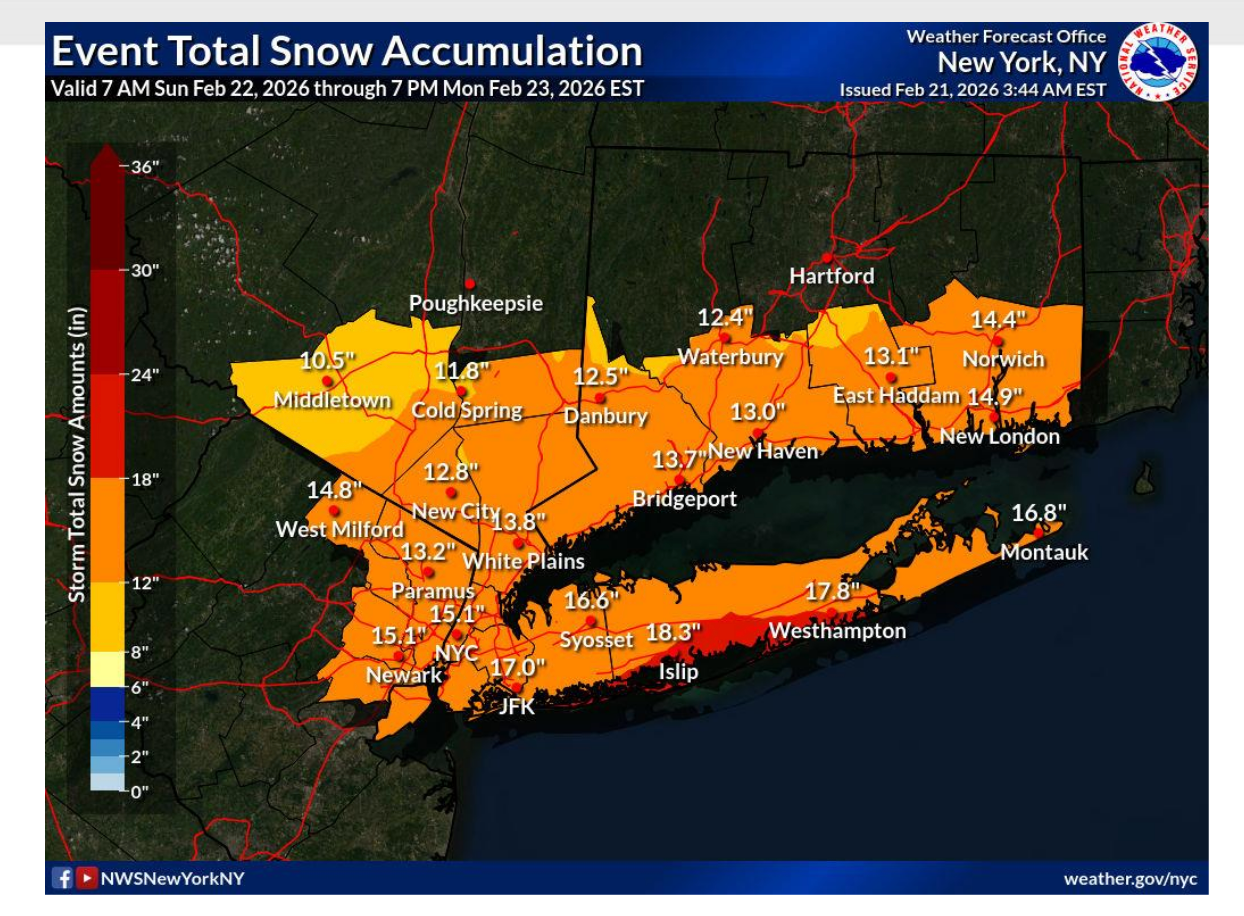
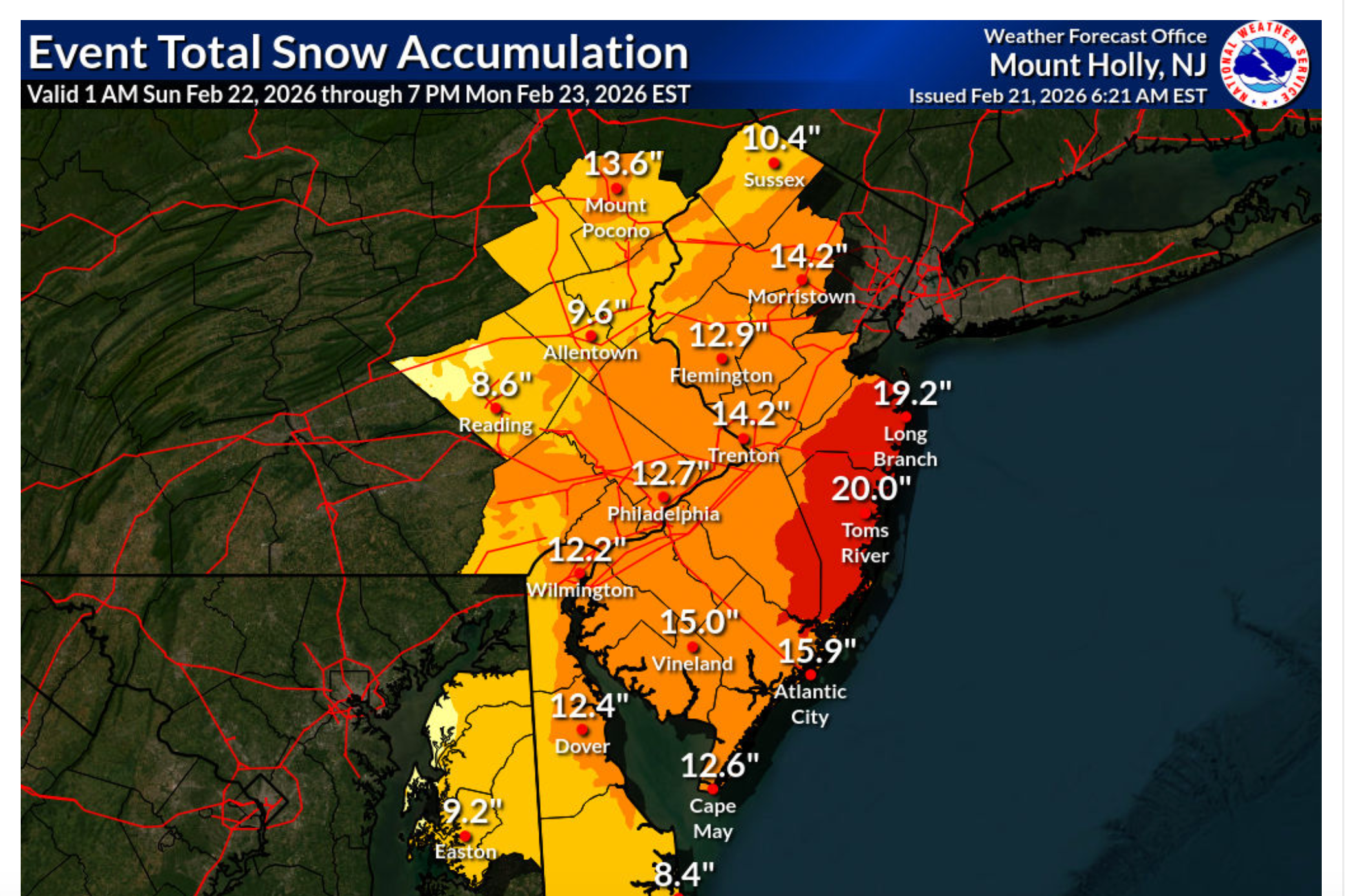
Sherrill said that 10-20 inches of snow are expected, with the heaviest snowfall from Sunday night into Monday morning, particularly along the coasts.
Find out what's happening in Hobokenfor free with the latest updates from Patch.
"This storm [poses] more risks than the last one because of the blizzard conditions and the heavy winds," she said Saturday.
NJ Transit CEO Kris Kolluri said Saturday that his agency will do its best to keep buses and trains running Sunday and Monday, depending on conditions. "If you can work from home on Monday, you should, and if we're able to provide the service safely, we will," he said.
Find out what's happening in Hobokenfor free with the latest updates from Patch.
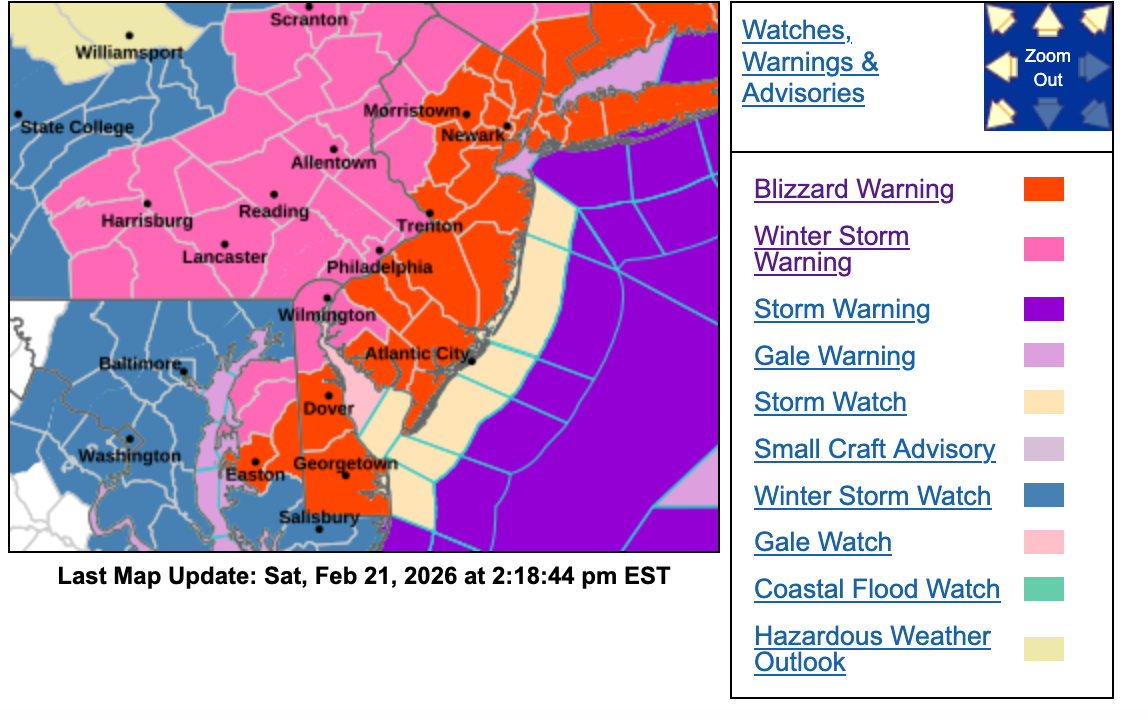
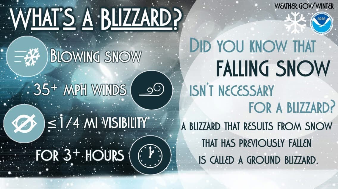
The National Weather Service issued a blizzard warning for 17 counties from 1 p.m. Sunday to 6 p.m. Monday.
The rest of the state is under a winter storm warning from 10 a.m. Sunday through 6 p.m. Monday.
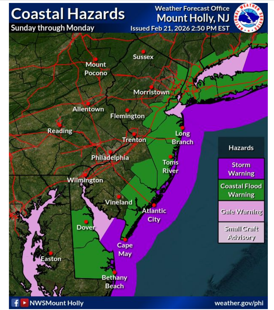
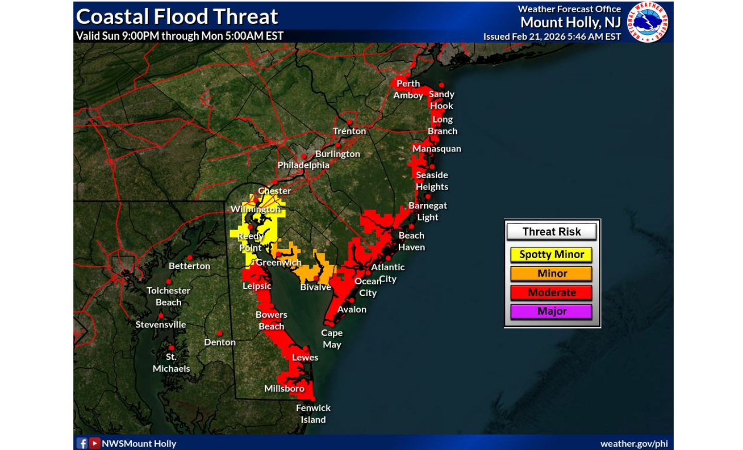
In addition, much of the shore is under a coastal flood warning (see maps below).
Forecasters say that coastal counties under a blizzard warning could see wind gusts as high as 55 MPH.
Snowfall rates could exceed 2 inches per hour, forecasters note.
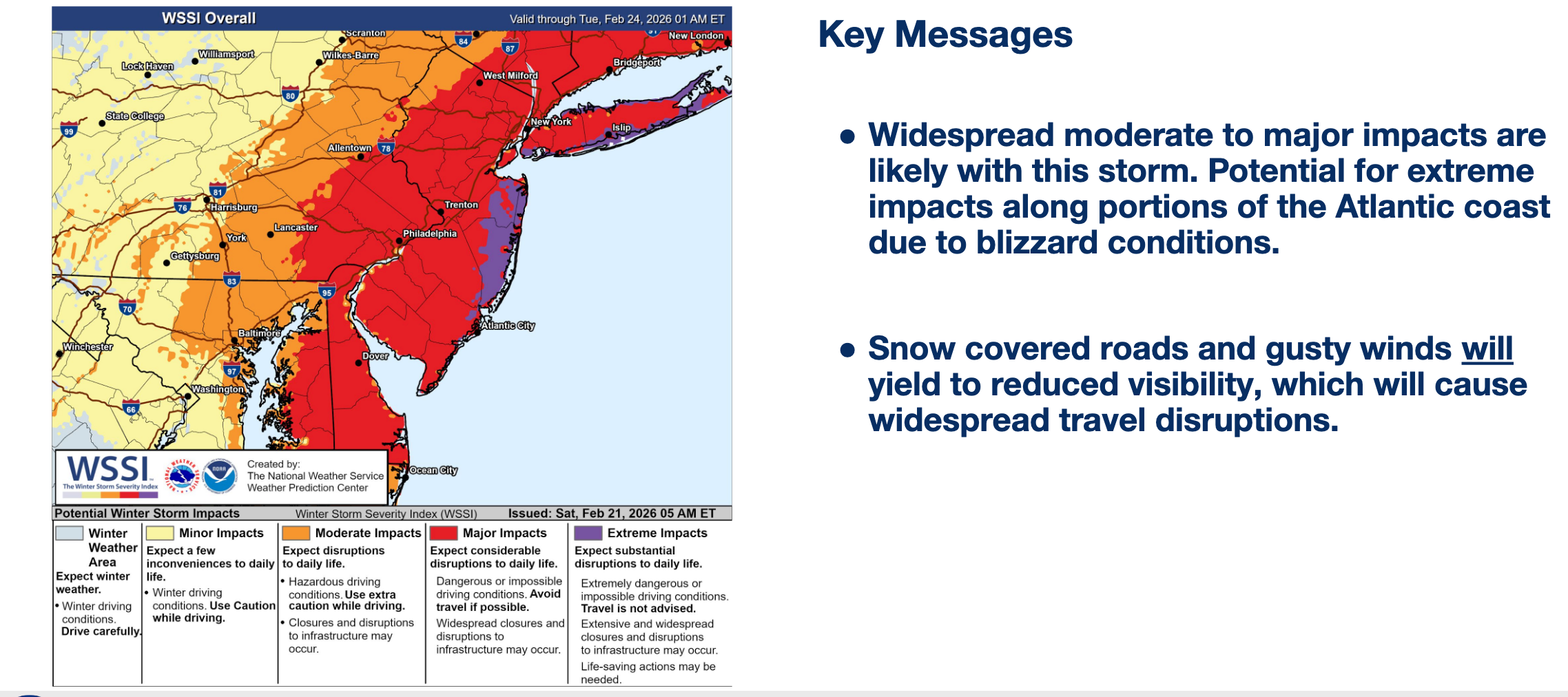
Starting Sunday afternoon, according to the NWS, "Travel could be very difficult to impossible. Areas of blowing snow could significantly reduce visibility. Gusty winds could bring down tree branches."
With snow drifts and blustery winds, the snowfall amounts could be even higher, forecasters say.
Where Totals Will Be Highest
In the northern part of the state, coastal regions may see more than 15 inches of snow, while Monmouth and Ocean counties may see up to 20 inches.
Flooding Early?
Northeastern New Jersey and much of the shore are under a coastal flood warning from 9 p.m. Sunday through 5 a.m. Monday, the NWS says.
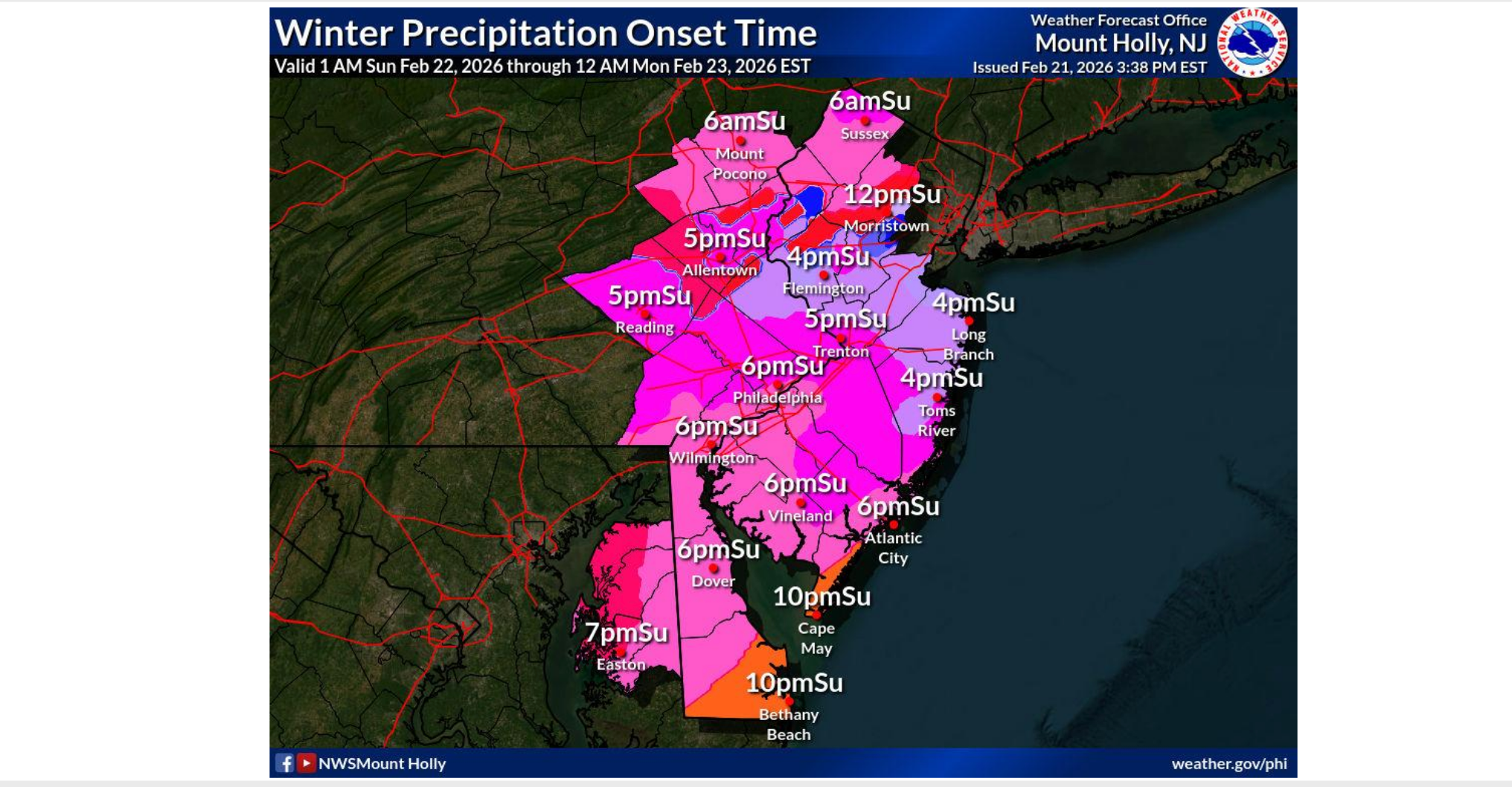
The first flakes are expected to fall around 6 a.m. Sunday in the mountains of northwestern New Jersey, and between noon and 10 p.m. elsewhere in the state.
Forecasters say that the storm may be destructive even as it leaves late Monday.
"Not only will the storm evolve into a significant nor'easter with strong winds and heavy snow along parts of the Atlantic coast, but it may become a bomb cyclone as it begins to move away," said AccuWeather Senior Meteorologist Chad Merrill. "A bomb cyclone is a storm that rapidly strengthens when the central barometric pressure in the storm drops 0.71 of an inch of mercury (24 millibars) in 24 hours or less."
The last time the Jersey Shore was under a blizzard warning was in 2022, when a nor'easter dumped 22 inches on parts of the state.
Past nor'easters that have brought blizzard conditions to New Jersey have included the historic storms of 1978 and 1993.
Get more local news delivered straight to your inbox. Sign up for free Patch newsletters and alerts.