Crime & Safety
WEATHER UPDATE: Ice, Snow, Speed Restrictions, Accidents Slow South Jersey To A Crawl
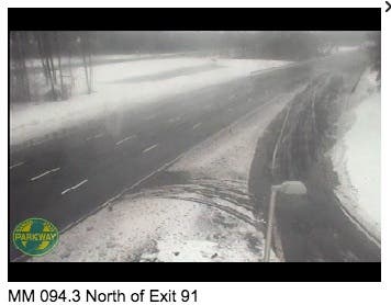
Snow, slush covered much of New Jersey's roads Sunday as drivers dealt with speed restrictions and accidents. All N.J. covered here.

Could this be the snowstorm that lives up to the hype?
Snow and sleet covered much of New Jersey Saturday and Sunday as drivers dealt with speed restrictions on the Garden State Parkway and on the New Jersey Turnpike, and a series of accidents began to pile up.
As much as 6 inches fell in South Jersey and the Jersey Shore while 2-4 inches fell farther north.
Find out what's happening in Moorestownfor free with the latest updates from Patch.
So far, there were reports of:
- A 35-mph speed restriction on the New Jersey Turnpike in both directions from Delaware Memorial Bridge to the George Washington Bridge
- Flooding on Route 34 in both directions North of CR 537/Colts Neck Rd in Colts Neck. One lane may be closed use caution.
- Flooding on Route 42 in both directions in the vicinity of I-295 in Bellmawr. Onelane may be closed use caution.
- 25-mph speed restricitons on the Ben Franklin Bridge, Betsy Ross Bridge, Commodore Barry Bridge and Walt Whitman Bridge.
- 25-mph speed restrictions on the Outerbridge Crossing and Goethals Bridge.
- A 45-mph speed restriction on the Garden State Parkway in both directions from Cape May to Exit 63, and a 35-mph restriction from Exit 63 to the New York state line
- An accident on the New Jersey Turnpike southbound exiting at Walt Whitman Service Area in Cherry Hill Twp. Right shoulder cancelled.
- An accident on I-195 eastbound West of Exit 16 - CR 537/Great Adventure in Millstone Twp. Right shoulder closed; use caution
- An accident on the New Jersey Turnpike inner roadway northbound exiting at Interchange 6 - Pennsylvania Turnpike in Mansfield. Right shoulder blocked.
- An accident on the Garden State Parkway local lanes northbound at Exit 105 in Tinton Falls. Left lane blocked.
- An overturned tractor trailer on I-287 northbound north of Exit 30 in Bernards. Right and center lanes closed, left lane open.
- A 35-mph speed restriction on the Atlantic City Expressway.
- An Accident on I-76 eastbound west of Exit 1D - U.S. 130 in Gloucester City. Right shoulder closed; use caution.
- An accident on the New Jersey Turnpike inner roadway northbound north of Interchange 7 - US 206 in Bordentown.
- An accident onthe Garden State Parkway southbound south of Exit 67/Bay Ave in Barnegat. All lanes open.
- An accident on the New Jersey Turnpike inner roadway northbound south of Interchange 9 - Route 18 in East Brunswick. Left lane blocked.
Here are some of the snow totals:
Find out what's happening in Moorestownfor free with the latest updates from Patch.
BURLINGTON COUNTY
- BORDENTOWN 6.6
CAMDEN COUNTY
- HADDON HEIGHTS 6.5
MERCER COUNTY
- PRINCETON 6.0
MIDDLESEX COUNTY
- METUCHEN 4.0
MONMOUTH COUNTY
- NEPTUNE TWP 6.0
MORRIS COUNTY
- LONG HILL TWP 4.7
OCEAN COUNTY
- TOMS RIVER 4.0
SOMERSET COUNTY
- BRIDGEWATER 3.6
WARREN COUNTY
- HACKETTSTOWN 3.0
Forecasters predicted anywhere from 2 to 4 inches of snow in South Jersey and the Jersey Shore, and 4 to 7 inches of accumulation possible in parts of North Jersey.
The National Weather Service has issued a “Winter Weather Advisory” that will be in effect between noon Saturday and 1 p.m. Sunday, with snow changing to some sleet, and then to freezing rain, and then to rain.
Initially, the National Weather Service predicted an inch or two would fall over most of New Jersey; now it’s either doubled that total in South Jersey and the Jersey Shore, and nearly quadruped it in northwestern New Jersey.
The Newark area is supposed to get 3 to 5 inches, while Ocean City will get less than a half inch, according to the National Weather Service.
“Snow will overspread the area early Saturday afternoon from southwest to northeast, and it could become heavy for a time,” according to the National Weather Service.
>>Related: WEATHER UPDATE: Hour-By-Hour Forecast Of Fierce Winds, Snow, Then Rain On The Way For New Jersey
As some warmer air moves in, the snow should mix with sleet and freezing rain, then change to rain Saturday night before tapering off during Sunday, according to the NWS.
Hazardous travel is expected Saturday afternoon into early Sunday. Visibilities will be as low as one-quarter-mile at times, with temperatures rising into the upper 20s Saturday afternoon, then rising through the 30s Saturday night into Sunday.
This next storm follows days of record low temperatures that have claimed at least five lives in Pennsylvania and at least one life in New Jersey.
Other Patch stories:
- Cops Stop Teens for Shoveling Snow, Stirring A Heap Of Controversy
- Hopatcong Teen Dies After 2-Car Crash in Morris County, Cops Say
- Gov. Christie to Hold First Town Hall in Five Months, In Moorestown
- Prosecutor: Gym Teacher Uploaded Child Porn At School, Ran Pot ‘Grow House’ At Home
- Prosecutor: Female Teacher Sexually Assaulted 6 Boys At School, In Her Car
Get more local news delivered straight to your inbox. Sign up for free Patch newsletters and alerts.