Weather
Point Pleasant, Brick Got More Rain Than Anybody In NJ This Week
These Jersey Shore towns got an incredible amount of rain, which could explain why they were flooded. Here's how much.

New Jersey got a ton of rain that flooded roads, downed wires and caused a host of problems on Tuesday. So it should be no surprise that the most rain fell in the areas that flooded – and they're all at the Jersey Shore.
Data from Rutgers University, nj.com and the National Weather Service shows that seven of the eight towns that got the most rain in New Jersey on Tuesday are located in Monmouth and Ocean Counties.
Here is the list:
Find out what's happening in Point Pleasantfor free with the latest updates from Patch.
- Brick: 4.55 inches
- Point Pleasant: 3.56 inches
- Seaside Heights: 3.19 inches
- Manasquan: 3.06 inches
- Franklin, Gloucester County: 2.43 inches
- Berkeley: 2.26
- Wall. 2.18
- Barnegat: 1.93 inches
Point Pleasant Boro, Point Pleasant Beach, Brick and Toms River experienced a lot of problems related to flooding.
Related:
Find out what's happening in Point Pleasantfor free with the latest updates from Patch.
- Point Pleasant Roads Flooded After Storm (Video)
- Storm Floods Toms River Roads: Photos, Video
- Cars Trapped As Storm Floods Brick Roads: Photos, Video
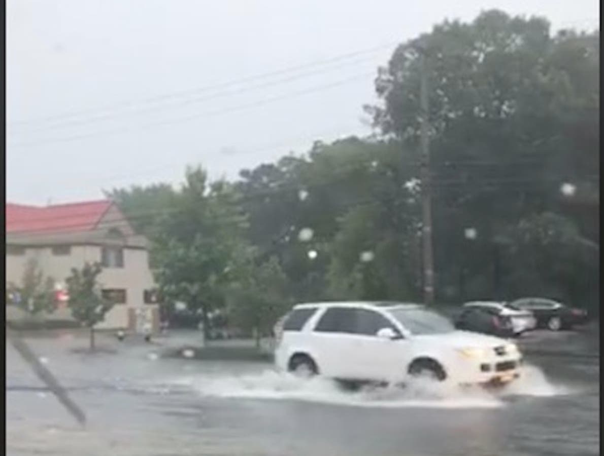
Police had to tell Point Pleasant Boro and Point Pleasant Beach residents on Tuesday to take necessary precautions since local roads flooded following the storm.
Residents were told to avoid all unnecessary travel as roads throughout Point Pleasant Boro and Beach flooded. Live videos showed Dorsett Dock Road, Bridge Avenue, Route 35 and other roads completely underwater.
Deanna Jividen of Point Pleasant Boro took a live video that showed flooding in front of Gerards Wine and Spirits on Bridge Avenue (see picture).
Here are other videos:
Severe flooding route 35 point pleasant beach @News12NJ @JGodynick @DaveCurren pic.twitter.com/bFEWwn9X5I
— Jim Murdoch News12NJ (@ReporterJim) July 17, 2018
Don't drive in the point pleasant beach area! Lots of spot flooding now in addition to the lightning @News12NJ @JGodynick @DaveCurren pic.twitter.com/e2klcquOQy
— Jim Murdoch News12NJ (@ReporterJim) July 17, 2018
Route 35 flooded in Point Pleasant Beach @News12NJ @DaveCurren @JGodynick pic.twitter.com/ASKmyx8gkc
— Jim Murdoch News12NJ (@ReporterJim) July 17, 2018
More Point Pleasant Beach flooding at the 88 35 circle @News12NJ @DaveCurren @JGodynick pic.twitter.com/kJ9jQGHWtt
— Jim Murdoch News12NJ (@ReporterJim) July 17, 2018
Some of the strongest storms New Jersey has had in weeks arrived on Tuesday, bringing with them damaging winds that could lead to power outages. More than 10,000 were without power (see list below).
A severe thunderstorm warning was declared for parts of the state, particularly in Central Jersey. There were 60-mph wind gusts and penny size hail.
Here were the power outages as of 3 p.m.
- NEWARK CITY 2,027
- BRICK TOWNSHIP 1,593
- MORRIS PLAINS BOROUGH 1,225
- MORRIS TOWNSHIP 998
- MIDLAND PARK BORO 895
- PARAMUS BORO 473
- BRANCHBURG TOWNSHIP 472
- FAIRVIEW BORO 448
- NEW PROVIDENCE BOROUGH 348
- WEST MILFORD TOWNSHIP 237
- LIBERTY TOWNSHIP 219
- CHATHAM TOWNSHIP 209
- OCEAN TOWNSHIP 162
- FAIRFIELD TWP 141
- PARSIPPANY TROY HILLS TOWNSHIP 135
- WALDWICK BORO 124
- MOUNT OLIVE TOWNSHIP 110
- MORRISTOWN TOWN 109
- MILLSTONE TOWNSHIP 69
- POINT PLEASANT BOROUGH 59
- WEST CALDWELL TWP 17
- MIDDLETOWN TOWNSHIP 16
- MOUNT ARLINGTON BOROUGH 11
- MONTVILLE TOWNSHIP 10
More flooding in Jersey City. So far, we haven’t seen any street closures but some streets are down to one lane. @CBSNewYork pic.twitter.com/NQsTzN3acD
— Marc Liverman (@MarcLiverman) July 17, 2018
Flooding under the approach to the Holland Tunnel in Jersey City. @CBSNewYork pic.twitter.com/BQNmhj7BJQ
— Marc Liverman (@MarcLiverman) July 17, 2018
Here is the forecast:
Wednesday: Sunny, with a high near 87. North wind around 9 mph.
Wednesday Night: Mostly clear, with a low around 60. North wind around 7 mph.
Thursday: Sunny, with a high near 84. North wind around 7 mph.
Thursday Night: Mostly clear, with a low around 62.
Friday: Sunny, with a high near 87.
Friday Night: Partly cloudy, with a low around 66.
Saturday: A chance of showers and thunderstorms. Partly sunny, with a high near 84. Chance of precipitation is 30%.
Saturday Night: A chance of showers and thunderstorms. Mostly cloudy, with a low around 68. Chance of precipitation is 50%.
Sunday: Showers likely and possibly a thunderstorm. Mostly cloudy, with a high near 82. Chance of precipitation is 70%.
Sunday Night: Showers likely and possibly a thunderstorm. Mostly cloudy, with a low around 69. Chance of precipitation is 60%.
Deanna Jividen photo
Get more local news delivered straight to your inbox. Sign up for free Patch newsletters and alerts.


