Weather
Hour-by-Hour Look At Drenching Storm In Hudson Valley
Here are the latest details about the next couple of days.


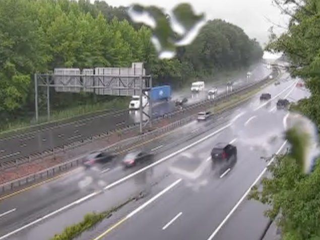
HUDSON VALLEY, NY — Buckle up. That is, after you gather up all your rain gear. The Hudson Valley is in for a soaking from Thursday night through Friday.
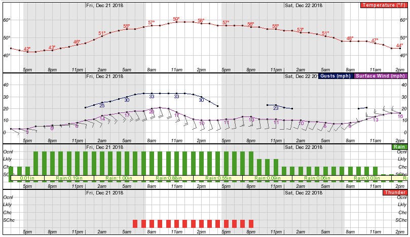
The rain is forecast to begin Thursday afternoon, but really pick up in intensity Thursday night. Fortunately — this is, after all, December — temperatures are forecast to climb overnight into the 50s. The temperature will keep going up during the day Friday.
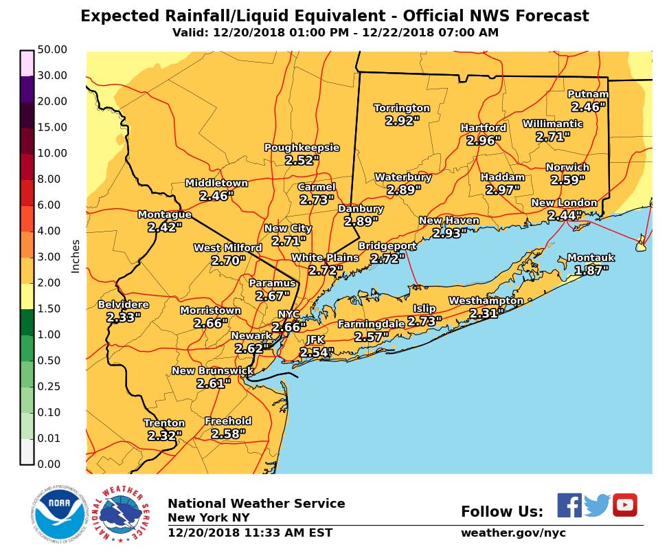
Our friends at Hudson Valley Weather said that 1 to 3 inches of rain are possible over the region, with some higher locations exceeding that.
Find out what's happening in Bedford-Katonahfor free with the latest updates from Patch.
"[S]uffice to say … heavy rain will be as issue in the overnight into early morning Friday hours," said Bill Potter and Alex Marra said.
And don't forget the potentially damaging wind gusts, during which power outages are possible.
Find out what's happening in Bedford-Katonahfor free with the latest updates from Patch.
Needless to say, with this much rain and wind, advisories have already been issued affecting all parts of the Hudson Valley, including coastal flood warnings for areas along the Sound Shore.
Here is the forecast from the National Weather Service for the next couple of days for northern Westchester:
- Thursday: A 30 percent chance of rain, mainly after 3pm. Cloudy, with a steady temperature around 43. Light east wind.
- Thursday Night: Rain. The rain could be heavy at times. Temperature rising to around 55 by 5am. East wind 5 to 10 mph increasing to 11 to 16 mph after midnight. Winds could gust as high as 28 mph. Chance of precipitation is 90%. New precipitation amounts between 1 and 2 inches possible.
- Friday: Rain and possibly a thunderstorm. Some of the storms could produce gusty winds and heavy rain. Patchy fog. High near 60. Breezy, with a south wind 16 to 21 mph decreasing to 10 to 15 mph in the afternoon. Winds could gust as high as 33 mph. Chance of precipitation is 100%. New rainfall amounts between 1 and 2 inches possible.
- Friday Night: Showers and possibly a thunderstorm before 9pm, then showers likely. Some of the storms could produce gusty winds and heavy rain. Patchy fog. Low around 46. South wind 9 to 13 mph, with gusts as high as 23 mph. Chance of precipitation is 80%. New precipitation amounts between a tenth and quarter of an inch, except higher amounts possible in thunderstorms.
- Saturday: A 30 percent chance of showers, mainly before noon. Mostly cloudy, with a temperature falling to around 41 by 5pm. Southwest wind 7 to 16 mph becoming west in the afternoon.
- Saturday Night: Partly cloudy, with a low around 31.
Image via Shutterstock.
Get more local news delivered straight to your inbox. Sign up for free Patch newsletters and alerts.