Community Corner
Details Released on Long Island Weather Forecast For February-April
The long-range forecast for February-April for the region has been released and many may find it surprising.

By Patch Staff
Have you had enough of snow?
The recent blizzard buried Long Islanders in more than 2-feet of snow, but many in the state might be surprised to hear what’s coming their way for February through April.
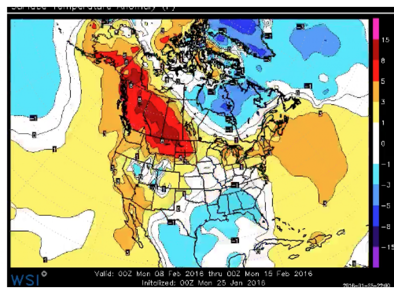
February 2016 will begin with a surge of mild air across the eastern United States, the “polar opposite” of February 2015, according to AccuWeather.
And a snowstorm that was possibly heading Long Island’s way this weekend will dodge the state and veer toward the east in the Atlantic Ocean.
“February will begin with a significant change to the weather pattern across the eastern United States,” AccuWeather Meteorologist Evan Duffey said in an AccuWeather news release.
More on Patch:
- Shaking on Long Island Caused by Sonic Boom, USGS Says
- Hero Cop Takes Head-On Crash With Wrong-Way Drunk Driver to Protect Motorists: Police
- Stew Leonard’s to Open Second Long Island Store
- Dog Pushed Out of Car, Struck On Road While Running After Owner Who Abandoned Him
- Watch: Adorable Puppy Navigates Snow Maze in Great Neck
Although a storm system is forecast to bring snow and severe weather to the Midwest, mild air from the Gulf of Mexico will surge northward and bring a stretch of above-average temperatures.
The Weather Channel provided a similar forecast, which was provided on a map that can be found here.
After one of the warmest Novembers and Decembers on record across much of the eastern U.S., January 2016 will end within a few degrees of normal in most locations, according to AccuWeather.
The Weather Channel in its February—April outlook also predicts warmer temps for the Northeast and Long Island. In fact, temps will be milder in the north than they normally are, and it will be chilly down south, compared to what they’re accustomed to there.
A cooldown in March is forecast for most of the country, except the Northeast, which should stay above average, the Weather Channel states.
Will it snow the rest of the winter?
It’s impossible to answer that question, but the Weather Channel said even in the midst of a mild winter, snowstorms can happen as long as the air is cold enough for a few days to support snow. So, just because we’re expecting milder temps on average for the rest of the winter, it doesn’t mean there won’t be snow.
So don’t put those shovels away quite yet!
Your local forecast via the National Weather Service:
The next chance to see some snowflakes currently is on Friday but we’re talking a slight flurry chance and no accumulation on Long Island.
Temps on Friday and Saturday will be near 40 degrees, and from Sunday through next Tuesday high temps will be in the upper 40s. Next Wednesday may be even warmer, with a high of 54 degrees expected.
There will be a chance of rain showers on Tuesday night and Wednesday.
>>>>>Sign up for a daily Patch newsletter and breaking news alerts here.
Get more local news delivered straight to your inbox. Sign up for free Patch newsletters and alerts.