Community Corner
WEATHER UPDATE: More Cold, then More Snow To Hit Nyack, Piermont
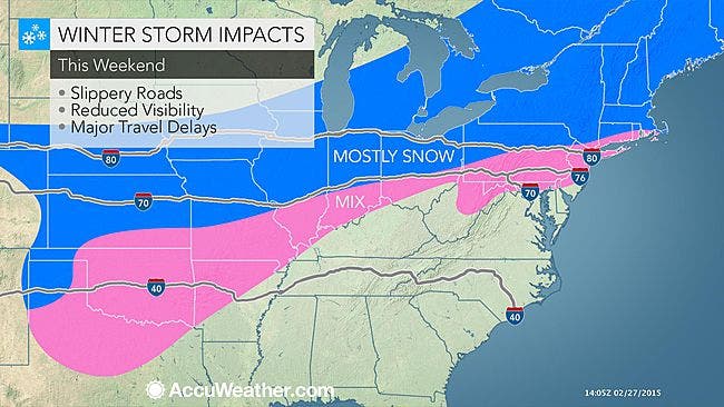
March is expected to come in like a lion with snow on Sunday into Monday and a wintry mix on Tuesday-Thursday.

It hasn’t snowed in almost a week. OK, we did get a short, intense squall yesterday but that doesn’t count, it didn’t really cover the dirty, frozen roadside snow.
So winter plans to make a grand return for the start of March. Essentially, you’ll want to write-off the first few days, because it’s one winter storm after another to begin the month.
It will remain cold today and Saturday to end February but also dry. That changes beginning Sunday evening.
Find out what's happening in Nyack-Piermontfor free with the latest updates from Patch.
Looking at the Hudson Valley, meteorologists agree that snow begins Sunday evening and becomes steadier late at night, and ends Monday morning, which will affect the Monday morning commute and students return to school.
And here’s an example of how they feel about it: Hudson Valley Weather’s Bill Potter entitled his Friday Outlook:
Find out what's happening in Nyack-Piermontfor free with the latest updates from Patch.
The Endless Winter
And of course more wintry mix is forecast for Tuesday night into Thursday morning as a storm moves up from the south along with some warmer temperatures.
Spring is still allegedly coming, right?
Here are what meteorologists are saying concerning the weekend.
Bill Potter at Hudson Valley Weather said, “Friday night… pack your bags… we’re going on one more trip to the arctic. Temps will very likely fall below zero once again… as mostly clear skies and a calm wind, combine with an arctic air mass to generate an extremely cold night. We’ll take 1 more swing at a record low Saturday morning.”
Joe Rao at News 12 said, “...on Sunday as a cold front approaches and scoots on by at night, look for sunshine to give way to clouds with some light snow possible by evening, continuing through Sun. night, perhaps carrying over into early Monday morning. Temps warm to near 30 on Sunday and to near 40 by next Monday. Fair and colder for Tuesday, then another storm could threaten on Tuesday night into Wednesday with mostly rain as temps soar to perhaps the mid 40’s.”
Alex Sosnowski, AccuWeather.com, said, “The Monday morning commute could be a real mess as millions of people head back to work or school following the weekend. People should expect another round of slippery roads and airline delays with possible cancellations and disruptions to daily activities.”
MAP: accuweather.com
Get more local news delivered straight to your inbox. Sign up for free Patch newsletters and alerts.