Weather
Latest Snowfall Estimates For Wednesday's Hudson Valley Storm
Plan on difficult travel conditions on Wednesday, the National Weather Service says. Here are the details.


The storm headed our way from the Ohio River Valley will bring a wintry mix that should create a mess for travelers all day Wednesday. Storm Watches are in effect for Dutchess, Orange, Putnam and Ulster counties, where 3-8 inches of snow are expected. No storm watches have been issued as yet for Rockland and Westchester counties; however the National Weather Service is predicting three inches of snow for New City and White Plains.
"By the time the storm exits Wednesday evening, we could see a wide range of snowfall amounts across the region," said Hudson Valley Weather.
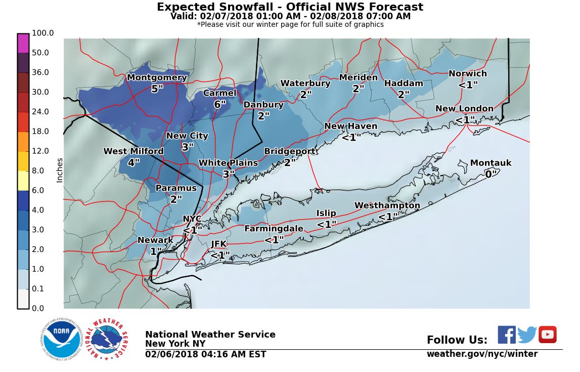
For the mid-Hudson Valley, the National Weather Service issued a storm watch at 3:12 a.m. in effect from February 7, 07:00 AM EST until February 8, 04:00 AM EST:
Find out what's happening in Ossining-Croton-On-Hudsonfor free with the latest updates from Patch.
- WHAT...Heavy mixed precipitation possible. Total snow and sleet accumulations of 4 to 8 inches and ice accumulations of a light glaze are possible.
For Orange and Putnam, the NWS issued a storm watch at 3:33 a.m. in effect from February 7, 06:00 AM EST until February 8, 04:00 AM EST.
- WHAT...Heavy mixed precipitation possible. Total snow accumulations of 3 to 6 inches, with localized amounts up to 7 inches, and ice accumulations up to a tenth of an inch possible.
For all:
Find out what's happening in Ossining-Croton-On-Hudsonfor free with the latest updates from Patch.
- WHEN...From Wednesday morning through late Wednesday night.
- ADDITIONAL DETAILS...Plan on difficult travel conditions, including during the morning and evening commute on Wednesday. Significant reductions in visibility are possible.
Get more local news delivered straight to your inbox. Sign up for free Patch newsletters and alerts.