Weather
Hazardous Weather Outlook Kicks off July Fourth Holiday Forecast for the Hudson Valley
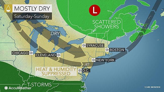
Overall the news is good, however.

The National Weather Service has issued a Hazardous Weather Outlook for Orange, Putnam, Rockland and Westchester Counties for Friday.
FRIDAY AFTERNOON AND EVENING...THE STORM PREDICTION CENTER IS
FORECASTING A MARGINAL RISK OF ISOLATED SEVERE THUNDERSTORMS
PRODUCING WIND GUSTS UP TO 60 MPH ACROSS THE LOWER HUDSON
VALLEY...NEW YORK CITY AND NORTHEAST NEW JERSEY. A WELL DEFINED
COLD FRONT IS FORECAST TO MOVE SOUTHEAST INTO A WARM MOIST
UNSTABLE MARITIME TROPICAL AIR MASS.
But while the start and finish of the July Fourth weekend could see some rain, the vast majority of the time we'll have dry weather.
Find out what's happening in Pleasantville-Briarcliff Manorfor free with the latest updates from Patch.
Plus it appears that temperatures will be only in the 80s, and the humidity will be low.
"In much of the Northeast, the start of the Fourth of July weekend will be noticeably different, compared to how the Memorial Day weekend began, when highs were in the 90s F," said AccuWeather Senior Meteorologist Kristina Pydynowski. "Temperatures will be fairly typical along the Interstate 95 corridor for early July, where the weather will be warm enough for shorts and short sleeves."
Find out what's happening in Pleasantville-Briarcliff Manorfor free with the latest updates from Patch.
SEE: Hudson Valley 2016 Complete Fireworks, Celebrations
And while rain and thunderstorms are predicted to sweep across the mid-Atlantic on July Fourth, right now meteorologists are predicting they will pass south of New York City.
IMAGE: AccuWeather.com
Get more local news delivered straight to your inbox. Sign up for free Patch newsletters and alerts.