Community Corner
Long Island Snow Total Predictions Rise Slightly, Special Weather Statement Issued
It shouldn't be much, but if a worst-case scenario pans out, you may need to find your shovel. Is it summer yet?

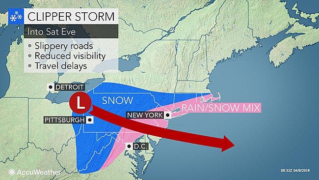
The National Weather Service has issued a special weather statement for Long Island as a burst of wintry weather takes aim at the region.
Snow total predictions for the island on Saturday have risen slightly. A total of 1-2 inches of snow is now projected for all of the island, except for the North Shore, which remains in line for less than an inch of accumulation, according to NWS snow forecast maps.
There's currently about a 50 percent chance that Long Island sees more than an inch of snow accumulation. It's a tricky forecast, though. A heavy band of snow is expected to remain south of the region, but if that band shifts to the north, a "reasonable worst-case scenario" would mean 3-5 inches of snow across Long Island and New York City if the heavier banding persists for several hours, the NWS says.
The precipitation will end Saturday night, but temperatures will sink into the upper-20s overnight. A freeze warning will be in effect from midnight until 10 a.m. Sunday. The cold will kill sensitive plants if they are not protected or brought indoors, the NWS says.
Here's the full special weather statement:
LOW PRESSURE WILL TRACK TO THE DELMARVA COAST THIS MORNING...AND THEN TRACK SOUTH OF LONG ISLAND THIS AFTERNOON AS IT GRADUALLY INTENSIFIES. LIGHT RAIN IS EXPECTED TO DEVELOP ACROSS THE REGION LATE THIS MORNING INTO EARLY AFTERNOON. THIS RAIN SHOULD BEGIN MIXING WITH SNOW THIS AFTERNOON AND CONTINUE INTO THIS EVENING. IF PRECIPITATION REMAINS LIGHT...LITTLE TO NO SNOW ACCUMULATION WOULD BE EXPECTED. THERE IS THOUGH...POTENTIAL FOR A MODERATE TO HEAVY PRECIPITATION BAND TO WORK INTO THE REGION FROM THE SOUTH THIS AFTERNOON BEFORE PULLING EAST THIS EVENING. IF THIS OCCURS...THE RAIN AND SNOW MIX WOULD QUICKLY CHANGE TO A MODERATE TO HEAVY SNOW WITH A FEW INCHES OF SNOW ACCUMULATION POSSIBLE. THIS IS A LOW PROBABILITY AT THIS TIME...BUT IF TRAVELING THIS AFTERNOON INTO EVENING BE PREPARED FOR THIS POTENTIAL AND THE ACCOMPANYING SIGNIFICANTLY REDUCED VISIBILITIES AND HAZARDOUS ROAD CONDITIONS.
The full forecast:
Saturday: Rain likely before 11am, then rain and snow. Temperature falling to around 35 by 3pm. Wind chill values between 25 and 35. Northeast wind 11 to 16 mph. Chance of precipitation is 90%. Total daytime snow accumulation of less than one inch possible.
Saturday Night: Rain and snow likely, mainly before 11pm. Cloudy, then gradually becoming partly cloudy, with a low around 28. Wind chill values between 20 and 25. Northwest wind 13 to 15 mph, with gusts as high as 26 mph. Chance of precipitation is 60%. New snow accumulation of less than a half inch possible.
Sunday: Sunny, with a high near 46. Wind chill values between 20 and 30 early. Northwest wind around 14 mph becoming west in the afternoon.
Sunday Night: A slight chance of rain and snow after midnight. Mostly cloudy, with a low around 36. Wind chill values between 25 and 30. South wind 13 to 16 mph. Chance of precipitation is 20%.
Monday: A chance of rain. Mostly cloudy, with a high near 53. Breezy, with a southwest wind 22 to 24 mph. Chance of precipitation is 40%.
Photo: AccuWeather
Get more local news delivered straight to your inbox. Sign up for free Patch newsletters and alerts.