Weather
Long Island Weather: Hour-By-Hour 'Bomb Cyclone' Snow Forecast
Everything you need to know about the heavy snow, damaging winds and potential flooding coming our way Thursday.


Here's how New York's National Weather Service office described things Wednesday afternoon: So far this winter, we've had intense cold. However, for this winter to really rank up there for an overall memorable winter known for cold and snow in these parts such as 1977-1978, 1993-1994 or 1995-1996, it needs to deliver with the snow. This looks about to change.
And change in a big way. A rare "bomb cyclone" snowstorm is set to bring Long Island to a standstill on Thursday. Parts of the island may see more than a foot of snow and wind gusts up to 55 mph will likely cause whiteout conditions on the roadways, the National Weather Service says.
Suffolk County, under a blizzard warning until 1 a.m. Friday, is expected to get hit the hardest. A total of 9-12 inches of snow accumulation with localized higher amounts is likely.
Find out what's happening in Sachemfor free with the latest updates from Patch.
"Traveling in Suffolk County will be impossible especially at the height of the storm on Thursday in the late morning and afternoon," the NWS says.
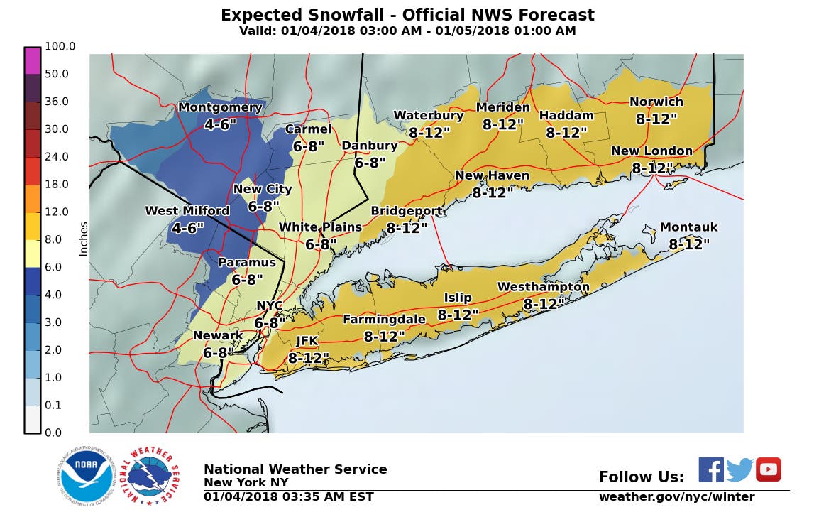
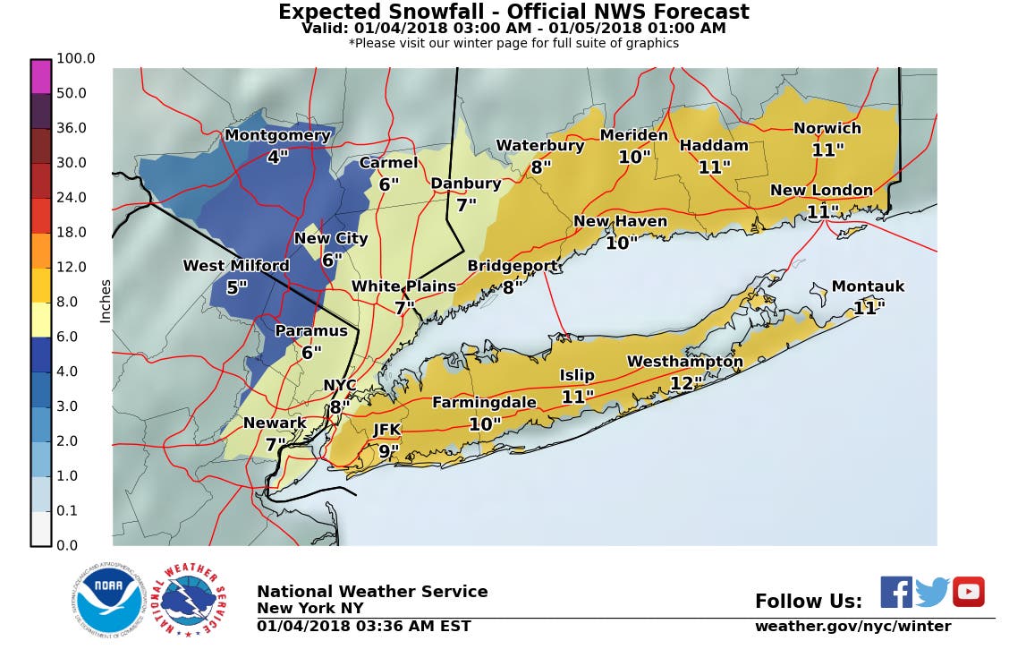
Things won't be much better in Nassau County, which is under a winter storm warning until 1 a.m. Friday. A total of 6-10 inches of snow is expected there.
Find out what's happening in Sachemfor free with the latest updates from Patch.
The storm will be a quick hitter as it rapidly moves up the coast. Snow is expected to begin early Thursday and continue into the evening. Check out the full hour-by-hour forecast below.
Most areas will see a 6-12 hour window for steady snow of at least moderate intensity, the NWS says. Snow could fall at a rate of up to two inches per hour in Suffolk and up to an inch per hour in Nassau. The strong winds may cause damage to trees and power lines, leading to power outages on the island. PSEG Long Island says it's ready for the storm.
Coastal flood advisories will be in effect for the entire South Shore and the North Fork from 9 a.m. to 2 p.m. Thursday and from 11 a.m. to 2 p.m. for northern Nassau and northwestern Suffolk.
"Some roads and low-lying property, including parking lots, parks, lawns and homes/businesses with
basements near the waterfront will experience shallow flooding," the advisories say.
Here's the hour-by-hour forecast for Thursday (the temperature will be in the mid-20s the entire day):
1 a.m.- 42 percent chance of snow
2 a.m.- 42 percent chance of snow
3 a.m.- 76 percent chance of snow
4 a.m.- 76 percent chance of snow
5 a.m.- 76 percent chance of snow
6 a.m.- 98 percent chance of snow
7 a.m.- 98 percent chance of snow
8 a.m.- 98 percent chance of snow
9 a.m.- 98 percent chance of snow, 36 mph wind gusts
10 a.m.- 98 percent chance of snow, 37 mph wind gusts
11 a.m.- 98 percent chance of snow, 38 mph wind gusts
Noon- 100 percent chance of snow, 39 mph wind gusts
1 p.m.- 100 percent chance of snow, 41 mph wind gusts
2 p.m.- 100 percent chance of snow, 44 mph wind gusts
3 p.m.- 100 percent chance of snow, 46 mph wind gusts
4 p.m.- 100 percent chance of snow, 47 mph wind gusts
5 p.m.- 100 percent chance of snow, 46 mph wind gusts
6 p.m.- 53 percent chance of snow, 43 mph wind gusts
7 p.m.- 53 percent chance of snow, 38 mph wind gusts
8 p.m.- 53 percent chance of snow, 38 mph wind gusts
9 p.m.- 17 percent chance of snow, 34 mph wind gusts
10 p.m.- 17 percent chance of snow, 32 mph wind gusts
11 p.m.- 17 percent chance of snow, 32 mph wind gusts
Midnight- 16 percent chance of snow, 28 mph wind gusts

Get more local news delivered straight to your inbox. Sign up for free Patch newsletters and alerts.