Weather
Special Weather Statement Issued For Long Island
BREAKING: Use caution if traveling overnight and early Monday, the National Weather Service says.

The National Weather Service has issued the following special weather statement for Long Island:
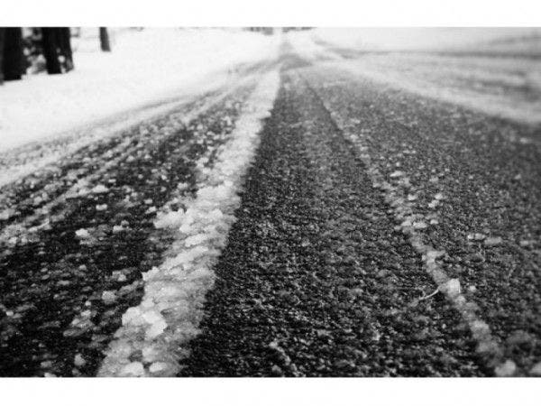
PATCHY BLACK ICE DEVELOPS TONIGHT INTO EARLY MONDAY...SNOW HAS MELTED AND WITH TEMPERATURES TONIGHT INTO EARLY MONDAY EXPECTED TO FALL BELOW FREEZING ACROSS THE ENTIRE REGION...THE RESIDUAL MOISTURE WILL REFREEZE. THIS WILL BE FIRST TO OCCUR IN OUTLYING AREAS AND INTERIOR VALLEYS AND LAST TO OCCUR WITHIN NEW YORK CITY. THESE PATCHES OF BLACK ICE WILL DEVELOP TONIGHT INTO EARLY MONDAY...CREATING SLIPPERY CONDITIONS ON SURFACES. WHEN TRAVELING...PROCEED WITH EXTRA CAUTION AND TRAVEL MORE SLOWLY.
The full forecast:
Sunday Night- Clear, with a low around 22. Light north wind.
Find out what's happening in Sayville-Bayportfor free with the latest updates from Patch.
Monday- Sunny, with a high near 41. Wind chill values between 25 and 35. Calm wind becoming southwest 5 to 8 mph in the morning.
Monday Night- A 20 percent chance of light rain after 3am. Mostly cloudy, with a low around 33. West wind 6 to 8 mph.
Find out what's happening in Sayville-Bayportfor free with the latest updates from Patch.
Tuesday- A chance of light rain before noon, then rain, mainly after noon. High near 40. Wind chill values between 30 and 35. Calm wind becoming east 5 to 8 mph in the afternoon. Chance of precipitation is 80%. New precipitation amounts of less than a tenth of an inch possible.
Tuesday Night- Rain. Patchy fog after 9pm. Temperature rising to around 44 by 3am. Southeast wind around 10 mph becoming south after midnight. Chance of precipitation is 80%. New precipitation amounts between a quarter and half of an inch possible.
Wednesday- A chance of rain before noon, then a chance of showers after noon. Patchy fog before 10am. Otherwise, cloudy, with a temperature rising to near 49 by noon, then falling to around 42 during the remainder of the day. Chance of precipitation is 50%.
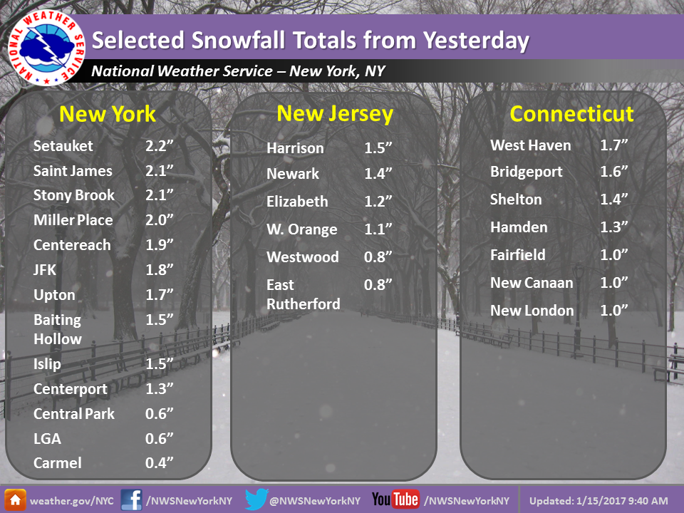
The NWS has also released snow totals for Saturday:
Get more local news delivered straight to your inbox. Sign up for free Patch newsletters and alerts.