Weather
Hazardous Weather Outlook Issued Ahead Of Heavy Rain Threat
A hazardous weather outlook has been issued for Eastern Pennsylvania, according to the National Weather Service.

By Tom Davis:
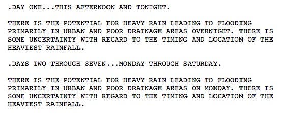
A hazardous weather outlook has been issued for Eastern Pennsylvania as heavy rain is supposed to hit the area on Sunday, Monday or both.
Here is the alert that the National Weather Service has issued for the entire state:
Find out what's happening in Newtownfor free with the latest updates from Patch.
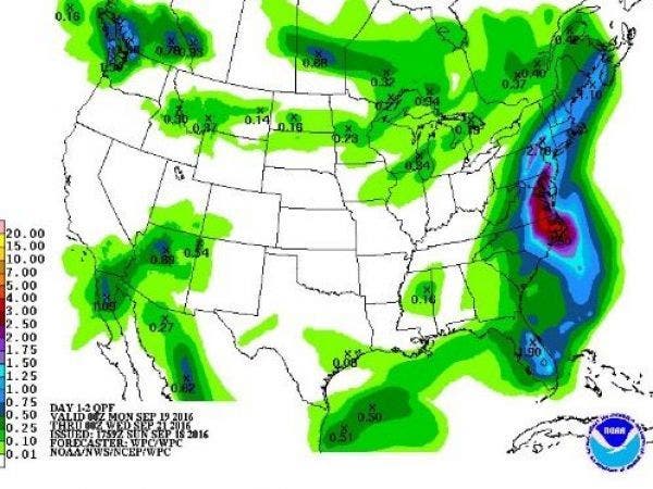
Gary Szatkowski, who served as a National Weather Service meteorologist, said the forecast shows for more than an inch of rain hitting the area.
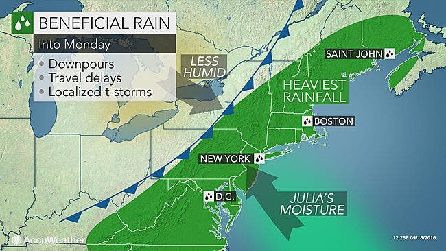
Moisture from Tropical Storm Julia is supposed to impact the area on Monday, according to AccWeather.
Find out what's happening in Newtownfor free with the latest updates from Patch.
Here is the forecast for the region:
Sunday evening: Showers and thunderstorms likely, then showers and possibly a thunderstorm after 4am. Low around 70. South wind 5 to 8 mph becoming calm. Chance of precipitation is 80%. New rainfall amounts between a quarter and half of an inch possible.
Monday: Showers likely and possibly a thunderstorm before 3pm, then a chance of showers and thunderstorms after 3pm. Cloudy, with a high near 81. South wind 3 to 5 mph. Chance of precipitation is 70%. New rainfall amounts between a half and three quarters of an inch possible.
Monday Night: A chance of showers. Mostly cloudy, with a low around 64. Light southeast wind. Chance of precipitation is 40%. New precipitation amounts of less than a tenth of an inch possible.
Tuesday: A slight chance of showers. Partly sunny, with a high near 83. Calm wind. Chance of precipitation is 20%.
Tuesday Night: Partly cloudy, with a low around 63. Light and variable wind.
Photo: Gary Szatkowski
Get more local news delivered straight to your inbox. Sign up for free Patch newsletters and alerts.