Weather
'Serious Arctic Blast' Coming To Pennsylvania - Including 'Bursts Of Snow'
Forecasters are saying that a "serious Arctic blast" is coming to Pennsylvania - and that will include some hazardous weather.


Forecasters are saying that a "serious Arctic blast" is coming to Pennsylvania this week - and that will include some hazardous weather.
That doesn't necessarily mean everybody's going to get lots of snow - what does mean is, at the very least, temperatures are expected to drop into the 20s or 30s, or lower, with some seriously cold winds.
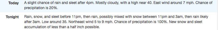
Pennsylvania drivers could face slick road conditions as early as Tuesday afternoon with a storm system delivering a rain, snow or mixed precipitation to parts of the region, forecasters said.
Find out what's happening in Newtownfor free with the latest updates from Patch.
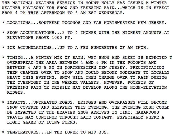
The Poconos and Lehigh Valley should expect this:
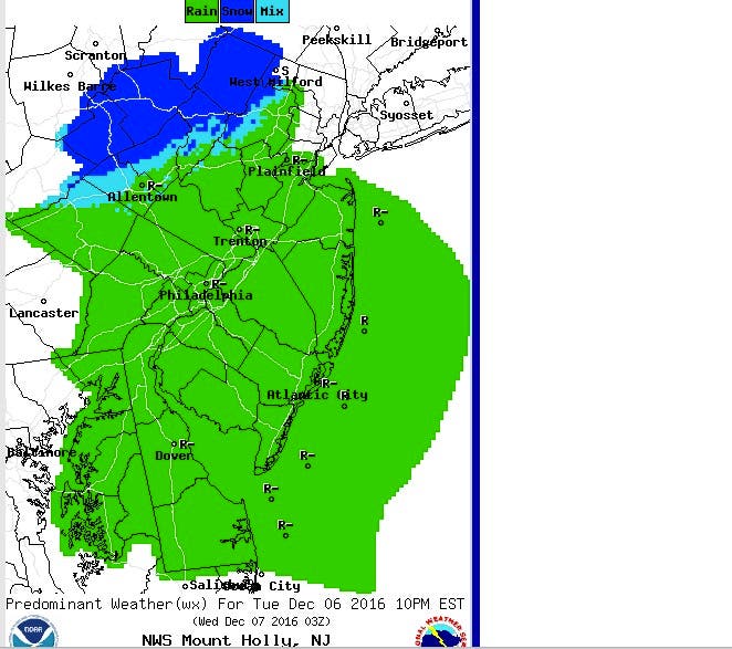
This is what eastern Pennsylvania should expect on Thursday afternoon:
Find out what's happening in Newtownfor free with the latest updates from Patch.
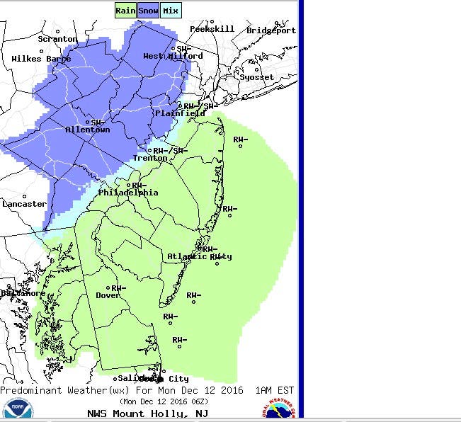
And this is what eastern Pennsylvania could see Sunday night:
Here is what central and western PA should expect:
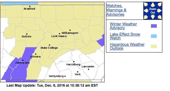
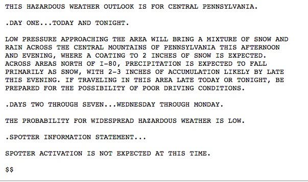
Here is the central PA advisory:
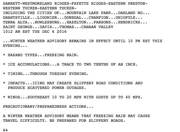
Here is the western PA advisory:
A winter weather advisory is in effect for the Poconos on Tuesday.
An Arctic air blast is moving eastward, and flurries, snow squalls and lake-effect snow will create wintry travel from the Upper Midwest to part of the northeastern United States later this week, according to an AccuWeather release.
After the arctic front passes late this wk, the coldest air of the season will invade much of the US. The warm Fall will be a distant memory pic.twitter.com/HigKYju0Oi
— Ed Vallee (@EdValleeWx) December 5, 2016
Prior to the arrival of the arctic air and lake-effect snow, pockets of snow and a wintry mix will occur in parts of central and northeastern U.S, according to the release.
Snow and a wintry mix will develop in parts of western Maryland, eastern West Virginia and central and northern Pennsylvania during Tuesday afternoon.
This wintry mix will then extend northeastward into parts of New York state and New England during Tuesday night. Enough snow can fall to shovel and plow, especially over the higher elevations. Travel along Interstate 80, I-81 and I-90 will be wet to slushy in the lower elevations and slippery in the higher terrain.
Patch file photo
Get more local news delivered straight to your inbox. Sign up for free Patch newsletters and alerts.