Weather
Severe Storms, Possible Hail Start Off July 4th Weekend Forecast In Pennsylvania
The weather might get off to a rocky start this holiday weekend, but hopefully it won't last too long.

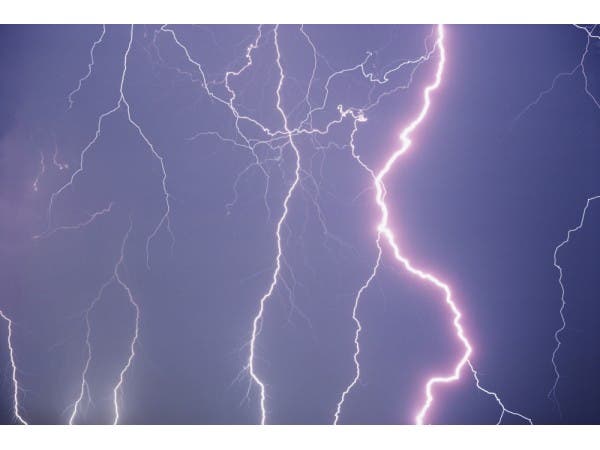
The July 4th weekend will likely begin with severe thunderstorms and the possibility of hail, according to forecasters.
The NWS has issued a Hazardous Weather Outlook, saying that Eastern Pennsylvania is at risk for severe thunderstorms on Friday afternoon and evening.
Heavy rain, damaging winds and "large hail" are possible, leading to localized flooding, especially in poor drainage areas, according to the NWS.
Find out what's happening in Newtownfor free with the latest updates from Patch.
The Hazardous Weather Outlook is in place for the following counties in Pennsylvania: Bucks, Chester, Delaware, Montgomery, Philadelphia, Carbon, Monroe, Berks, Lehigh and Northampton.
The good news: after the storm moves out Friday, skies should clear and make way for a nice weekend, except for a slight risk of thunderstorms on Monday night. Saturday and Sunday are expected to be sunny with highs in the mid-80s. Monday should be clear during the daytime, with currently a 30-percent chance of storms at night.
Find out what's happening in Newtownfor free with the latest updates from Patch.
Check back to Patch for updates and information on how that possible storm could impact fireworks displays planned for July 4. Find local fireworks shows here.
Here is the NWS's map of Friday's storm:

Here is the weather forecast for the holiday weekend:
Today: Showers and thunderstorms likely, mainly between 4pm and 5pm. Some storms could be severe, with large hail and damaging winds. Partly sunny, with a high near 87. South wind around 9 mph, with gusts as high as 20 mph. Chance of precipitation is 60%. New rainfall amounts between a tenth and quarter of an inch, except higher amounts possible in thunderstorms.
Tonight: Scattered showers and thunderstorms, mainly before 2am. Some storms could be severe, with large hail and damaging winds. Mostly cloudy, with a low around 64. Southwest wind around 7 mph. Chance of precipitation is 50%. New rainfall amounts between a tenth and quarter of an inch, except higher amounts possible in thunderstorms.
Saturday: Sunny, with a high near 83. Northwest wind 8 to 10 mph.
Saturday Night: Mostly clear, with a low around 60. West wind around 6 mph becoming calm in the evening.
Sunday: Sunny, with a high near 86. West wind 3 to 7 mph.
Sunday Night: Partly cloudy, with a low around 64.
Independence Day: Partly sunny, with a high near 86.
Monday Night: A chance of showers and thunderstorms. Mostly cloudy, with a low around 66. Chance of precipitation is 30%.
Get more local news delivered straight to your inbox. Sign up for free Patch newsletters and alerts.