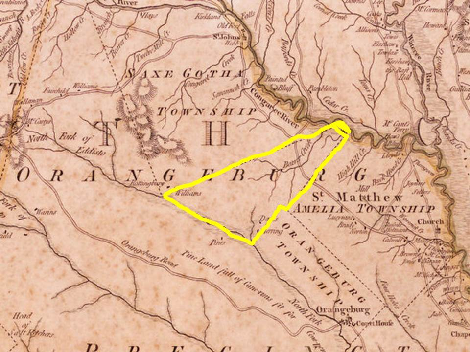
When Lexington was once Saxe Gotha, a township in the Orangeburgh District, there was an area which is today part of Lexington County that was not part of any township. It is an area that in recent months has come to be known as the "Congaree Cone" because of its conical shape with the smallest end starting at the Congaree and the wide end resting along the north fork of the Edisto River. Today, this area is the lower part of Lexington county near the borders of Orangeburg and Aiken counties.
The township act of 1736 set up townships in the backcountry to help expand colonization and buffer the low country from perceived threats by Native Americans. Townships had to be formed and located carefully to avoid disruption to important roads and paths and in such a way to not change the area too drastically or too quickly. Present day Lexington was once an important intersection of roads and paths running east/west and north/south.
The significance of the area now known as the "Congaree Cone' is staring to attract much attention since the recent discoveries of important colonial and Native American sites. Many people are questioning the narrow end of the cone at the Congaree River which suggests the ability to limit or control passage through a small area. It is important to remember that trade had established a multicultural community in this area as early as the early 1500s. This culture and thriving business existed long before the colonization of the 1700s. The area of the "Congaree Cone" holds clues to Lexington's and South Carolina's ancient past.