Health & Fitness
Check Out City Online Mapping
New online mapping tool has more information and is easier to use.
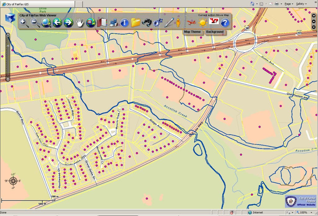

Poking around on the city website the other day, I noticed a link to a beta test for a new online city mapping site. The city has had an online mapping site for a few years now, but it is slow an difficult to navigate. This new site is easier to use, quicker to navigate, and has more information.
You can use a standard street map for a base, or look at zoning and utilities. It appears to be updated regularly, as you can see property lines for recent subdivisions, such as the DR Horton development that is currently under construction on Old Lee Highway and Ridge Avenue, near Fairfax Circle (this is the area shown in the attached images). Also, there is a layer for 2' contour lines, which was not available in the old version. You have to zoom in pretty close to see them.
The one downfall is that you don't have access to historical imagery as you did in the old version. They have satellite photos from 1997 to the present, but also from 1937! It is always fun to look back at the farm that used to be where you house is now. Hopefully this feature will eventually be added.
Find out what's happening in Fairfax Cityfor free with the latest updates from Patch.
The city GIS web-site is located here. Click on "New City Online Mapping Site" at the bottom to see the new version, or click on "I Agree" and "Submit" to see the old version. Try not to waste as much time looking at this as I have!