Weather
Severe Storms Possible As Record Heat Surges Into VA: See Latest Forecast
A surge of early-summer heat will push into Virginia this week, challenging record-high temperatures and bringing a risk of severe storms.

Mother Nature will provide a summer preview as a surge of heat expands across Virginia this week, with temperatures climbing to near or above 90 in some areas, according to the latest forecasts.
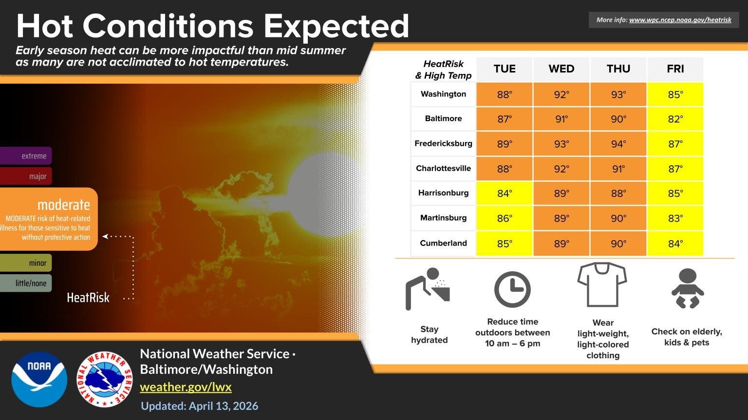
The early-season heat wave will result in at least a Moderate Heat Risk this week, according to the National Weather Service. Even though the humidity is low, those sensitive to higher temperatures — older adults, infants, outdoor workers and athletes — could be more at risk for heat-related illnesses.
"This is impressive heat for mid-April, arriving weeks earlier than we typically see in many cities,"AccuWeather Senior Meteorologist Matt Benz said in a statement. "Early-season heat can hit harder than people expect because it arrives before routines, clothing and outdoor plans have adjusted to summerlike conditions."
Find out what's happening in Old Town Alexandriafor free with the latest updates from Patch.
Warmth is expected to move into the D.C. region on Tuesday, with a forecast high of 90 degrees and 94 degrees on Wednesday. This will likely be the earliest 90-degree heat since April 2013. The all-time April record of 95 degrees could be challenged on Wednesday.
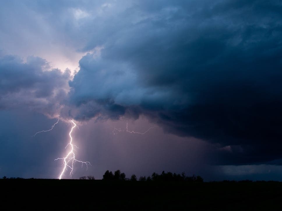
On Tuesday night, there's also a chance of a few strong to severe thunderstorms, with damaging wind gusts as the main threat. These thunderstorms are most likely to occur along and north of Interstate 70, according to the NWS.
Find out what's happening in Old Town Alexandriafor free with the latest updates from Patch.
Friday isn’t quite as hot with a few more clouds and a chance for a few showers or thunderstorms, The Washington Post's Capital Weather Gang wrote in its latest forecast.
"Highs are mainly in the 80s, but near 90 is possible in southern spots," the Capital Weather Gang said.
As temperatures surge in the coming days, the risk of wildfires will also increase, forecasters said.
"Dry brush and fallen leaves remain widespread," AccuWeather forecasters warned. "The combination of sunshine, gusty breezes and dry air will create near-ideal conditions for ignition and rapid fire spread."
Virginia residents should use caution with power equipment, open flames, or anything that can produce sparks or embers.
Here's a detailed look at the daily forecast for the D.C. region:
Tuesday: Mostly sunny, with a high near 88. Southwest wind 7 to 15 mph, with gusts as high as 26 mph.
Tuesday Night: A slight chance of showers before 9pm. Partly cloudy, with a low around 70. Southwest wind 7 to 11 mph. Chance of precipitation is 20%.
Wednesday: Mostly sunny, with a high near 92. Southwest wind 7 to 13 mph, with gusts as high as 23 mph.
Wednesday Night: Partly cloudy, with a low around 73. Southwest wind 8 to 10 mph.
Thursday: Partly sunny, with a high near 91. Southwest wind 7 to 13 mph, with gusts as high as 23 mph.
Thursday Night: A slight chance of showers. Mostly cloudy, with a low around 70. Chance of precipitation is 20%.
Friday: A chance of showers. Partly sunny, with a high near 86. Chance of precipitation is 30%.
Friday Night: Partly cloudy, with a low around 64.
Saturday: Mostly sunny, with a high near 87.
Get more local news delivered straight to your inbox. Sign up for free Patch newsletters and alerts.