Weather
Tidal Flooding Advances On Old Town Alexandria Streets: See Photos
With Alexandria under a coastal flood warning, the worst tidal flooding since Hurricane Isabel in 2003 is predicted. See our photos.

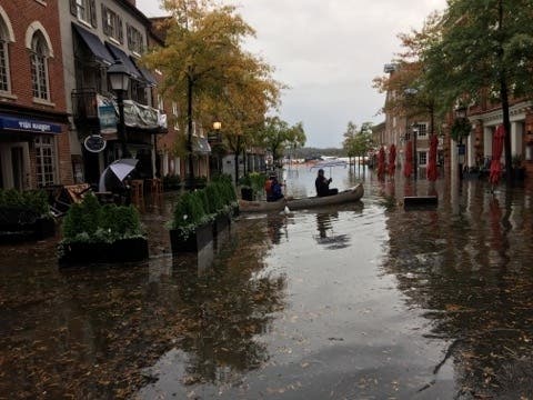
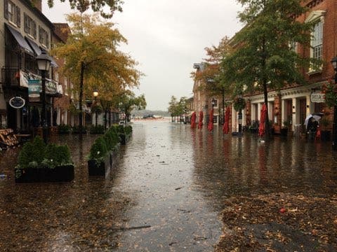
ALEXANDRIA, VA — Tidal flooding isn't uncommon at the foot of King Street in Old Town Alexandria, but Friday brought a significant amount of water that closed several streets.
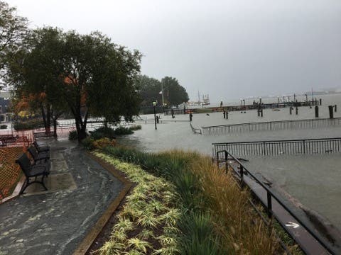
The National Weather Service had put the Alexandria waterfront on the Potomac River and other coastal areas around the DC region under a coastal flooding warning for the next several days. Friday's tidal flooding is the worst since 2003's Hurricane Isabel in some localities. Alexandria's coastal flood warning is in effect until 8 a.m. Sunday.
At 3:24 p.m. on Friday, the highest observed tide in the Potomac River at Alexandria was 5.99 feet. That's up from the last high tide of 4.58 feet around 2:12 a.m. Friday. The next high tide is expected to reach 5.87 feet around 2 a.m. Saturday. The flood stage is considered to be 3.3 feet, while a moderate flood stage is 4.2 feet and major flood stage is 6.6 feet.
Find out what's happening in Old Town Alexandriafor free with the latest updates from Patch.
Historically, the highest tidal levels recorded in the Potomac River at Alexandria were 8.66 feet on Sept. 19, 2003, when Hurricane Isabel affected the area. After Hurricane Isabel, the next highest were 7.4 feet on March 19, 1936, this latest high tide of 5.99 feet on Friday, Oct. 29, 2021, 5.06 feet on April 16, 2011, 5.04 feet on Sept. 10, 2018 and 4.92 feet on April 30, 2014.
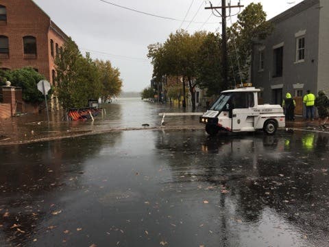
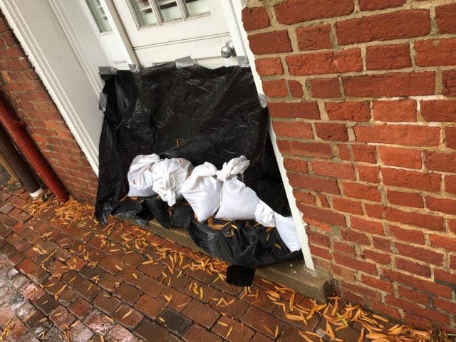
There are numerous road closures around the waterfront due to the coastal flooding, per Alexandria Police. Union Street is closed at King Street and surrounding blocks. Other blocks between Union Street and Lee Street near the floodwaters are also closed. Drivers should avoid driving through barriers and turn around rather than driving through floodwaters.
Find out what's happening in Old Town Alexandriafor free with the latest updates from Patch.
Patch went to the Alexandria waterfront to scope out the flooding situation. Here are some photos showing the extent of flooding.


Subscribe to your local Patch newsletter. Download our mobile application from the App Store or Google Play.
Get more local news delivered straight to your inbox. Sign up for free Patch newsletters and alerts.