Weather
Ida Updates: Tree Damage Reported Across Tuscaloosa County
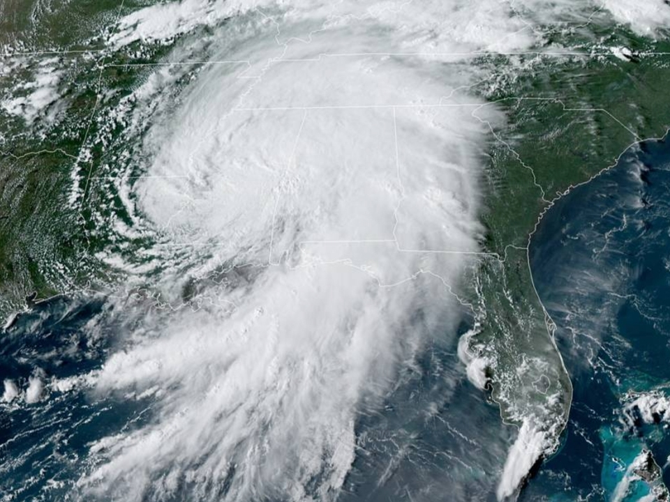
Here's our up-to-the-minute severe weather coverage as Ida brings wind, rain and potentially dangerous storms to much of the state.

TUSCALOOSA, AL — Follow us here for live updates through the start of the week as Hurricane Ida moves over the southeast and through Alabama.
To reporting flooding or storm damage, email me at ryan.phillips@patch.com.
Noon, Aug. 31
Find out what's happening in Tuscaloosafor free with the latest updates from Patch.
- Tuscaloosa County EMA says the Flash Flood Watch across all of Central Alabama has been cancelled, with the heaviest rains now moving east of the area. Officials expect conditions to improve into the afternoon. (More)
- At least one home on Jack Warner Parkway in east Tuscaloosa received damage after a tree fell after high winds moved through the area. (More)
Tuscaloosa County EMA has received reports of tree damage at the following locations
- Boyd Road at Dunns Creek Road
- Old Columbus Road at Westwood Circle
- Romulus Road at Coyote Trail
- Romulus Church Road at Sipsey Valley Road S
- Upper Columbus Road at Preacher Lee Road
- Pine Lake Road
- Lock 17 Road
- Watermelon Road
- Griffin Ridge at Johns Road
- Hepzibah Church Road
- Clements Road
- Douglas Drive
- Abernathy Road
- North River Circle
- Sharon Dr at Sylvia
- Woodbank Way
- Hummingbird Lane
- Malone Creek Road
Outages as of noon Tuesday
Find out what's happening in Tuscaloosafor free with the latest updates from Patch.
- Bibb County - 240
- Fayette County - 54
- Hale County - 14
- Pickens County - 1
- Sumter County - 0
- Tuscaloosa County - 781
- Walker County - 220
- Statewide - 4,699
- The National Weather Service said in an 8 a.m. update that the best chance for an isolated tornado remains across far eastern and southeastern Alabama. However, officials were quick to point out that gusty winds up to 30 mph will be possible at times for the western and central parts of the state. (More)
- Tuscaloosa County remains under a Flash Flood Watch and Wind Advisory through Tuesday evening.
- Apart from debris on roadways, no major damage or flooding was reported in the Tuscaloosa Patch coverage area overnight.
8 a.m., Aug. 31
Damage reports
- Trees down on Lock 17 Road, Woodbank Way, Hummingbird Lane and Watermelon Road, north of Yellow Creek Road.
- Flooding was reported one Old Fayette Road near Brady Montgomery Road.
Outages as of 8 a.m. Tuesday morning
- Bibb County - 240
- Fayette County - 1,128
- Hale County - 14
- Pickens County - 42
- Sumter County - 0
- Tuscaloosa County - 154
- Walker County - 377
- Statewide - 11,713
11:30 p.m., Aug 30.
*Final update for the evening unless news breaks*
- A Flood Warning has been issued for parts of Greene, Hale, Marengo, Pickens, and Sumter counties as heavy rains cause rivers and tributaries to rise. Here's a more detailed look at the areas of focus. (More)
- WVUA 23 Chief Meteorologist Richard Scott says the heaviest rain is currently located north of Tuscaloosa and Birmingham at the moment: "The rain will continue at times overnight, with some localized flooding possible. The tornado risk for the rest of the night appears unlikely, but we’ll keep an eye on radar trends. Have a way to receive warnings incase a storm is able to rotate and produce a brief tornado. There’s a fair chance we will go trough the night without a single warning." (More)
- Despite some school closings and delays in surrounding counties, all Tuscaloosa County education institutions plan to return to normal operations on Tuesday.
Storm debris reports
- Alabama Highway 69 southbound past Yellow Creek Road in Tuscaloosa.
- Alabama Highway 69 northbound near Tidmore Walton Drive in Moundville.
- U.S. Highway 82 westbound near Daffron Road and Country Road 85 in Duncanville.
All reported debris has been cleared.
Here's a look at current outages in the Tuscaloosa Patch coverage area:
- Bibb County - 106
- Fayette County - 242
- Hale County - 17
- Pickens County - 99
- Sumter County - 177
- Tuscaloosa County - 726
- Walker County - 341
- Statewide - 6,680
Click here for the latest outage updates.
8 p.m., Aug. 30
- No damage or flooding has been reported in Tuscaloosa County as Ida moves over west Alabama, but Tuscaloosa County EMA said localized flooding remains possible as tropical rains are expected to continue into Tuesday. The possibility still remains for spin-up tornadoes tonight.
Here's a look at current outages in the Tuscaloosa Patch coverage area:
- Bibb County - 62
- Fayette County - 53
- Hale County - 257
- Pickens County - 320
- Sumter County - 209
- Tuscaloosa County - 285
- Walker County - 251
7:30 p.m., Aug. 30.
- Per the latest reports, 482 Tuscaloosa County households and businesses are without power, along with 250 in Hale County. (More)
- The National Weather Service says the center of the storm is now in central Mississippi, which will see west Alabama inundated with rain bands into Tuesday. (More)
- Pickens County Schools will be delayed two hours on Tuesday.
7 p.m., Aug. 30
- More than 300 people are currently without power in Tuscaloosa County, per the latest reports. Another 138 outages are also being reported in Hale County. (More)
6 p.m., Aug. 30
- Marion County Schools, Walker County Schools and Winston County Schools have all announced they will be closed on Tuesday in anticipation of severe weather.
- After nearly 1,000 across west Alabama were without power Monday afternoon, service seems to have returned for most across the area. (More)
- In an afternoon update, WVUA Chief Meteorologist Richard Scott wrote that the risk will likely end for the by 2 a.m. tonight. (WVUA 23 News)
- Annie Mapp reported Monday that the City of Tuscaloosa's Infrastructure and Public Services department visited 50 locations over the weekend to check culverts and drainage areas ahead of the heavy rain expected. (ABC 33/40)
- Tuscaloosa County EMA says localized flooding remains possible as tropical rains continue and the possibility still persists for a spin-up tornado through the night. (More)
Here's a look at current outages in the Tuscaloosa Patch coverage area:
- Bibb County - 1
- Fayette County - 1
- Hale County - 26
- Pickens County - 18
- Tuscaloosa County - 90
4:20 p.m. Aug. 30
- The Tuscaloosa County School System says it will resume normal operations on Tuesday, Aug. 31.
Here's a look at current outages in the Tuscaloosa Patch coverage area:
- Bibb County - 74
- Fayette County - 12
- Hale County - 689
- Pickens County - 408
- Tuscaloosa County - 63
4 p.m., Aug. 30
- Hale County currently has 462 Alabama Power customers without electricity, which is the highest total among counties in the Tuscaloosa Patch coverage area. Tuscaloosa County currently has 36 active outages, while Bibb County has 74. (More)
- Tuscaloosa County EMA said a Tornado Watch is not expected for Tuscaloosa County at this time, but a few brief spin-ups remain possible. (More)
- Northport Mayor Bobby Herndon said he plans to start collecting donated items Wednesday to be transported to those in need in Louisiana. (More)
3:30 p.m., Aug. 30
- The University of Alabama remains open and said it continues to monitor weather conditions. UA reminds students that Tuscaloosa will be under a wind advisory and Flash Flood Watch through Tuesday afternoon. (More)
- Tuscaloosa City Schools announced it will return to in-person instruction tomorrow after cancelling school Monday. (More)
- The National Hurricane Center has downgraded Ida to a tropical depression, which is still expected to bring widespread impacts across the southeast. (More)
- At present, 41 Alabama Power customers are without power in Tuscaloosa County (More)
2:30 p.m., Aug. 30
- The National Weather Service forecast office in Birmingham says it is monitoring an area of heavy rotation in northeast Tuscaloosa County at the moment, but no warnings have been issued. (More)
1 p.m., Aug. 30
- WVUA 23 Chief Meteorologist Richard Scott says moderate to heavy rain continues to spread east across west Alabama, but there remains no evidence of severe weather for Tuscaloosa at the moment. He said winds will increase in the evening hours, possibly reaching up to 30 mph. (More)
- Tuscaloosa County EMA pointed out that a wind advisory has been issued for Tuscaloosa County and much of the state, with gusts up to 40 mph possible later today. Tuscaloosa County remains under a Flash Flood Watch. (More)
- As of 1 p.m. Monday, 57 Alabama Power customers were without electricity in Tuscaloosa County. (More)
- No storm damage or major flooding has been reported in the Tuscaloosa metropolitan area.
- Marion County Schools and Winston County Schools both announced they will be closed on Tuesday in anticipated of additional severe weather.
9 a.m., Aug. 30
- The Tuscaloosa Public Library will be closed Monday due to the threat of inclement weather.
- WVUA 23 Chief Meteorologist Richard Scott said in a 9 a.m. update that there are no severe weather issues in the Tuscaloosa area. "Rain continues to increase, and flooding will become a problem later today and tonight," he said.
7:30 a.m., Aug. 30
- Tuscaloosa County remains under a Flash Flood Watch until Tuesday.
- Tuscaloosa County EMA expects 2-4 inches of rain, with higher amounts possible, in addition to 25 mph sustained winds with gusts over 40 mph.
- The following schools will be closed today due to the approach from Ida, which remains a tropical storm: University of West Alabama, Tuscaloosa Academy, Fayette County Schools, Hale County Schools, Pickens County Schools, Walker County Schools
- The University of Alabama has yet to announce if it will close its campus in Tuscaloosa at some point during the day.
- Ida has caused thousands of power outages in Louisiana as it tracks north, along with causing the flow of the Mississippi River to reverse. (More on Patch)
QUOTE WORTHY: "Tropical Storm Ida is located south of Jackson, MS, with winds at 60mph. Heavy rain will gradually spread in today, with a risk of isolated tornadoes & flash flooding. Tornado risk ends by 2 a.m. tonight for west AL and 10 a.m. Tuesday for east AL." - WVUA Chief Meteorologist Richard Scott in an update 6:20 a.m. Monday.
9:30 p.m., Aug. 29
- Tuscaloosa City Schools — closed Monday
- Tuscaloosa County School System — closed Monday
- Shelton State Community College — closed Monday
- Stillman College — closed Monday
Latest updates:
- Tuscaloosa County, City Schools To Close Monday As Ida Nears
- Hurricane Ida: Flash Flood Watch For Tuscaloosa, Impacts Expected
Have a news tip or suggestion on how I can improve Tuscaloosa Patch? Maybe you're interested in having your business become one of the latest sponsors for Tuscaloosa Patch? Email all inquiries to me at ryan.phillips@patch.com
Get more local news delivered straight to your inbox. Sign up for free Patch newsletters and alerts.