Traffic & Transit
U.S. 50 Traffic Backed Up A Dozen Miles Before Bay Bridge
Drivers heading home from the Eastern Shore on Labor Day ran into a traffic jam stretching 14 miles long before the Chesapeake Bay Bridge.

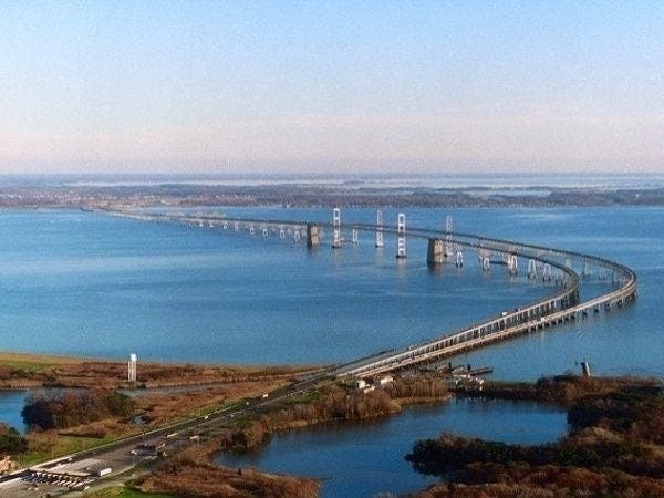
ANNE ARUNDEL COUNTY — Residents who enjoyed Labor Day weekend on the Eastern Shore ran into a sizable traffic jam as they headed home westbound along U.S. 50, finding themselves stuck in traffic that stretched more than 10 miles without moving before they ever reached the Chesapeake Bay Bridge.
The Maryland Transportation Authority tweeted at 1:38 p.m. Labor Day that "westbound U.S. 50 delays 10+mi prior to the Bay Bridge." They advised travelers to stay later in the hopes of avoiding the logjam of cars and to stay off local roads.
Heavy westbound US 50 delays continue prior to the Bay Bridge. Stay later IF possible. Motorists urged to stay on US 50 to keep local roads open for 1st responders & residents. 1-877-BAYSPAN (229-7726) #MDShorebound #mdtraffic pic.twitter.com/6DK3r8Zjp2
— MDTA (@TheMDTA) September 2, 2019
Area residents have come to expect this type of a traffic jam on holiday weekends, including Labor Day. The headache-sized backup only fueled the controversy surrounding the three options a study has offered to help relieve traffic on the Chesapeake Bay Bridge, which includes adding a third span and possibly a new bridge. The Chesapeake Bay Bridge currently is the shortest way for vehicles to cross the bay from the Eastern Shore to the rest of the state.
Find out what's happening in Annapolisfor free with the latest updates from Patch.
However, Maryland Gov. Larry Hogan only supports one of the options, Patch reported.
"There is only one option I will ever accept: adding a third span to our existing Bay Bridge," Hogan said on Twitter. "While the federal process requires multiple proposals, the data is indisputable — this option would maximize congestion relief and minimize environmental impact.
Find out what's happening in Annapolisfor free with the latest updates from Patch.
"Inaction is simply not an option. Research tells us that if we fail to act, motorists could experience up to 14-mile delays by 2040," the governor added. "Marylanders all across the state depend on being able to cross the Chesapeake Bay, and this is the only serious way forward."
The original 14 sites ranged from a northernmost bridge running from Aberdeen to Cecilton, three Baltimore County jumping-off points that reach to Church Hill or Centreville, or a southernmost span from the Patuxent Naval Air Station to the Somerset area. The site maps prepared by the Maryland Transportation Authority and the Federal Highway Administration can be found online.
The three possible locations for building a bridge are:
- Corridor 6: MD 100 to US 301 between Pasadena (Anne Arundel County), Rock Hall (Kent County) and Centreville (Queen Anne's County);
- Corridor 7: existing Bay Bridge corridor, US 50/301 to US 50 between Crofton (Anne Arundel County) and Queenstown (Queen Anne's County); and
- Corridor 8: US 50/301 between Crofton (Anne Arundel County) and Easton (Talbot County).
In August 2016, Gov. Larry Hogan ordered the Maryland Transportation Authority to explore options for a second Chesapeake Bay crossing as way to improve life for farmers, vacationers, business owners and residents. On a typical summer Sunday, 96,000 vehicles cross the bridge; by 2040 the traffic count could increase by 30 percent, he said.
State analysis determined the existing Bay Bridge spans would last through 2065. By 2040, daily backups in the eastbound direction could extend 13 miles in the summer, with 14-mile backups in the westbound lanes, the governor said. The state analysis of the Bay Bridge shows that the vital structure is good for another 50 years of use with regular maintenance and repairs.
Get more local news delivered straight to your inbox. Sign up for free Patch newsletters and alerts.