Weather
Winter Weather Advisory Issued For 8 MD Counties Plus Baltimore
Snow may arrive Tuesday during a high-traffic time. Here's how much forecasters expect and when it will be heaviest in central Maryland.

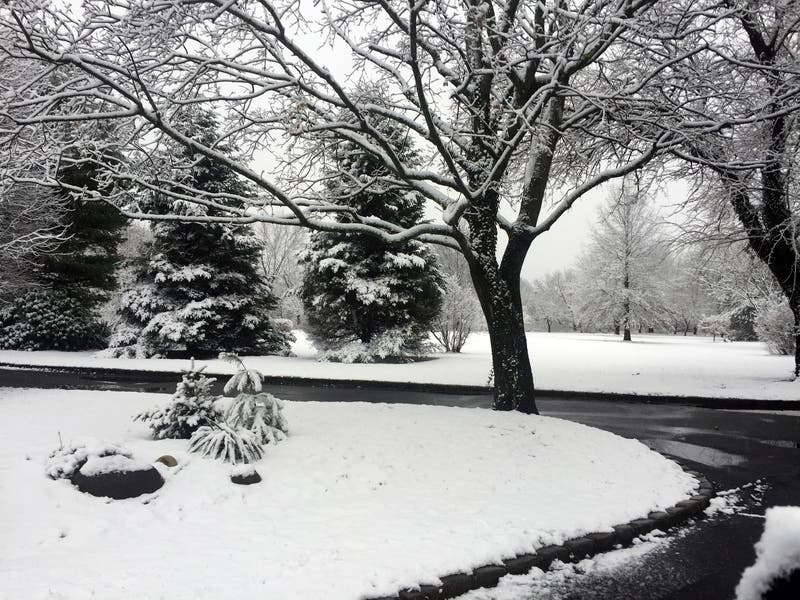
The National Weather Service has issued a winter weather advisory, calling for 1 to 3 inches of snow in parts of central Maryland. Accumulations may be higher in northern Maryland, officials advised. Forecasters expect snow will be the heaviest Tuesday afternoon into early evening.
Snow may fall at a rate of greater than 1 inch per hour, with visibility limited to a one-quarter mile at times. Forecasters anticipate the heaviest snow between 2 and 6 p.m.
Roads may become snow-covered and slippery, especially northwest of Interstate 95 into the evening commute, according to the advisory.
Find out what's happening in Bel Airfor free with the latest updates from Patch.
Snow is expected to arrive in the Baltimore-Washington region in mid-to-late Tuesday afternoon and spread from southwest to northeast. Light snow will mix with rain, then transition to all snow, possibly moderate to heavy at times. It will last about four to five hours in any given spot, according to the National Weather Service forecast discussion.
Find out what's happening in Bel Airfor free with the latest updates from Patch.
Public schools in Baltimore, Carroll, Frederick, Howard, Montgomery and Washington counties are letting out early Tuesday based on the inclement weather in the forecast. Harford and Prince George's county public school systems as well as Baltimore City Public Schools canceled all after-school and evening activities. Anne Arundel County is opening four warming centers overnight.
The federal government is shutting down its D.C. area offices at 1 p.m. Tuesday. The Maryland Transit Administration announced it would begin using larger train sets earlier than usual out of Union Station — at 1:15 p.m. — to accommodate the influx of federal workers. While crews have been treating platforms and parking lots, officials advised pedestrians to use caution.
The winter weather advisory is effective from noon to 7 p.m. for these areas:
- Baltimore City
- Baltimore County
- Carroll County
- Frederick County
- Harford County
- Howard County
Anne Arundel, Calvert, Charles and Prince George's counties, as well as southern Baltimore and southeast Harford counties, are under a hazardous weather outlook, meaning there is potential for severe weather and its impacts, such as slick roads. The outlook also applies to the District of Columbia and parts of northern Virginia.
In northeastern Maryland, Cecil County is under a separate winter weather advisory from 5 p.m. to midnight, when up to 3 inches of snow may fall. Drivers should anticipate slippery roads during the evening commute.
In western Maryland, a winter weather advisory is effective from 11 a.m. to 6 p.m. calling for 1 to 3 inches of snow in Allegany and Washington counties.
During the advisory period, officials encourage drivers to slow down and be extra careful. In addition, people should give themselves extra time to get where they are going. Transportation officials remind motorists that if their wipers are on, headlights must be on as well.
Pedestrians should watch their first few steps outside on sidewalks, driveways and stairs, which may be slippery.
Below-freezing temperatures overnight could create icy, slushy roads, forecasters advised.
In addition to parts of central, northeastern and western Maryland, the winter weather advisory applies to areas in eastern West Virginia and northern Virginia.
Here's the forecast for the Baltimore metropolitan area, according to the National Weather Service:
Tuesday: Slight chance of snow before 2 p.m., then snow, possibly mixed with rain, ending by 8 p.m. High near 42 and low around 31. Up to about 1.5 inches of accumulation are possible.
Wednesday: Mostly sunny, with a high near 42 and low around 23. Breezy, with winds of about 15 to 20 mph in the afternoon and gusts as high as 30 mph.
Thursday: Sunny, with a high near 37 and low around 31.
Friday: Mostly cloudy, with a high near 53 and low around 48. There's a 50 percent chance of precipitation after 8 p.m.
Saturday: Rain is likely, mainly after 8 a.m., with chances increasing from 60 percent during the day to 70 percent in the evening. Mostly cloudy, with a high near 64 and a low around 54.
Sunday: Rain likely. Partly sunny, with a high near 62 and low around 37. The chance of precipitation is 70 percent during the day, decreasing to 40 percent in the evening.
Monday: Partly sunny, with a high near 49. There's a 30 percent chance of showers.
Get more local news delivered straight to your inbox. Sign up for free Patch newsletters and alerts.