Weather
First Look At Fourth Of July Weekend Forecast In New Jersey
Headed to the beach, out for fireworks or planning a picnic? Check out an early look at the holiday weekend forecast in New Jersey.


Headed to the beach, out for fireworks or planning a picnic for the Fourth of July holiday weekend?
It's a week away, but the first early look at the forecast is in. If it holds up, we could be in for a nice, hot summer holiday weekend - although rain is possible.
According to the Weather Channel, the weekend will kick off Friday with partly cloudy skies and temperatures in the mid 80s. The sunshine continues Saturday with mostly sunny skies and temperatures in the low 90s.
Find out what's happening in Hopatcong-Spartafor free with the latest updates from Patch.
On Sunday, there is a chance of morning showers. Then on Monday, the Fourth of July, the Weather Channel is predicting sunny skies and temperatures in the upper 80s. During the evening, the skies should continue to clear and temperatures will cool off to a low in the 60s overnight, the extended forecast says.
That conflicts somewhat with the National Weather Service's early predictions, which says that rain is possible throughout the state, beginning Friday night and lasting through Saturday and Sunday.
Find out what's happening in Hopatcong-Spartafor free with the latest updates from Patch.
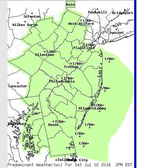
Here's the weather map for 2 p.m. on Saturday:
Water levels along the Jersey Shore are supposed to remain less than a foot for the rest of the week and weekend, and the surf should be relatively normal, according to the National Weather Service.
Now let's just cross our fingers the forecast doesn't change.
Read more: The 2016 New Jersey Fireworks Guide
Here's a look at the weather this week:
Monday night: Partly sunny, with a high near 84. South wind 9 to 11 mph.
Monday night: A chance of showers and thunderstorms. Cloudy, with a low around 67. South wind 8 to 11 mph. Chance of precipitation is 50 percent. New rainfall amounts between a tenth and quarter of an inch, except higher amounts possible in thunderstorms.
Tuesday: A chance of showers and thunderstorms before 11am, then a slight chance of showers between 11 a.m. and 1 p.m, then a slight chance of showers and thunderstorms after 1 p.m. Mostly cloudy, with a high near 82. South wind 6 to 10 mph. Chance of precipitation is 40 percent. New rainfall amounts between a tenth and quarter of an inch, except higher amounts possible in thunderstorms.
Tuesday night: A chance of showers and thunderstorms. Mostly cloudy, with a low around 66. South wind 5 to 8 mph. Chance of precipitation is 50 percent. New rainfall amounts between a tenth and quarter of an inch, except higher amounts possible in thunderstorms.
Wednesday: A chance of showers and thunderstorms, mainly between noon and 4pm. Partly sunny, with a high near 84. Light and variable wind becoming south around 6 mph in the afternoon. Chance of precipitation is 30 percent. New rainfall amounts of less than a tenth of an inch, except higher amounts possible in thunderstorms.
Wednesday night: Partly cloudy, with a low around 63.
Thursday: Sunny, with a high near 85.
Thursday night: Partly cloudy, with a low around 65.
Friday: Partly sunny, with a high near 85.
Friday night: Mostly cloudy, with a low around 65.
Saturday: Partly sunny, with a high near 86.
Saturday night: Mostly cloudy, with a low around 65.
Sunday: Partly sunny, with a high near 83.
Get more local news delivered straight to your inbox. Sign up for free Patch newsletters and alerts.